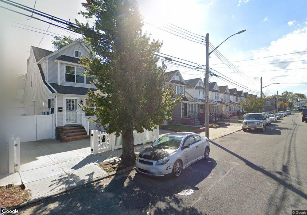
191-34 113th Rd St. Albans, NY 11412
Hollis NeighborhoodEstimated Value: $731,000 - $815,000
4
Beds
3
Baths
1,750
Sq Ft
$442/Sq Ft
Est. Value
About This Home
This home is located at 191-34 113th Rd, St. Albans, NY 11412 and is currently estimated at $773,504, approximately $442 per square foot. 191-34 113th Rd is a home located in Queens County with nearby schools including P.S. 118 Lorraine Hansberry, I.S. 192 The Linden, and Riverton Street Charter School.
Ownership History
Date
Name
Owned For
Owner Type
Purchase Details
Closed on
Jul 28, 2021
Sold by
Bh Properties Express Inc
Bought by
Mulling Lorraine Pamela Brown and Smith Vincent E
Current Estimated Value
Home Financials for this Owner
Home Financials are based on the most recent Mortgage that was taken out on this home.
Original Mortgage
$746,234
Outstanding Balance
$678,558
Interest Rate
2.9%
Mortgage Type
Purchase Money Mortgage
Estimated Equity
$94,946
Purchase Details
Closed on
Dec 18, 2020
Sold by
Jordan Eugene Wallace and Jordan Helen L
Bought by
Bh Properties Express Inc
Create a Home Valuation Report for This Property
The Home Valuation Report is an in-depth analysis detailing your home's value as well as a comparison with similar homes in the area
Home Values in the Area
Average Home Value in this Area
Purchase History
| Date | Buyer | Sale Price | Title Company |
|---|---|---|---|
| Mulling Lorraine Pamela Brown | $760,000 | -- | |
| Bh Properties Express Inc | $430,000 | -- |
Source: Public Records
Mortgage History
| Date | Status | Borrower | Loan Amount |
|---|---|---|---|
| Open | Mulling Lorraine Pamela Brown | $746,234 |
Source: Public Records
Tax History Compared to Growth
Tax History
| Year | Tax Paid | Tax Assessment Tax Assessment Total Assessment is a certain percentage of the fair market value that is determined by local assessors to be the total taxable value of land and additions on the property. | Land | Improvement |
|---|---|---|---|---|
| 2025 | $5,117 | $27,005 | $7,647 | $19,358 |
| 2024 | $5,117 | $25,478 | $7,356 | $18,122 |
| 2023 | $5,085 | $25,319 | $6,256 | $19,063 |
| 2022 | $4,768 | $42,120 | $11,520 | $30,600 |
| 2021 | $4,901 | $39,960 | $11,520 | $28,440 |
| 2020 | $4,154 | $34,380 | $11,520 | $22,860 |
| 2019 | $3,839 | $29,460 | $11,520 | $17,940 |
| 2018 | $3,714 | $21,099 | $8,601 | $12,498 |
| 2017 | $3,803 | $19,905 | $9,901 | $10,004 |
| 2016 | $3,634 | $19,905 | $9,901 | $10,004 |
| 2015 | $2,142 | $18,753 | $9,766 | $8,987 |
| 2014 | $2,142 | $17,694 | $11,052 | $6,642 |
Source: Public Records
Map
Nearby Homes
- 19427 Murdock Ave
- 191-34 114th Rd
- 19432 113th Rd
- 191-40 112th Rd
- 191-16 114th Rd
- 19431 114th Rd
- 191-47 114th Dr
- 19445 Murdock Ave
- 194-42 Murdock Ave
- 194-56 Murdock Ave
- 194-16 112th Ave
- 18908 114th Rd
- 190-59 112th Ave
- 190-63 112th Ave
- 189-18 114th Dr
- 194-29 112th Ave
- 19022 111th Rd
- 194- 24 111th Rd
- 114-22 197th St
- 18833 Keeseville Ave
- 19134 113th Rd
- 19132 113th Rd
- 19136 113th Rd
- 19140 113th Rd
- 191-28 113th Rd
- 19128 113th Rd
- 19140 113th Rd
- 19126 113th Rd
- 19142 113th Rd
- 19124 113th Rd
- 19144 113th Rd
- 19133 Murdock Ave
- 19135 Murdock Ave
- 19129 Murdock Ave
- 19137 Murdock Ave
- 19127 Murdock Ave
- 191-20 113th Rd
- 19120 113th Rd
- 19146 113th Rd
- 19146 113th Rd Unit 2F