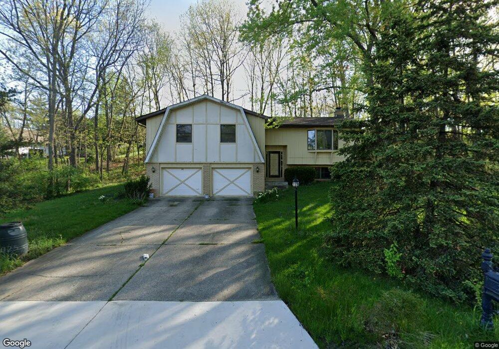
191 Amhurst Ct Valparaiso, IN 46385
Porter County NeighborhoodEstimated Value: $390,415 - $501,000
3
Beds
3
Baths
2,706
Sq Ft
$164/Sq Ft
Est. Value
About This Home
This home is located at 191 Amhurst Ct, Valparaiso, IN 46385 and is currently estimated at $443,854, approximately $164 per square foot. 191 Amhurst Ct is a home located in Porter County with nearby schools including Union Township Middle School and Wheeler High School.
Ownership History
Date
Name
Owned For
Owner Type
Purchase Details
Closed on
Sep 20, 2016
Sold by
Stiles Margaret M
Bought by
Stiles Margaret M and The Margaret Stiles Trust
Current Estimated Value
Purchase Details
Closed on
Nov 18, 2010
Sold by
Stiles Margaret M and Margaret M Stiles Living Trust
Bought by
Stiles Margaret M
Home Financials for this Owner
Home Financials are based on the most recent Mortgage that was taken out on this home.
Original Mortgage
$40,000
Interest Rate
4.23%
Mortgage Type
Credit Line Revolving
Purchase Details
Closed on
Aug 28, 2007
Sold by
Stiles Margaret M
Bought by
Stiles Margaret M and The Margaret M Stiles Living T
Create a Home Valuation Report for This Property
The Home Valuation Report is an in-depth analysis detailing your home's value as well as a comparison with similar homes in the area
Home Values in the Area
Average Home Value in this Area
Purchase History
| Date | Buyer | Sale Price | Title Company |
|---|---|---|---|
| Stiles Margaret M | -- | None Available | |
| Stiles Margaret M | -- | Chicago Title Insurance Co | |
| Stiles Margaret M | -- | None Available |
Source: Public Records
Mortgage History
| Date | Status | Borrower | Loan Amount |
|---|---|---|---|
| Previous Owner | Stiles Margaret M | $40,000 |
Source: Public Records
Tax History Compared to Growth
Tax History
| Year | Tax Paid | Tax Assessment Tax Assessment Total Assessment is a certain percentage of the fair market value that is determined by local assessors to be the total taxable value of land and additions on the property. | Land | Improvement |
|---|---|---|---|---|
| 2024 | $2,100 | $289,600 | $56,400 | $233,200 |
| 2023 | $1,967 | $280,000 | $53,700 | $226,300 |
| 2022 | $1,827 | $254,100 | $53,700 | $200,400 |
| 2021 | $1,784 | $230,200 | $53,700 | $176,500 |
| 2020 | $1,731 | $218,800 | $48,800 | $170,000 |
| 2019 | $1,638 | $206,700 | $48,800 | $157,900 |
| 2018 | $1,676 | $197,100 | $48,800 | $148,300 |
| 2017 | $1,488 | $194,200 | $48,800 | $145,400 |
| 2016 | $1,470 | $192,400 | $46,100 | $146,300 |
| 2014 | $1,520 | $197,400 | $43,500 | $153,900 |
| 2013 | -- | $208,900 | $49,100 | $159,800 |
Source: Public Records
Map
Nearby Homes
- 194 Wexford Rd
- 459 Amhurst Rd
- 483 Roxbury Rd
- 464 Roxbury Rd
- 459 Surrey Hill Ln
- 220 N 500 W
- 460 Roxbury Rd
- 454 Roxbury Rd
- 447 Scarborough Rd
- 148 Timber Point Ct
- 143 N 500 W
- 175 Shorewood Dr
- 446 Surrey Hill Ln
- 536 W Us Highway 30
- 419 Scarborough Rd
- 149 Westchester Ln
- 397 Shorewood Ct
- 421 Chadwick Cir
- 246 Pixley Ct
- 122 Shorewood Dr
- 194 Amhurst Place
- 187 Amhurst Ct
- 188 Amhurst Ct
- 190 Amhurst Ct
- 192 Amhurst Place
- 196 Amhurst Place
- 192 Amhurst Ct
- 186 Amhurst Ct
- 197 Amhurst Ct
- 483 Amhurst Rd
- 199 Amhurst Ct
- 194 Amhurst Ct
- 198 Amhurst Place
- 198 Amhurst Ct
- 190 Amhurst Place
- 491 Amhurst Rd
- 189 Ashford Ct
- 199 Amhurst Place
- 486 Amhurst Rd
- 188 Amhurst Place