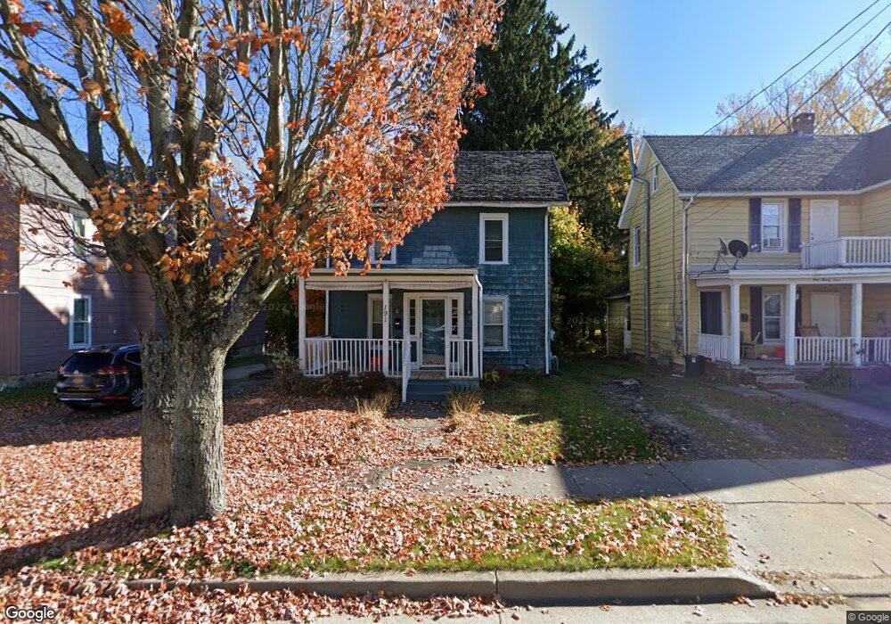
191 Barrett Ave Jamestown, NY 14701
Estimated Value: $66,000 - $69,000
4
Beds
2
Baths
2,184
Sq Ft
$31/Sq Ft
Est. Value
About This Home
This home is located at 191 Barrett Ave, Jamestown, NY 14701 and is currently estimated at $67,713, approximately $31 per square foot. 191 Barrett Ave is a home located in Chautauqua County with nearby schools including Jamestown High School, Catholic Academy of The Holy Family, and Jamestown SDA School.
Ownership History
Date
Name
Owned For
Owner Type
Purchase Details
Closed on
Sep 2, 2022
Sold by
County Of Chautauqua
Bought by
Stewart Uvie and Sledge-Stewart Brenda
Current Estimated Value
Purchase Details
Closed on
Aug 31, 2022
Sold by
County Of Chautauqua
Bought by
Sherbine Robert
Purchase Details
Closed on
Jul 27, 2017
Sold by
County Of Chautauqua
Bought by
Sherbine Robert
Purchase Details
Closed on
Jul 12, 2017
Sold by
Kitty L Crowdir Financ Of Her Successo
Bought by
County Of Chautauqua
Purchase Details
Closed on
Jan 21, 2011
Sold by
Langworthy Thomas
Bought by
Sherbine Robert
Create a Home Valuation Report for This Property
The Home Valuation Report is an in-depth analysis detailing your home's value as well as a comparison with similar homes in the area
Home Values in the Area
Average Home Value in this Area
Purchase History
| Date | Buyer | Sale Price | Title Company |
|---|---|---|---|
| Stewart Uvie | $26,300 | -- | |
| Sherbine Robert | -- | -- | |
| Sherbine Robert | $4,114 | County Of Chautauqua Law Dep | |
| County Of Chautauqua | $4,114 | Law Department County Of Cha | |
| Sherbine Robert | $32,000 | -- |
Source: Public Records
Tax History
| Year | Tax Paid | Tax Assessment Tax Assessment Total Assessment is a certain percentage of the fair market value that is determined by local assessors to be the total taxable value of land and additions on the property. | Land | Improvement |
|---|---|---|---|---|
| 2024 | $1,673 | $32,000 | $4,200 | $27,800 |
| 2023 | $1,660 | $32,000 | $4,200 | $27,800 |
| 2022 | $1,662 | $32,000 | $4,200 | $27,800 |
| 2021 | $1,665 | $32,000 | $4,200 | $27,800 |
| 2020 | $1,663 | $32,000 | $4,200 | $27,800 |
| 2019 | $1,218 | $32,000 | $4,200 | $27,800 |
| 2018 | $1,257 | $32,000 | $4,200 | $27,800 |
| 2017 | $1,076 | $32,000 | $4,200 | $27,800 |
| 2016 | $1,071 | $32,000 | $4,200 | $27,800 |
| 2015 | -- | $32,000 | $4,200 | $27,800 |
| 2014 | -- | $32,000 | $4,200 | $27,800 |
Source: Public Records
Map
Nearby Homes
- 193 Barrett Ave
- 187 Barrett Ave
- 715 Newland Ave
- 183 Barrett Ave
- 199 Barrett Ave Unit 2
- 199 Barrett Ave
- 713 Newland Ave
- 201 Barrett Ave
- 190 Barrett Ave
- 196 Barrett Ave
- 188 Barrett Ave
- 711 Newland Ave
- 316 Forest Ave
- 318 Forest Ave
- 205 Barrett Ave
- 320 Forest Ave
- 314 Forest Ave
- 718 Newland Ave
- 206 Barrett Ave
- 716 Newland Ave
Your Personal Tour Guide
Ask me questions while you tour the home.