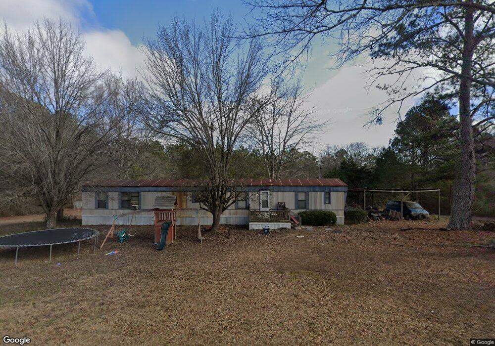
191 Berry Rd Cedartown, GA 30125
Estimated Value: $196,000 - $360,000
3
Beds
3
Baths
1,120
Sq Ft
$236/Sq Ft
Est. Value
About This Home
This home is located at 191 Berry Rd, Cedartown, GA 30125 and is currently estimated at $263,771, approximately $235 per square foot. 191 Berry Rd is a home with nearby schools including Cedar Christian School.
Ownership History
Date
Name
Owned For
Owner Type
Purchase Details
Closed on
Sep 11, 2008
Sold by
Foor Brian Keith
Bought by
Mcelwee David H and Mcelwee Diane
Current Estimated Value
Purchase Details
Closed on
Dec 23, 1998
Sold by
Foor Dennis R
Bought by
Foor Brian Keith
Purchase Details
Closed on
Jul 7, 1998
Sold by
Foor Dennis R
Bought by
Foor Brian Keith
Purchase Details
Closed on
Apr 1, 1998
Sold by
Lord William H and Lord Betty A
Bought by
Foor Dennis R
Purchase Details
Closed on
May 31, 1989
Sold by
Williamsen Gail A
Bought by
Lord Betty and Lord William
Purchase Details
Closed on
Jul 1, 1983
Bought by
Williamsen Gail A
Create a Home Valuation Report for This Property
The Home Valuation Report is an in-depth analysis detailing your home's value as well as a comparison with similar homes in the area
Home Values in the Area
Average Home Value in this Area
Purchase History
| Date | Buyer | Sale Price | Title Company |
|---|---|---|---|
| Mcelwee David H | $45,000 | -- | |
| Foor Brian Keith | -- | -- | |
| Foor Brian Keith | -- | -- | |
| Foor Dennis R | $10,500 | -- | |
| Lord Betty | $7,900 | -- | |
| Williamsen Gail A | -- | -- |
Source: Public Records
Tax History Compared to Growth
Tax History
| Year | Tax Paid | Tax Assessment Tax Assessment Total Assessment is a certain percentage of the fair market value that is determined by local assessors to be the total taxable value of land and additions on the property. | Land | Improvement |
|---|---|---|---|---|
| 2024 | $1,914 | $106,257 | $13,274 | $92,983 |
| 2023 | $1,555 | $78,896 | $13,274 | $65,622 |
| 2022 | $1,288 | $67,651 | $8,850 | $58,801 |
| 2021 | $1,626 | $67,651 | $8,850 | $58,801 |
| 2020 | $962 | $39,918 | $8,850 | $31,068 |
| 2019 | $642 | $23,891 | $8,850 | $15,041 |
| 2018 | $348 | $19,775 | $8,850 | $10,925 |
| 2017 | $457 | $18,808 | $10,237 | $8,571 |
| 2016 | $491 | $20,028 | $11,457 | $8,571 |
| 2015 | $492 | $20,028 | $11,457 | $8,571 |
| 2014 | $493 | $19,926 | $10,952 | $8,974 |
Source: Public Records
Map
Nearby Homes
- 0 Old Esom Hill Loop Unit 7654342
- 0 Old Esom Hill Loop Unit 10611077
- 0 Cornelius Rd Unit 7646589
- 255 Reynolds Rd
- 966 Judkin Mill Rd
- 0 Judkin Mill Rd Unit LotWP001 19369404
- 325 Fairview Ave
- 293 4th St
- 2460 Hidden Creek Rd
- 35 Harris Loop
- 382 5th St
- 1106 Frances St
- 497 Judkin Mill Rd
- 149 Irwin St
- 151 W Ellawood Ave
- 729 S College St
- 119 New Harmony Rd
- 35 Old Mill Rd