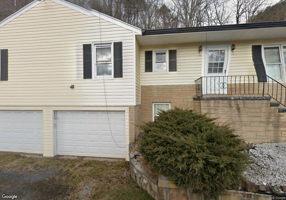
191 Calhoun Ln Sugar Grove, WV 26815
Estimated Value: $290,000 - $335,000
3
Beds
2
Baths
2,306
Sq Ft
$138/Sq Ft
Est. Value
About This Home
This home is located at 191 Calhoun Ln, Sugar Grove, WV 26815 and is currently estimated at $317,884, approximately $137 per square foot. 191 Calhoun Ln is a home located in Pendleton County with nearby schools including Pendleton County Middle/High School.
Ownership History
Date
Name
Owned For
Owner Type
Purchase Details
Closed on
Sep 11, 2019
Sold by
Rabeno Marian B
Bought by
Losh Danny W
Current Estimated Value
Create a Home Valuation Report for This Property
The Home Valuation Report is an in-depth analysis detailing your home's value as well as a comparison with similar homes in the area
Home Values in the Area
Average Home Value in this Area
Purchase History
| Date | Buyer | Sale Price | Title Company |
|---|---|---|---|
| Losh Danny W | $160,000 | -- |
Source: Public Records
Tax History Compared to Growth
Tax History
| Year | Tax Paid | Tax Assessment Tax Assessment Total Assessment is a certain percentage of the fair market value that is determined by local assessors to be the total taxable value of land and additions on the property. | Land | Improvement |
|---|---|---|---|---|
| 2025 | $609 | $109,680 | $14,520 | $95,160 |
| 2024 | $598 | $108,000 | $14,520 | $93,480 |
| 2023 | $583 | $105,840 | $14,520 | $91,320 |
| 2022 | $512 | $95,340 | $14,400 | $80,940 |
| 2021 | $639 | $94,140 | $14,220 | $79,920 |
| 2020 | $635 | $93,480 | $13,860 | $79,620 |
| 2019 | $684 | $101,040 | $13,560 | $87,480 |
| 2018 | $428 | $83,460 | $13,560 | $69,900 |
| 2017 | $417 | $81,420 | $12,720 | $68,700 |
| 2016 | $414 | $80,940 | $12,720 | $68,220 |
| 2015 | $404 | $79,920 | $13,740 | $66,180 |
| 2014 | -- | $74,760 | $15,480 | $59,280 |
Source: Public Records
Map
Nearby Homes
- Lot 5 Caddis Fly Dr
- Lot 24 & 27 Native Trout Ln
- Lot 27 Native Trout Ln
- Lot 24 Stone Fly Ln
- Lot #21 Stone Fly Ln
- 21 acres Buck Hill Ln
- 0 Buck Hill Ln
- 227 Dogwood Ln
- 00 Jack Mountain Rd
- 30 Polecat Hollow Blvd
- 0 High Valley Dr N
- 43 High Valley Dr S
- 42 High Valley Dr S
- 0 High Valley Dr S
- 41 High Valley Dr S
- 21 Acres Buck Hill Ln
- 187 Leonard Ln
- TBD High Valley Dr N
- 0 Summit Dr Unit 669156
- TBD Summit Dr. Summit Dr
- 4682 Doe Hill Rd
- 4290 Doe Hill Rd
- 237 Caddis Fly Ln
- 430 Route 23
- 430 Aurora Ln
- 385 Misty Mountain Dr
- 694 Hiner Mill Rd
- 404 Misty Mountain Rd
- 0 Doe Hill Rd Unit 1006825870
- 0 Doe Hill Rd Unit 1006823838
- 0 Doe Hill Rd Unit 1006657074
- 0 Doe Hill Rd Unit PT7798244
- 0 Doe Hill Rd Unit WVPT101550
- 0 Doe Hill Rd Unit 1006911872
- 0 Doe Hill Rd Unit 1009895838
- 0 Doe Hill Rd Unit 1009554932
- 0 Doe Hill Rd Unit 1009554830
- 0 Doe Hill Rd Unit 1009554796
- 0 Caddis Fly Ln Unit PT8078670
- 0 Native Trout Ln Unit 1003504916