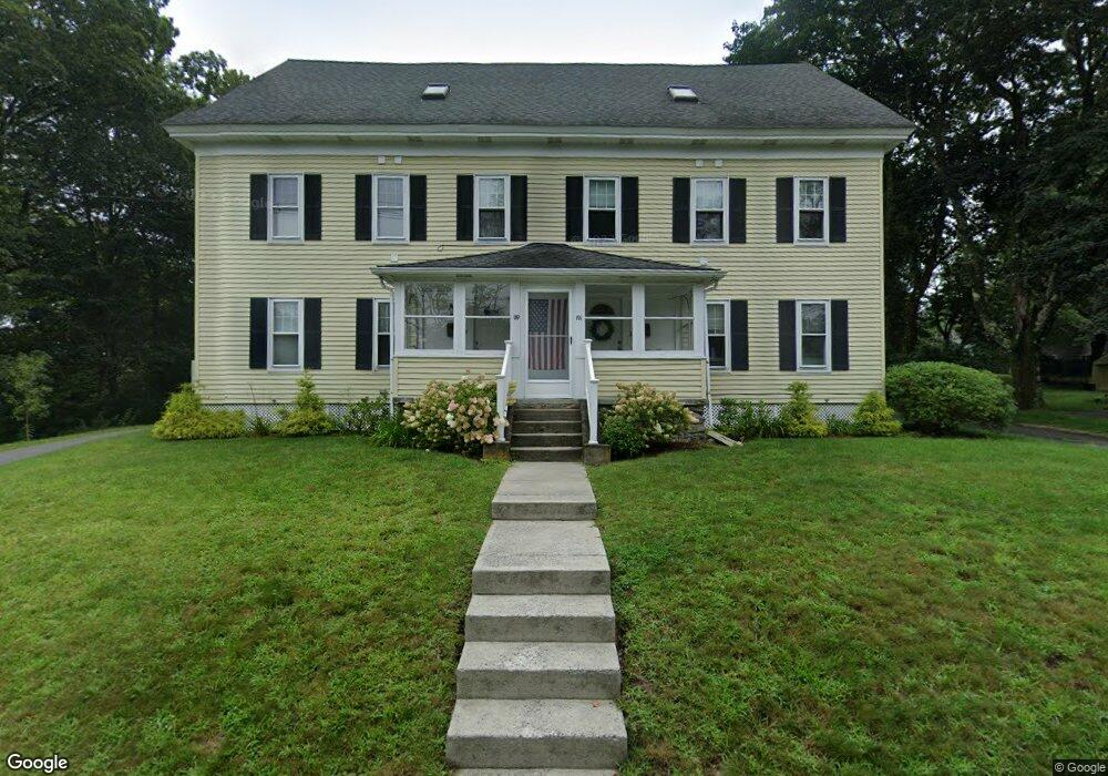
191 Conant St Concord, MA 01742
Estimated Value: $785,000 - $1,120,000
4
Beds
3
Baths
1,939
Sq Ft
$466/Sq Ft
Est. Value
About This Home
This home is located at 191 Conant St, Concord, MA 01742 and is currently estimated at $904,175, approximately $466 per square foot. 191 Conant St is a home located in Middlesex County with nearby schools including Thoreau Elementary School, Concord Middle School, and Nashoba Brooks School.
Ownership History
Date
Name
Owned For
Owner Type
Purchase Details
Closed on
Mar 23, 2020
Sold by
Bomer and Norton Christy
Bought by
Callahan Nora T and Callahan Richard E
Current Estimated Value
Home Financials for this Owner
Home Financials are based on the most recent Mortgage that was taken out on this home.
Original Mortgage
$509,580
Outstanding Balance
$450,445
Interest Rate
3.4%
Mortgage Type
New Conventional
Estimated Equity
$453,730
Purchase Details
Closed on
Nov 26, 2008
Sold by
Nelson David and Eannuzzo Nicholas
Bought by
Norton Linda E and Norton Thomas F
Home Financials for this Owner
Home Financials are based on the most recent Mortgage that was taken out on this home.
Original Mortgage
$330,550
Interest Rate
6.47%
Mortgage Type
Purchase Money Mortgage
Create a Home Valuation Report for This Property
The Home Valuation Report is an in-depth analysis detailing your home's value as well as a comparison with similar homes in the area
Home Values in the Area
Average Home Value in this Area
Purchase History
| Date | Buyer | Sale Price | Title Company |
|---|---|---|---|
| Callahan Nora T | $536,400 | None Available | |
| Norton Linda E | $481,500 | -- |
Source: Public Records
Mortgage History
| Date | Status | Borrower | Loan Amount |
|---|---|---|---|
| Open | Callahan Nora T | $509,580 | |
| Previous Owner | Norton Linda E | $330,550 |
Source: Public Records
Tax History Compared to Growth
Tax History
| Year | Tax Paid | Tax Assessment Tax Assessment Total Assessment is a certain percentage of the fair market value that is determined by local assessors to be the total taxable value of land and additions on the property. | Land | Improvement |
|---|---|---|---|---|
| 2025 | $85 | $638,100 | $0 | $638,100 |
| 2024 | $8,148 | $620,600 | $0 | $620,600 |
| 2023 | $7,797 | $601,600 | $0 | $601,600 |
| 2022 | $7,756 | $525,500 | $0 | $525,500 |
| 2021 | $9,377 | $637,000 | $0 | $637,000 |
| 2020 | $9,065 | $637,000 | $0 | $637,000 |
| 2019 | $8,954 | $631,000 | $0 | $631,000 |
| 2018 | $8,271 | $578,800 | $0 | $578,800 |
Source: Public Records
Map
Nearby Homes
- 70 McCallar Ln
- 102 Highland St
- 1687 Main St
- 54 Maple St
- 27 Water St
- 37 Water St
- 70 Hillside Ave
- 111 Central St
- 88 Wright Rd
- 1844 Main St Unit 1844
- 10 Wright Rd
- 65 Summit St
- 114 Upland Rd
- 80 N Branch Rd
- 23 Concord Greene Unit 4
- 12 S Meadow Ridge Unit 12
- 12 S Meadow Ridge
- 16 Concord Greene Unit 5
- 1053 Main St
- 24 Concord Greene Unit 7
- 191 Conant St Unit 191
- 191 Conant St Unit 2
- 189 Conant St Unit 1
- 189 Conant St Unit U-189
- 188 Conant St
- 194 Conant St
- 1550 Main St
- 175 Conant St
- 44 Damon St
- Lot 2248 Conant St
- 51 Damon St
- 1574 Main St
- 1576 Main St
- 1576 Main St Unit 1
- 1544 Main St
- 45 Damon St
- 1582 Main St
- 20 Damon St
- 16 Damon St
- 26 Damon St