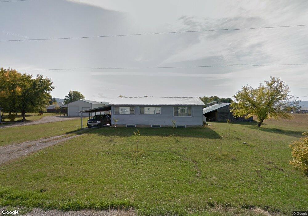
191 Degrief Rd Colville, WA 99114
Estimated Value: $268,628 - $390,000
2
Beds
1
Bath
2,240
Sq Ft
$139/Sq Ft
Est. Value
About This Home
This home is located at 191 Degrief Rd, Colville, WA 99114 and is currently estimated at $312,157, approximately $139 per square foot. 191 Degrief Rd is a home located in Stevens County with nearby schools including Hofstetter Elementary School, Fort Colville Elementary School, and Colville Junior High School.
Ownership History
Date
Name
Owned For
Owner Type
Purchase Details
Closed on
May 14, 2010
Sold by
Blackburn Owen L and Blackburn Joann
Bought by
Gibbs Gene A
Current Estimated Value
Home Financials for this Owner
Home Financials are based on the most recent Mortgage that was taken out on this home.
Original Mortgage
$143,846
Outstanding Balance
$98,514
Interest Rate
5.5%
Mortgage Type
FHA
Estimated Equity
$213,643
Create a Home Valuation Report for This Property
The Home Valuation Report is an in-depth analysis detailing your home's value as well as a comparison with similar homes in the area
Home Values in the Area
Average Home Value in this Area
Purchase History
| Date | Buyer | Sale Price | Title Company |
|---|---|---|---|
| Gibbs Gene A | $146,500 | Stevens County Title Company |
Source: Public Records
Mortgage History
| Date | Status | Borrower | Loan Amount |
|---|---|---|---|
| Open | Gibbs Gene A | $143,846 |
Source: Public Records
Tax History Compared to Growth
Tax History
| Year | Tax Paid | Tax Assessment Tax Assessment Total Assessment is a certain percentage of the fair market value that is determined by local assessors to be the total taxable value of land and additions on the property. | Land | Improvement |
|---|---|---|---|---|
| 2024 | $826 | $124,129 | $60,000 | $64,129 |
| 2023 | $830 | $124,966 | $60,000 | $64,966 |
| 2022 | $877 | $122,600 | $60,000 | $62,600 |
| 2021 | $918 | $114,627 | $60,000 | $54,627 |
| 2020 | $913 | $114,627 | $60,000 | $54,627 |
| 2019 | $929 | $115,818 | $60,000 | $55,818 |
| 2018 | $1,085 | $113,079 | $60,000 | $53,079 |
| 2017 | $982 | $112,933 | $60,000 | $52,933 |
| 2016 | $1,013 | $112,933 | $60,000 | $52,933 |
| 2015 | $1,056 | $115,129 | $60,000 | $55,129 |
| 2013 | -- | $113,095 | $63,000 | $50,095 |
Source: Public Records
Map
Nearby Homes
- 176 Aladdin Rd
- 1900 Tamarack St
- 170-TBD State Route 20
- Xxx Aladdin Rd
- 1650ABC E Fairway Loop Rd
- 1650 E Fairway Loop Rd
- 960 E Astor Ave
- 860 E 2nd Ave
- 967 E Birch Ave
- 272 S Alder St
- 2037 Ringneck Loop
- 935 E Birch Ave
- 2058 Ringneck Loop
- 1262 E Elep Ave
- 697 N Hofstetter St
- 2082 Whitetail Way
- 117 Crestview Dr
- 508 N Cedar St
- 350 N Cedar St
- 135 Highway 20 E
- 183 Degrief Rd
- 180 Degrief Rd
- 195 Degrief Rd
- 134 Laundry Rd
- 145 Highway 20 E
- 147 Highway 20 E
- 154 Laundry Rd
- 151 Highway 20 E
- 178 Degrief Rd
- 178 Degrief Rd
- 140 Aladdin Rd
- 153 Highway 20 E
- 1763 Laundry Rd
- 159 Degrief Rd
- 3 Aladdin Rd
- 4 Aladdin Rd
- 5 Aladdin Rd
- 2 Aladdin Rd
- TBD Degrief Rd