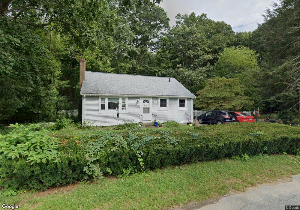
191 Donald Tennant Cir North Attleboro, MA 02760
North Attleboro NeighborhoodEstimated Value: $427,834 - $525,000
3
Beds
2
Baths
918
Sq Ft
$513/Sq Ft
Est. Value
About This Home
This home is located at 191 Donald Tennant Cir, North Attleboro, MA 02760 and is currently estimated at $471,209, approximately $513 per square foot. 191 Donald Tennant Cir is a home located in Bristol County with nearby schools including North Attleboro High School, Cadence Academy Preschool - North Attleborough, and Bishop Feehan High School.
Ownership History
Date
Name
Owned For
Owner Type
Purchase Details
Closed on
Nov 30, 2007
Sold by
Carpeno Ruth J
Bought by
Cyr Shaun C and Cyr Amanda F
Current Estimated Value
Home Financials for this Owner
Home Financials are based on the most recent Mortgage that was taken out on this home.
Original Mortgage
$233,814
Outstanding Balance
$149,366
Interest Rate
6.48%
Mortgage Type
Purchase Money Mortgage
Estimated Equity
$321,843
Create a Home Valuation Report for This Property
The Home Valuation Report is an in-depth analysis detailing your home's value as well as a comparison with similar homes in the area
Home Values in the Area
Average Home Value in this Area
Purchase History
| Date | Buyer | Sale Price | Title Company |
|---|---|---|---|
| Cyr Shaun C | $248,000 | -- |
Source: Public Records
Mortgage History
| Date | Status | Borrower | Loan Amount |
|---|---|---|---|
| Open | Cyr Shaun C | $233,814 |
Source: Public Records
Tax History Compared to Growth
Tax History
| Year | Tax Paid | Tax Assessment Tax Assessment Total Assessment is a certain percentage of the fair market value that is determined by local assessors to be the total taxable value of land and additions on the property. | Land | Improvement |
|---|---|---|---|---|
| 2025 | $3,895 | $330,400 | $114,600 | $215,800 |
| 2024 | $3,725 | $322,800 | $114,600 | $208,200 |
| 2023 | $3,868 | $302,400 | $114,600 | $187,800 |
| 2022 | $3,747 | $269,000 | $114,600 | $154,400 |
| 2021 | $3,037 | $253,000 | $114,600 | $138,400 |
| 2020 | $2,908 | $245,300 | $114,600 | $130,700 |
| 2019 | $3,345 | $234,900 | $104,200 | $130,700 |
| 2018 | $2,677 | $223,900 | $104,200 | $119,700 |
| 2017 | $2,857 | $216,100 | $104,200 | $111,900 |
| 2016 | $2,805 | $212,200 | $115,700 | $96,500 |
| 2015 | $2,706 | $205,900 | $121,500 | $84,400 |
| 2014 | $2,611 | $197,200 | $112,400 | $84,800 |
Source: Public Records
Map
Nearby Homes
- 196 Donald Tennant Cir
- 11 Landry Ave
- 115 Westfield Dr
- 57 Vine St
- 11 Buckthorn Ln
- Lot 2 Jeffrey Dr
- Lot 5 Jeffrey Dr
- 5 Old Wood Rd
- 116 George St
- 255 Mckeon Dr
- 12 Houde St
- 40 Natalie Dr
- 150 Gilbert St
- 24 Maverick Dr
- 20 Sperry Ln
- 835 Mt Hope St Unit 39
- 28 Messenger St
- 21 Shady Ln
- 9 Sunnyside Dr Unit 9
- 711 Mount Hope St Unit 13
- 199 Donald Tennant Cir
- 190 Donald Tennant Cir
- 205 Donald Tennant Cir
- 206 Donald Tennant Cir
- 206 Donald Tennant Cir
- 42 Donald Tennant Cir
- 34 Donald Tennant Cir
- 48 Donald Tennant Cir
- 209 Donald Tennant Cir
- 26 Donald Tennant Cir
- 56 Donald Tennant Cir
- 66 Donald Tennant Cir
- 215 Donald Tennant Cir
- 323 Kelley Blvd
- 39 Donald Tennant Cir
- 33 Donald Tennant Cir
- 47 Donald Tennant Cir
- 14 Donald Tennant Cir
- 27 Donald Tennant Cir
- 70 Donald Tennant Cir