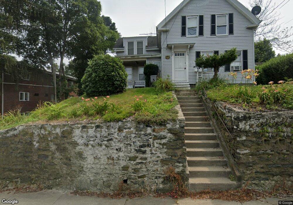
191 E Main St Marlborough, MA 01752
Estimated Value: $537,000 - $660,000
3
Beds
3
Baths
1,507
Sq Ft
$380/Sq Ft
Est. Value
About This Home
This home is located at 191 E Main St, Marlborough, MA 01752 and is currently estimated at $572,543, approximately $379 per square foot. 191 E Main St is a home located in Middlesex County with nearby schools including Marlborough High School, New Covenant Christian School, and Glenhaven Academy - JRI School.
Ownership History
Date
Name
Owned For
Owner Type
Purchase Details
Closed on
Oct 27, 2004
Sold by
Rojas Hernan M and Rojas Lidia
Bought by
Rojas Lidia M and Rojas Sabino F
Current Estimated Value
Home Financials for this Owner
Home Financials are based on the most recent Mortgage that was taken out on this home.
Original Mortgage
$130,000
Interest Rate
5.74%
Mortgage Type
Purchase Money Mortgage
Purchase Details
Closed on
Aug 1, 1997
Sold by
Brisbois Robert B
Bought by
Rojas Sabino F and Rojas Lidia
Home Financials for this Owner
Home Financials are based on the most recent Mortgage that was taken out on this home.
Original Mortgage
$138,139
Interest Rate
7.55%
Mortgage Type
Purchase Money Mortgage
Purchase Details
Closed on
Jul 2, 1991
Sold by
Marlboro Co-Op Bk
Bought by
Brisbois Brisbois Robert B Robert B and Brisbois Eleni
Purchase Details
Closed on
May 22, 1991
Sold by
191 East Main St Rt
Bought by
Marlboro Co-Op Bk
Create a Home Valuation Report for This Property
The Home Valuation Report is an in-depth analysis detailing your home's value as well as a comparison with similar homes in the area
Home Values in the Area
Average Home Value in this Area
Purchase History
| Date | Buyer | Sale Price | Title Company |
|---|---|---|---|
| Rojas Lidia M | -- | -- | |
| Rojas Sabino F | $141,000 | -- | |
| Brisbois Brisbois Robert B Robert B | $110,000 | -- | |
| Marlboro Co-Op Bk | $82,000 | -- |
Source: Public Records
Mortgage History
| Date | Status | Borrower | Loan Amount |
|---|---|---|---|
| Open | Marlboro Co-Op Bk | $121,000 | |
| Closed | Rojas Lidia M | $130,000 | |
| Previous Owner | Marlboro Co-Op Bk | $138,139 |
Source: Public Records
Tax History
| Year | Tax Paid | Tax Assessment Tax Assessment Total Assessment is a certain percentage of the fair market value that is determined by local assessors to be the total taxable value of land and additions on the property. | Land | Improvement |
|---|---|---|---|---|
| 2025 | $5,023 | $509,400 | $213,600 | $295,800 |
| 2024 | $4,656 | $454,700 | $194,100 | $260,600 |
| 2023 | $4,773 | $413,600 | $156,800 | $256,800 |
| 2022 | $4,697 | $358,000 | $149,300 | $208,700 |
| 2021 | $4,362 | $316,100 | $121,600 | $194,500 |
| 2020 | $4,236 | $298,700 | $118,500 | $180,200 |
| 2019 | $4,041 | $287,200 | $116,100 | $171,100 |
| 2018 | $3,633 | $248,300 | $96,700 | $151,600 |
| 2017 | $3,243 | $211,700 | $94,800 | $116,900 |
| 2016 | $3,114 | $203,000 | $94,800 | $108,200 |
| 2015 | $3,111 | $197,400 | $97,300 | $100,100 |
Source: Public Records
Map
Nearby Homes
- 24 Clinton St
- 61 Lincoln St
- 75 Lincoln St
- 48 Cook Ln
- 35 High St Unit 9
- 112 Shawmut Ave
- 19 Ames Place
- 24 Bolton St
- 12 Bridge St
- 37 Union St
- 183 Sherwood Dr S
- 181 Boston Post Rd E Unit 26
- 181 Boston Post Rd E Unit 64
- 144 Howe St
- 70 Phelps St
- 272 Lincoln St Unit 301
- 272 Lincoln St Unit 302
- 272 Lincoln St Unit 102
- 38 Airport Blvd
- 173 Howe St
- 183 E Main St
- 195 E Main St
- 12 Walnut St
- 186 E Main St Unit 4
- 186 E Main St Unit 10
- 186 E Main St Unit 16
- 186 E Main St Unit 24
- 186 E Main St Unit 19
- 186 E Main St Unit 23 & 4
- 186 E Main St
- 202 E Main St
- 202 E Main St Unit 3
- 202 E Main St Unit 2
- 7 Walnut St Unit 2
- 7 Walnut St Unit 1
- 11 Clinton St
- 22 Walnut St
- 167 E Main St
- 11 Walnut St
- 211 E Main St Unit 1, 4
Your Personal Tour Guide
Ask me questions while you tour the home.