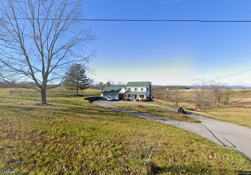
191 E Mattie Rd Breezewood, PA 15533
Estimated Value: $276,000 - $322,000
3
Beds
2
Baths
1,624
Sq Ft
$185/Sq Ft
Est. Value
About This Home
This home is located at 191 E Mattie Rd, Breezewood, PA 15533 and is currently estimated at $300,000, approximately $184 per square foot. 191 E Mattie Rd is a home located in Bedford County with nearby schools including Everett Area High School.
Ownership History
Date
Name
Owned For
Owner Type
Purchase Details
Closed on
Feb 12, 2020
Sold by
Weaver Joshua D and Weaver Casey L
Bought by
Long Steven E and Long Donna Sue
Current Estimated Value
Purchase Details
Closed on
Feb 15, 2008
Sold by
Powell Anthony L and Powell Michelle J
Bought by
Weaver Joshua D and Weaver Casey L
Home Financials for this Owner
Home Financials are based on the most recent Mortgage that was taken out on this home.
Original Mortgage
$153,000
Interest Rate
6.14%
Mortgage Type
New Conventional
Purchase Details
Closed on
Jun 17, 2005
Sold by
Norris Gregory A and Norris Roxanne B
Bought by
Powell Anthony L and Powell Michelle J
Home Financials for this Owner
Home Financials are based on the most recent Mortgage that was taken out on this home.
Original Mortgage
$26,000
Interest Rate
5.78%
Mortgage Type
Seller Take Back
Create a Home Valuation Report for This Property
The Home Valuation Report is an in-depth analysis detailing your home's value as well as a comparison with similar homes in the area
Home Values in the Area
Average Home Value in this Area
Purchase History
| Date | Buyer | Sale Price | Title Company |
|---|---|---|---|
| Long Steven E | $220,000 | None Available | |
| Weaver Joshua D | $145,000 | None Available | |
| Powell Anthony L | $130,000 | None Available |
Source: Public Records
Mortgage History
| Date | Status | Borrower | Loan Amount |
|---|---|---|---|
| Previous Owner | Weaver Joshua D | $153,000 | |
| Previous Owner | Powell Anthony L | $26,000 |
Source: Public Records
Tax History Compared to Growth
Tax History
| Year | Tax Paid | Tax Assessment Tax Assessment Total Assessment is a certain percentage of the fair market value that is determined by local assessors to be the total taxable value of land and additions on the property. | Land | Improvement |
|---|---|---|---|---|
| 2025 | $2,413 | $134,100 | $32,700 | $101,400 |
| 2024 | $2,285 | $134,100 | $32,700 | $101,400 |
| 2023 | $2,148 | $134,100 | $32,700 | $101,400 |
| 2022 | $2,123 | $134,100 | $32,700 | $101,400 |
| 2021 | $2,079 | $134,100 | $32,700 | $101,400 |
| 2020 | $2,079 | $134,100 | $32,700 | $101,400 |
| 2019 | $2,007 | $134,100 | $32,700 | $101,400 |
| 2018 | $2,007 | $134,100 | $32,700 | $101,400 |
| 2017 | $1,962 | $134,100 | $32,700 | $101,400 |
| 2016 | -- | $134,100 | $32,700 | $101,400 |
| 2014 | -- | $134,100 | $32,700 | $101,400 |
Source: Public Records
Map
Nearby Homes
- 1422 Big Run Rd
- 0 Akers Rd Unit PABD2002772
- 0 Akers Rd Unit 78245
- 0 Akers Rd Unit 25509172
- 151 Rio Grande Rd
- 0 Monroe Mountain Rd
- 1217 Barton Rd
- 0 N Hixson Rd
- Off Addison Ridge Rd
- 1790 Monroe Mountain Rd
- 1764 Monroe Mountain Rd
- 1904 Monroe Mountain Rd
- 370 Kalers Loft Ln
- 451 Mcdaniel Rd
- 165 Flickerville Rd
- 664 S Breezewood Rd
- Lot 6 E Graceville Rd
- Lot 8 E Graceville Rd
- 2179 Layton Rd
- Lot 8 East Graceville Rd
- 126 E Mattie Rd
- 3035 W Mattie Rd
- 107 E Mattie Rd
- Lot X W Mattie Rd
- 3099 W Mattie Rd
- 3252 Rock Hill Church Rd
- 2914 W Mattie Rd
- 302 E Mattie Rd
- 3084 W Mattie Rd
- 104 Mt Pleasant Rd
- 3243 Rock Hill Church Rd
- 3119 W Mattie Rd Unit 1
- 3119 W Mattie Rd
- 2854 W Mattie Rd
- 3116 W Mattie Rd
- 172 Linda Vista Ln
- 172 Linda Vista Ln
- 3596 Addison Ridge Rd
- 144 Line Rd
- 2637 W Mattie Rd