
J
Seller's Agent in 2023
Joseph Gerry
Prudent Real Estate Associates
(570) 424-5408
1 in this area
45 Total Sales
Estimated Value: $127,000 - $237,000
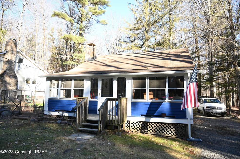
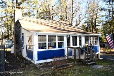
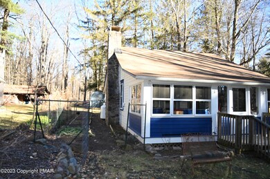
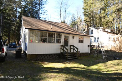
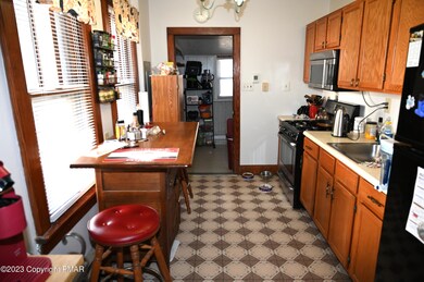
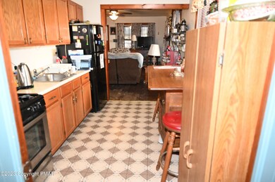
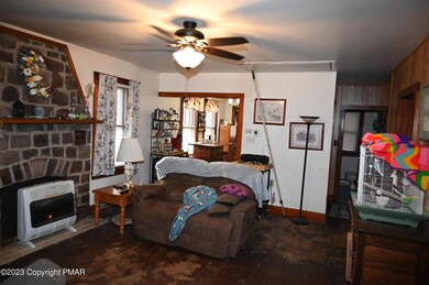
A One Floor Cape with Attic Storage awaits your showing. Situated on a Township Road with NO DUES OR HOA. Home is serviced by Public Sewer and On-Site Well. Front & Rear Porches are usable for storage etc. they are however, not heated. Livingroom has a Stone Fireplace. There are 2 bedrooms and possibility of a 3rd, which does not have a closet. Attic is accessed by a drop-down stair unit. Home was built in 1940, and has lasted the test of time. Wood Flooring of yesteryear and quaint interior for comfortable and affordable living. Great location just off Route 115, Route 80 and Route 940. Great back yard with a Large Storage Shed. As a Plus, On those Spring, Summer and Fall night you can enjoy the outdoors by sitting around the fire-pit, listening and enjoying nature at it's best.
Last Agent to Sell the Property
Prudent Real Estate Associates License #RM063615 Listed on: 01/16/2023
| Date | Buyer | Sale Price | Title Company |
|---|---|---|---|
| Meyer Brigitte | $126,000 | -- | |
| Wagner Pamela | $83,500 | None Available |
| Date | Status | Borrower | Loan Amount |
|---|---|---|---|
| Open | Meyer Brigitte | $105,000 |
| Date | Event | Price | List to Sale | Price per Sq Ft |
|---|---|---|---|---|
| 03/20/2023 03/20/23 | Sold | $126,000 | -9.4% | $151 / Sq Ft |
| 02/04/2023 02/04/23 | Pending | -- | -- | -- |
| 01/16/2023 01/16/23 | For Sale | $139,000 | -- | $167 / Sq Ft |
| Year | Tax Paid | Tax Assessment Tax Assessment Total Assessment is a certain percentage of the fair market value that is determined by local assessors to be the total taxable value of land and additions on the property. | Land | Improvement |
|---|---|---|---|---|
| 2025 | $497 | $63,600 | $17,300 | $46,300 |
| 2024 | $412 | $63,600 | $17,300 | $46,300 |
| 2023 | $1,617 | $63,600 | $17,300 | $46,300 |
| 2022 | $1,595 | $63,600 | $17,300 | $46,300 |
| 2021 | $1,595 | $63,600 | $17,300 | $46,300 |
| 2019 | $1,305 | $7,600 | $2,250 | $5,350 |
| 2018 | $1,305 | $7,600 | $2,250 | $5,350 |
| 2017 | $1,320 | $7,600 | $2,250 | $5,350 |
| 2016 | $277 | $7,600 | $2,250 | $5,350 |
| 2015 | -- | $7,600 | $2,250 | $5,350 |
| 2014 | -- | $7,600 | $2,250 | $5,350 |
J
Seller's Agent in 2023
Joseph Gerry
Prudent Real Estate Associates
(570) 424-5408
1 in this area
45 Total Sales
B
Buyer's Agent in 2023
Brigitte White
The Collective Real Estate Agency
(484) 750-8175
2 in this area
11 Total Sales
Source: Pocono Mountains Association of REALTORS®
MLS Number: PM-103336
APN: 19.20.1.63
Disclaimer: Certain information contained herein is derived from information provided by parties other than Homes.com. All information provided is deemed reliable, but is not guaranteed to be accurate and should be independently verified.
![]() The data relating to real estate for sale on this web site includes listings held by MLS-IDX Participants of the Internet Data Exchange program of the Multiple Listing Service of the Pocono Mountains Association of Realtors®. Listings marked with the Internet Data Exchange logo are not necessarilty the listings of the owner of this web site. All listing data is the copyrighted property of the aforesaid Associations and its MLS-IDX Participants with all rights reserved. The information contained herein is believed to be accurate, but no warranty as such is expressed or implied.
The data relating to real estate for sale on this web site includes listings held by MLS-IDX Participants of the Internet Data Exchange program of the Multiple Listing Service of the Pocono Mountains Association of Realtors®. Listings marked with the Internet Data Exchange logo are not necessarilty the listings of the owner of this web site. All listing data is the copyrighted property of the aforesaid Associations and its MLS-IDX Participants with all rights reserved. The information contained herein is believed to be accurate, but no warranty as such is expressed or implied.
Ask me questions while you tour the home.