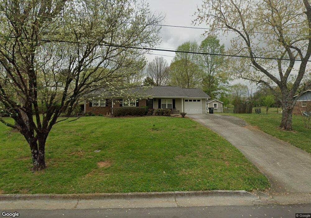
191 Holly Dr SW Calhoun, GA 30701
Estimated Value: $198,888 - $241,000
3
Beds
1
Bath
1,191
Sq Ft
$184/Sq Ft
Est. Value
About This Home
This home is located at 191 Holly Dr SW, Calhoun, GA 30701 and is currently estimated at $219,222, approximately $184 per square foot. 191 Holly Dr SW is a home located in Gordon County with nearby schools including Calhoun Primary School, Calhoun Elementary School, and Calhoun Middle School.
Ownership History
Date
Name
Owned For
Owner Type
Purchase Details
Closed on
May 13, 2024
Sold by
Davis Myrtle V
Bought by
Davis Kenneth W
Current Estimated Value
Purchase Details
Closed on
Oct 8, 2012
Sold by
Davis Cameron Wayne
Bought by
Davis V Myrtle
Purchase Details
Closed on
Feb 8, 2010
Sold by
Davis Myrtle V
Bought by
Davis Cameron Wayne
Purchase Details
Closed on
Feb 5, 2008
Sold by
Llanberis Ltd
Bought by
Davis Myrtle V
Purchase Details
Closed on
Jan 15, 2007
Sold by
Davis Myrtle V
Bought by
Llanberis Ltd
Purchase Details
Closed on
Aug 18, 1987
Sold by
Farmers Home
Bought by
Davis Myrtle V
Create a Home Valuation Report for This Property
The Home Valuation Report is an in-depth analysis detailing your home's value as well as a comparison with similar homes in the area
Home Values in the Area
Average Home Value in this Area
Purchase History
| Date | Buyer | Sale Price | Title Company |
|---|---|---|---|
| Davis Kenneth W | $125,880 | -- | |
| Davis V Myrtle | -- | -- | |
| Davis Cameron Wayne | $25,000 | -- | |
| Davis Myrtle V | -- | -- | |
| Llanberis Ltd | -- | -- | |
| Davis Myrtle V | -- | -- |
Source: Public Records
Tax History Compared to Growth
Tax History
| Year | Tax Paid | Tax Assessment Tax Assessment Total Assessment is a certain percentage of the fair market value that is determined by local assessors to be the total taxable value of land and additions on the property. | Land | Improvement |
|---|---|---|---|---|
| 2024 | $641 | $53,868 | $5,200 | $48,668 |
| 2023 | $598 | $50,352 | $5,200 | $45,152 |
| 2022 | $432 | $47,396 | $5,200 | $42,196 |
| 2021 | $481 | $40,920 | $5,200 | $35,720 |
| 2020 | $489 | $41,364 | $5,200 | $36,164 |
| 2019 | $487 | $41,364 | $5,200 | $36,164 |
| 2018 | $333 | $36,552 | $5,040 | $31,512 |
| 2017 | $320 | $34,592 | $5,040 | $29,552 |
| 2016 | $321 | $34,592 | $5,040 | $29,552 |
| 2015 | $317 | $33,952 | $5,040 | $28,912 |
| 2014 | $296 | $32,331 | $5,040 | $27,291 |
Source: Public Records
Map
Nearby Homes
- 261 Liberty Ln SW
- 0 Highway 53 Spur SW Unit 7529096
- 490 McDaniel Station Rd SW
- 506 McDaniel Station Rd SW
- 458 McDaniel Station Rd SW
- 474 McDaniel Station Rd SW
- 121 Foxhall Dr SW
- 0 Reeves Station Rd SW Unit 10548197
- 0 Reeves Station Rd SW Unit 7601645
- 00 Belmont Dr
- 130 Brookstone Dr SW
- 137 Regency Row SW
- 1401 U S 41
- 1311 Us Highway 41
- 0 W Belmont Dr Unit 10489910
- 1943 Rome Rd SW
- 413 Beamer Rd SW
- 176 Village Way SW
- 271 Old Belwood Rd SE
- The Braselton II Plan at Fair Oak
- 179 Holly Dr SW
- 205 Holly Dr SW
- 315 Flora Dr SW
- 217 Holly Dr SW
- 167 Holly Dr SW
- 303 Flora Dr SW
- 190 Holly Dr SW
- 162 Laurel Place SW
- 204 Holly Dr SW
- 180 Holly Dr SW
- 319 Flora Dr SW
- 160 Laurel Place SW
- 179 Laurel Place SW
- 216 Holly Dr SW
- 166 Holly Dr SW
- 155 Holly Dr SW
- 325 Flora Dr SW
- 310 Flora Dr SW Unit 16
- 310 Flora Dr SW
- 158 Laurel Place SW