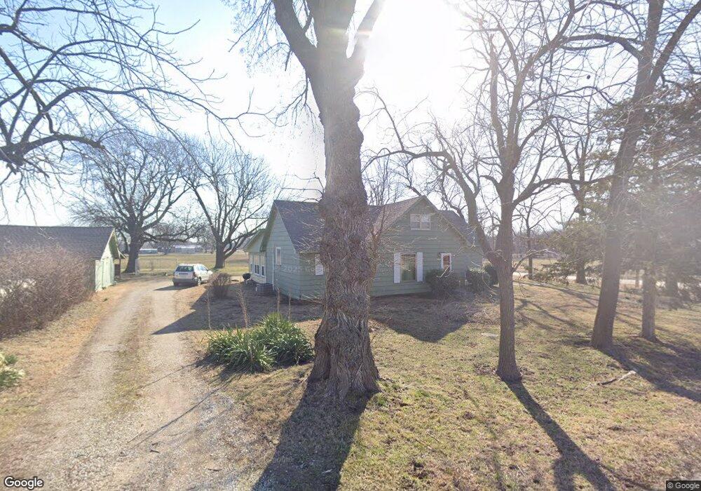
191 Main St Asbury, MO 64832
Estimated Value: $127,000 - $274,000
Studio
1
Bath
2,178
Sq Ft
$84/Sq Ft
Est. Value
About This Home
This home is located at 191 Main St, Asbury, MO 64832 and is currently estimated at $182,383, approximately $83 per square foot. 191 Main St is a home with nearby schools including Carl Junction Primary School (K-1), Carl Junction Intermediate School, and Carl Junction Primary School (2-3).
Ownership History
Date
Name
Owned For
Owner Type
Purchase Details
Closed on
May 27, 2025
Sold by
Elliott Kevin S and Elliott Mia A
Bought by
Lablank Ashley Nicole and Lablank Cortlin K
Current Estimated Value
Purchase Details
Closed on
Jun 14, 2024
Sold by
Lablank Ashley Nicole and Lablank Cortlin K
Bought by
Elliott Kevin S and Elliott Mia A
Purchase Details
Closed on
Dec 12, 2019
Sold by
Lablank Ashley and Lablank Cortlin K
Bought by
Elliott Kevin S and Elliott Mia A
Create a Home Valuation Report for This Property
The Home Valuation Report is an in-depth analysis detailing your home's value as well as a comparison with similar homes in the area
Purchase History
| Date | Buyer | Sale Price | Title Company |
|---|---|---|---|
| Lablank Ashley Nicole | -- | Waco Title | |
| Elliott Kevin S | -- | None Listed On Document | |
| Elliott Kevin S | -- | None Available |
Source: Public Records
Tax History
| Year | Tax Paid | Tax Assessment Tax Assessment Total Assessment is a certain percentage of the fair market value that is determined by local assessors to be the total taxable value of land and additions on the property. | Land | Improvement |
|---|---|---|---|---|
| 2025 | $805 | $17,130 | $630 | $16,500 |
| 2024 | $802 | $15,050 | $630 | $14,420 |
| 2023 | $802 | $15,050 | $630 | $14,420 |
| 2022 | $791 | $14,740 | $630 | $14,110 |
| 2021 | $786 | $14,740 | $630 | $14,110 |
| 2020 | $717 | $13,460 | $630 | $12,830 |
Source: Public Records
Map
Nearby Homes
- 000 290 Cr
- 0002 Cr 290
- 0001 Cr 290
- Tbd County Road 270
- 0001 Cr-290
- 0002 Cr-290
- 13106 County Lane 268
- 13786 County Road 270
- TBD Kafir Rd
- 0 Kafir Rd Unit HMS2589605
- 10437 County Road 270
- Lot 4B Hwy 171 & Fir Rd
- Lot 4 Hwy 171 & Fir Rd
- 0000 Kafir Rd
- TBD Route Yy
- 29320 State Highway Yy
- 29865 State Highway Yy
- 1000 Aberdeen Ave
- 1001 Aberdeen Ave
- 908 Aberdeen Ave
Your Personal Tour Guide
Ask me questions while you tour the home.