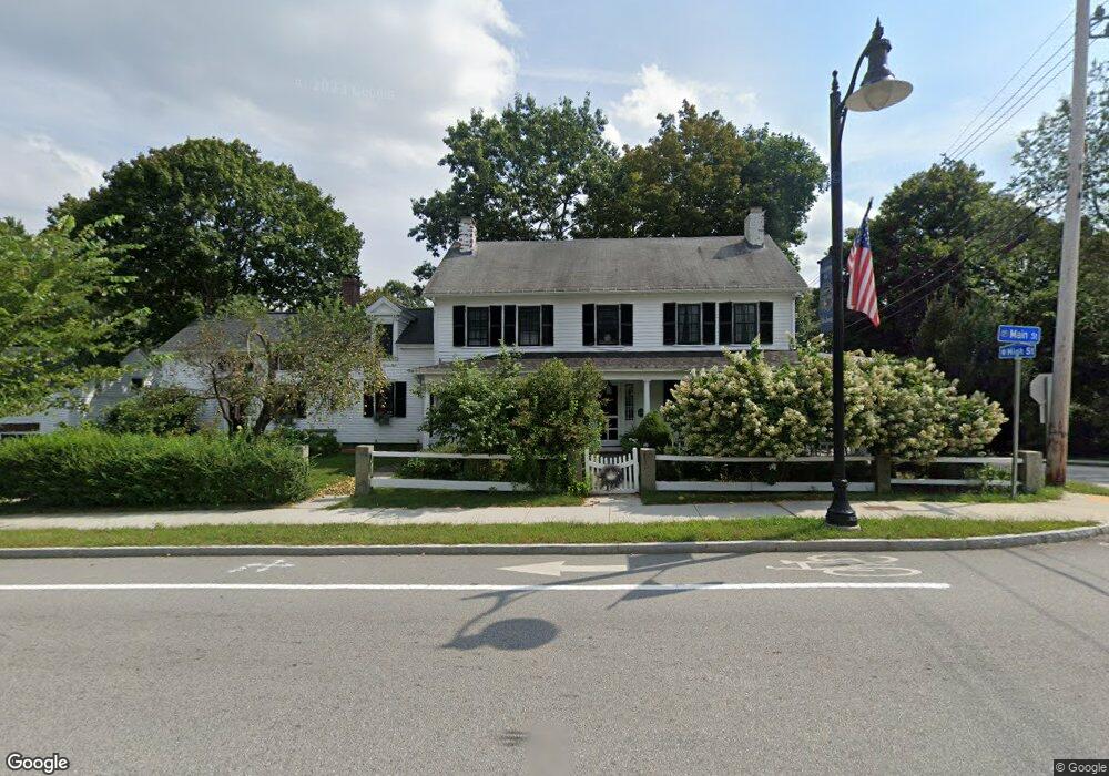
191 Main St Medway, MA 02053
Estimated Value: $638,162 - $811,000
5
Beds
2
Baths
2,466
Sq Ft
$296/Sq Ft
Est. Value
About This Home
This home is located at 191 Main St, Medway, MA 02053 and is currently estimated at $729,041, approximately $295 per square foot. 191 Main St is a home located in Norfolk County with nearby schools including John D. McGovern Elementary School, Burke-Memorial Elementary, and Medway Middle School.
Ownership History
Date
Name
Owned For
Owner Type
Purchase Details
Closed on
Mar 22, 1991
Sold by
Bauer William H and Bauer Rosemary J
Bought by
White William J and White Maryjane
Current Estimated Value
Create a Home Valuation Report for This Property
The Home Valuation Report is an in-depth analysis detailing your home's value as well as a comparison with similar homes in the area
Home Values in the Area
Average Home Value in this Area
Purchase History
| Date | Buyer | Sale Price | Title Company |
|---|---|---|---|
| White William J | $24,600 | -- |
Source: Public Records
Mortgage History
| Date | Status | Borrower | Loan Amount |
|---|---|---|---|
| Open | White William J | $191,600 | |
| Closed | White William J | $20,000 | |
| Closed | White William J | $120,000 |
Source: Public Records
Tax History
| Year | Tax Paid | Tax Assessment Tax Assessment Total Assessment is a certain percentage of the fair market value that is determined by local assessors to be the total taxable value of land and additions on the property. | Land | Improvement |
|---|---|---|---|---|
| 2025 | $7,564 | $530,800 | $275,400 | $255,400 |
| 2024 | $7,644 | $530,800 | $275,400 | $255,400 |
| 2023 | $7,532 | $472,500 | $240,600 | $231,900 |
| 2022 | $7,200 | $425,300 | $203,600 | $221,700 |
| 2021 | $6,951 | $398,100 | $184,000 | $214,100 |
| 2020 | $6,571 | $375,500 | $162,200 | $213,300 |
| 2019 | $6,131 | $361,300 | $153,500 | $207,800 |
| 2018 | $6,124 | $346,800 | $131,700 | $215,100 |
| 2017 | $6,113 | $341,100 | $131,700 | $209,400 |
| 2016 | $5,783 | $319,300 | $109,900 | $209,400 |
| 2015 | $5,549 | $304,200 | $109,900 | $194,300 |
| 2014 | $5,514 | $292,700 | $120,800 | $171,900 |
Source: Public Records
Map
Nearby Homes
- 2 Mechanic St Unit 1
- 176 Main St Unit 3
- 10 Franklin St
- 6 Freedom Trail
- 5 Richardson St
- 4 Shaw St
- 6 Kingson Ln Unit 2
- 39 West St
- 462 Hartford Ave
- 79 Lovering St Unit B
- 10 Prospect St
- 60 Pine St
- 8 Woodhaven Dr
- 106 Holliston St
- 204 Village St
- 44 Arapahoe Rd
- 50 Main St
- 33 Gorwin Dr
- 40 Timber Crest Dr
- 14 Sanford St Unit 15
- 189 Main St
- 27 High St
- 192 Main St Unit F
- 192 Main St Unit E
- 192 Main St Unit D/E
- 192 Main St Unit F/G
- 192 Main St Unit C
- 192 Main St Unit 4
- 192 Main St Unit 2
- 192 Main St Unit 1
- 192 Main St Unit D
- 192 Main St Unit H
- 192 Main St Unit G
- 192 Main St
- 190 Main St
- 187 Main St
- 28 High St
- 6 Slocumb Place
- 188 Main St
- 183 Main St