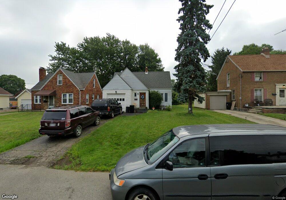
191 Marlow Rd Mansfield, OH 44906
Estimated Value: $102,163 - $121,000
3
Beds
2
Baths
973
Sq Ft
$116/Sq Ft
Est. Value
About This Home
This home is located at 191 Marlow Rd, Mansfield, OH 44906 and is currently estimated at $112,541, approximately $115 per square foot. 191 Marlow Rd is a home located in Richland County with nearby schools including Goal Digital Academy, Mansfield Elective Academy, and Discovery School.
Ownership History
Date
Name
Owned For
Owner Type
Purchase Details
Closed on
Sep 9, 2019
Sold by
Merwine Larry D
Bought by
Sps Properties Of Mansfield Llc
Current Estimated Value
Purchase Details
Closed on
Oct 24, 2013
Sold by
Powers Dustin L
Bought by
Merwine Larry D
Purchase Details
Closed on
Apr 1, 2002
Sold by
Tolley Charles R
Bought by
Powers Dustin L
Home Financials for this Owner
Home Financials are based on the most recent Mortgage that was taken out on this home.
Original Mortgage
$60,800
Interest Rate
6.93%
Mortgage Type
New Conventional
Purchase Details
Closed on
Oct 3, 1995
Sold by
Clifton Ernie R
Bought by
Tolley Charles R and Tolley Linda D
Home Financials for this Owner
Home Financials are based on the most recent Mortgage that was taken out on this home.
Original Mortgage
$48,600
Interest Rate
7.48%
Mortgage Type
New Conventional
Purchase Details
Closed on
Nov 1, 1986
Create a Home Valuation Report for This Property
The Home Valuation Report is an in-depth analysis detailing your home's value as well as a comparison with similar homes in the area
Home Values in the Area
Average Home Value in this Area
Purchase History
| Date | Buyer | Sale Price | Title Company |
|---|---|---|---|
| Sps Properties Of Mansfield Llc | -- | None Available | |
| Merwine Larry D | $22,000 | Chicago Title Agency Of Nort | |
| Powers Dustin L | $64,000 | -- | |
| Tolley Charles R | $43,580 | -- | |
| -- | $42,500 | -- |
Source: Public Records
Mortgage History
| Date | Status | Borrower | Loan Amount |
|---|---|---|---|
| Previous Owner | Powers Dustin L | $60,800 | |
| Previous Owner | Tolley Charles R | $48,600 |
Source: Public Records
Tax History
| Year | Tax Paid | Tax Assessment Tax Assessment Total Assessment is a certain percentage of the fair market value that is determined by local assessors to be the total taxable value of land and additions on the property. | Land | Improvement |
|---|---|---|---|---|
| 2024 | $882 | $18,420 | $3,710 | $14,710 |
| 2023 | $882 | $18,420 | $3,710 | $14,710 |
| 2022 | $770 | $13,480 | $3,190 | $10,290 |
| 2021 | $775 | $13,480 | $3,190 | $10,290 |
| 2020 | $793 | $13,480 | $3,190 | $10,290 |
| 2019 | $879 | $13,480 | $3,190 | $10,290 |
| 2018 | $867 | $13,480 | $3,190 | $10,290 |
| 2017 | $699 | $13,480 | $3,190 | $10,290 |
| 2016 | $555 | $8,590 | $4,620 | $3,970 |
| 2015 | $530 | $8,590 | $4,620 | $3,970 |
| 2014 | $523 | $8,590 | $4,620 | $3,970 |
| 2012 | $988 | $21,790 | $4,620 | $17,170 |
Source: Public Records
Map
Nearby Homes
- 143 Fairlawn Ave
- 135 Fairlawn Ave
- 129 Fairlawn Ave
- 679 Coleman Rd
- 686 Barnard Ave
- 988 Kentland Dr
- 356 S Linden Rd
- 232 S Trimble Rd Unit 234
- 216 S Trimble Rd Unit 218
- 189 Westwood Ave
- 244 S Trimble Rd Unit 246
- 116 Stewart Ave S
- 108 Stewart Ave S
- 960 W Linden Cir
- 133 Stewart Ave S
- 126 Dawson Ave
- 24 Stewart Ave S
- 71 Dawson Ave
- 455 Marion Ave
- 616 Cline Ave
Your Personal Tour Guide
Ask me questions while you tour the home.