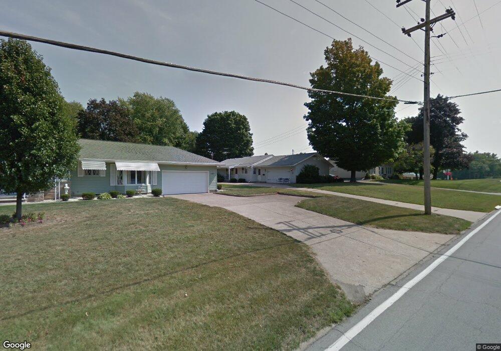
191 S Leavitt Rd Amherst, OH 44001
Estimated Value: $189,000 - $215,000
3
Beds
2
Baths
1,254
Sq Ft
$163/Sq Ft
Est. Value
About This Home
This home is located at 191 S Leavitt Rd, Amherst, OH 44001 and is currently estimated at $204,445, approximately $163 per square foot. 191 S Leavitt Rd is a home located in Lorain County with nearby schools including Powers Elementary School, Walter G. Nord Middle School, and Amherst Junior High School.
Ownership History
Date
Name
Owned For
Owner Type
Purchase Details
Closed on
Apr 21, 2006
Sold by
Phillips Betty Jane and Phillips Ronnie H
Bought by
Urig Robert E and Urig Rose M
Current Estimated Value
Home Financials for this Owner
Home Financials are based on the most recent Mortgage that was taken out on this home.
Original Mortgage
$104,000
Outstanding Balance
$5,280
Interest Rate
6.42%
Mortgage Type
Fannie Mae Freddie Mac
Estimated Equity
$199,165
Purchase Details
Closed on
Feb 21, 2001
Sold by
Waldron Lydia
Bought by
Martin Jean and Phillips Betty Jane
Create a Home Valuation Report for This Property
The Home Valuation Report is an in-depth analysis detailing your home's value as well as a comparison with similar homes in the area
Home Values in the Area
Average Home Value in this Area
Purchase History
| Date | Buyer | Sale Price | Title Company |
|---|---|---|---|
| Urig Robert E | -- | Real Living Title Agency Ltd | |
| Martin Jean | -- | -- |
Source: Public Records
Mortgage History
| Date | Status | Borrower | Loan Amount |
|---|---|---|---|
| Open | Urig Robert E | $104,000 |
Source: Public Records
Tax History Compared to Growth
Tax History
| Year | Tax Paid | Tax Assessment Tax Assessment Total Assessment is a certain percentage of the fair market value that is determined by local assessors to be the total taxable value of land and additions on the property. | Land | Improvement |
|---|---|---|---|---|
| 2024 | $1,871 | $45,241 | $11,893 | $33,348 |
| 2023 | $2,507 | $51,072 | $13,692 | $37,380 |
| 2022 | $2,407 | $51,072 | $13,692 | $37,380 |
| 2021 | $2,414 | $51,072 | $13,692 | $37,380 |
| 2020 | $2,275 | $42,740 | $11,460 | $31,280 |
| 2019 | $2,231 | $42,740 | $11,460 | $31,280 |
| 2018 | $2,243 | $42,740 | $11,460 | $31,280 |
| 2017 | $2,006 | $35,880 | $9,170 | $26,710 |
| 2016 | $2,022 | $35,880 | $9,170 | $26,710 |
| 2015 | $2,013 | $35,880 | $9,170 | $26,710 |
| 2014 | $2,107 | $37,380 | $9,550 | $27,830 |
| 2013 | $2,114 | $37,380 | $9,550 | $27,830 |
Source: Public Records
Map
Nearby Homes
- 1140 Woodside Dr
- 135 Ridgeland Dr
- 891 Park Ave
- 179 Jackson St
- 105 N Woodhill Dr
- 825 Cleveland Ave
- 7475 S Dewey Rd
- 653 Brennan Dr
- 0 Middle Ridge Rd Unit 5102632
- 0 Middle Ridge Rd Unit 5160578
- 574 Fieldstone Dr
- 2176 Myla Way
- 6394 Balsam Dr
- 7325 Hidden Glen Dr
- 8 Riviera Ave
- 726 Sunrise Dr
- 45200 Middle Ridge Rd
- 752 Trails End Dr
- 60 Flamingo Ave
- 357 Rockridge Dr
- 189 S Leavitt Rd
- 195 S Leavitt Rd
- 196 Butternut Dr
- 185 S Leavitt Rd
- 194 S Leavitt Rd
- 198 Butternut Dr
- 198 S Leavitt Rd
- 190 Butternut Dr
- 184 S Leavitt Rd
- 186 Butternut Dr
- 183 S Leavitt Rd
- 60 Hume Hill Dr
- 1175 Park Ave
- 195 Butternut Dr
- 184 Butternut Dr
- 61 Hume Hill Dr
- 208 S Leavitt Rd
- 1243 Park Ave
- 179 S Leavitt Rd
- 58 Hume Hill Dr