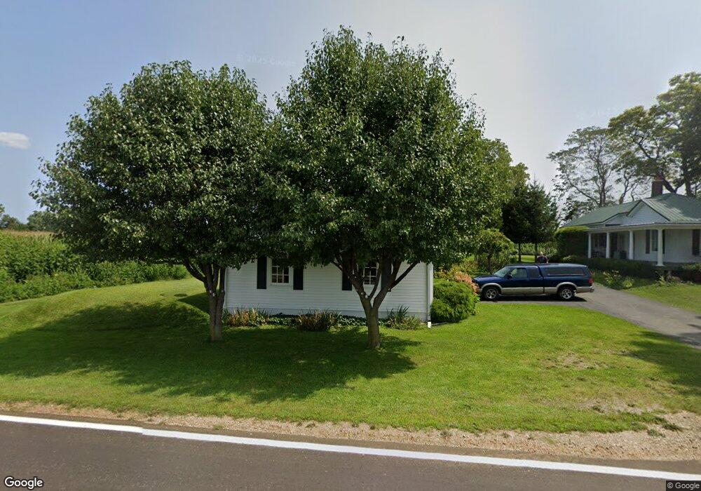
191 S Stringtown Rd Quincy, MI 49082
Estimated Value: $159,584 - $211,000
3
Beds
1
Bath
1,470
Sq Ft
$130/Sq Ft
Est. Value
About This Home
This home is located at 191 S Stringtown Rd, Quincy, MI 49082 and is currently estimated at $191,646, approximately $130 per square foot. 191 S Stringtown Rd is a home located in Branch County with nearby schools including Jennings Elementary School, Quincy Middle School, and Quincy High School.
Ownership History
Date
Name
Owned For
Owner Type
Purchase Details
Closed on
Aug 16, 2024
Sold by
Strang Steven A and Okeefe-Strang Maureen E
Bought by
Strang Steven A and Okeefe-Strang Maureen E
Current Estimated Value
Purchase Details
Closed on
Aug 21, 2006
Sold by
Strang Nancy J
Bought by
Strang Steven A and Strang Maureen Okeefe
Purchase Details
Closed on
Sep 1, 1999
Sold by
Downer Robert E
Bought by
Strang Nancy J
Purchase Details
Closed on
Dec 19, 1996
Sold by
Downer Wallace E and Downer Glayds L
Bought by
Downer Robert E
Create a Home Valuation Report for This Property
The Home Valuation Report is an in-depth analysis detailing your home's value as well as a comparison with similar homes in the area
Purchase History
| Date | Buyer | Sale Price | Title Company |
|---|---|---|---|
| Strang Steven A | -- | None Listed On Document | |
| Strang Steven A | -- | None Available | |
| Strang Nancy J | -- | -- | |
| Downer Robert E | -- | -- |
Source: Public Records
Tax History
| Year | Tax Paid | Tax Assessment Tax Assessment Total Assessment is a certain percentage of the fair market value that is determined by local assessors to be the total taxable value of land and additions on the property. | Land | Improvement |
|---|---|---|---|---|
| 2025 | $1,371 | $73,577 | $0 | $0 |
| 2024 | $12 | $68,491 | $0 | $0 |
| 2023 | $477 | $62,399 | $0 | $0 |
| 2022 | $1,246 | $60,040 | $0 | $0 |
| 2021 | $1,893 | $54,769 | $0 | $0 |
| 2020 | $1,893 | $53,493 | $0 | $0 |
| 2019 | -- | $55,305 | $0 | $0 |
| 2018 | -- | $47,447 | $0 | $0 |
| 2017 | -- | $44,296 | $0 | $0 |
| 2016 | -- | $39,247 | $0 | $0 |
| 2015 | -- | $39,220 | $0 | $0 |
| 2014 | -- | $40,268 | $0 | $0 |
| 2013 | -- | $38,361 | $0 | $0 |
Source: Public Records
Map
Nearby Homes
- 4111 Blair Rd
- 0 Wildwood Rd
- 9059 Kellogg Dr
- 9055 Kellogg Dr
- 8941 Kellogg Dr
- 211 S Ray Quincy Rd
- 8875 Kellogg Dr
- 3870 Rus Dic Dr
- 9180 Arkansaw Rd
- 5100 Long Lake Rd
- 490 Kelley Rd
- 944 Lukesport Rd
- 981 Generic Dr
- 5211 Long Lake Rd
- 201 Wildwood Beach Rd
- 0 Brocklebank Rd
- 808 Rolling Meadows Dr
- V L Long Lake Rd
- V/L Long Lake Rd
- 204 Crockett Dr
- 194 S Stringtown Rd
- 198 S Stringtown Rd
- 183 S Stringtown Rd
- 182 S Stringtown Rd
- 1279 Fisher Rd
- 1285 Fisher Rd
- 1216 Fisher Rd
- 1288 Fisher Rd
- 230 Stringtown Rd
- 1215 Fisher Rd
- 1215 Fisher Rd
- 1296 Fisher Rd
- 1212 Fisher Rd
- 241 Stringtown Rd
- 141 S Stringtown Rd
- 1200 Fisher Rd
- 10840 Bankers Rd
- 1189 Fisher Rd
- 1186 Fisher Rd
- 1183 Fisher Rd
Your Personal Tour Guide
Ask me questions while you tour the home.