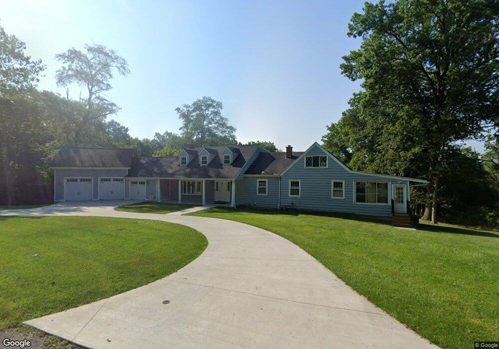
191 Sheffield Rd Cincinnati, OH 45240
Estimated Value: $349,000 - $461,000
4
Beds
2
Baths
2,332
Sq Ft
$167/Sq Ft
Est. Value
About This Home
This home is located at 191 Sheffield Rd, Cincinnati, OH 45240 and is currently estimated at $390,209, approximately $167 per square foot. 191 Sheffield Rd is a home located in Hamilton County with nearby schools including Woodlawn Elementary School, Princeton Community Middle School, and Princeton High School.
Ownership History
Date
Name
Owned For
Owner Type
Purchase Details
Closed on
Sep 29, 2020
Sold by
Popham Ken
Bought by
Popham Kenneth R and Popham Karen L
Current Estimated Value
Purchase Details
Closed on
Mar 29, 2018
Sold by
Hollender David and Hollaender Sandea E
Bought by
Popham Ken
Purchase Details
Closed on
Mar 28, 2018
Sold by
Estate Of Mark Hollaender
Bought by
Hollaender Janet
Create a Home Valuation Report for This Property
The Home Valuation Report is an in-depth analysis detailing your home's value as well as a comparison with similar homes in the area
Home Values in the Area
Average Home Value in this Area
Purchase History
| Date | Buyer | Sale Price | Title Company |
|---|---|---|---|
| Popham Kenneth R | -- | None Available | |
| Popham Ken | $200,000 | None Available | |
| Hollaender Janet | -- | None Available |
Source: Public Records
Tax History
| Year | Tax Paid | Tax Assessment Tax Assessment Total Assessment is a certain percentage of the fair market value that is determined by local assessors to be the total taxable value of land and additions on the property. | Land | Improvement |
|---|---|---|---|---|
| 2025 | $7,533 | $129,668 | $22,540 | $107,128 |
| 2024 | $6,622 | $129,668 | $22,540 | $107,128 |
| 2023 | $6,629 | $129,668 | $22,540 | $107,128 |
| 2022 | $5,902 | $100,745 | $20,115 | $80,630 |
| 2021 | $5,756 | $90,350 | $20,115 | $70,235 |
| 2020 | $5,209 | $90,350 | $20,115 | $70,235 |
| 2019 | $3,867 | $61,614 | $17,339 | $44,275 |
| 2018 | $3,660 | $61,614 | $17,339 | $44,275 |
| 2017 | $3,460 | $61,614 | $17,339 | $44,275 |
| 2016 | $3,074 | $54,086 | $17,339 | $36,747 |
| 2015 | $3,099 | $54,086 | $17,339 | $36,747 |
| 2014 | $3,107 | $54,086 | $17,339 | $36,747 |
| 2013 | $3,076 | $60,092 | $19,264 | $40,828 |
Source: Public Records
Map
Nearby Homes
- 156 Sheffield Rd
- 820 van Nes Dr
- 958 Summit Ave
- 162 Sheffield Rd
- 483 Vista Glen Dr
- 95 E Fountain Ave
- 398 Brookhaven Ave
- 163 Washington Ave
- 10483 Toulon Dr
- 440 W Sharon Rd
- 45 S Lake Ave
- 10060 Ronnie Rd
- 10055 Ronnie Rd
- 10133 Leacrest Rd
- 10167 Wayne Ave
- 220 E Sharon Rd
- 335 Albion Ave
- 51 Grove Rd
- 564 Waycross Rd
- 502 Marion Rd
- 184 Sheffield Rd
- 176 Sheffield Rd
- 150 Sheffield Rd
- 177 Sheffield Rd
- 161 Sheffield Rd
- 168 Sheffield Rd
- 0 Sheffield Unit 1775883
- 143 Sheffield Rd
- 133 Sheffield Rd
- 138 Sheffield Rd
- 121 Sheffield Rd
- 132 Sheffield Rd
- 111 Sheffield Rd
- 105 Sheffield Rd
- 101 Sheffield Rd
- 93 Sheffield Rd
- 51 Bishopsgate Dr
- 51 Bishopsgate Dr
- 83 Sheffield Rd
- 81 Sheffield Rd
Your Personal Tour Guide
Ask me questions while you tour the home.