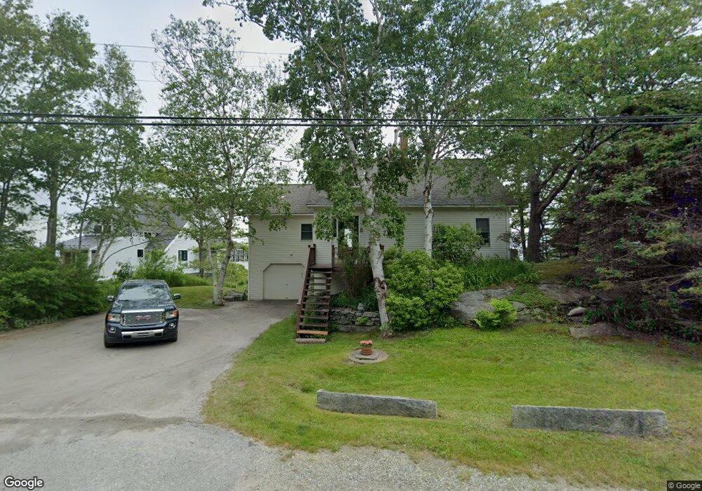
191 State Route 32 New Harbor, ME 04554
Estimated Value: $780,000 - $1,371,000
--
Bed
--
Bath
--
Sq Ft
8,712
Sq Ft Lot
About This Home
This home is located at 191 State Route 32, New Harbor, ME 04554 and is currently estimated at $1,000,092. 191 State Route 32 is a home with nearby schools including Bristol Consolidated School.
Create a Home Valuation Report for This Property
The Home Valuation Report is an in-depth analysis detailing your home's value as well as a comparison with similar homes in the area
Home Values in the Area
Average Home Value in this Area
Tax History Compared to Growth
Tax History
| Year | Tax Paid | Tax Assessment Tax Assessment Total Assessment is a certain percentage of the fair market value that is determined by local assessors to be the total taxable value of land and additions on the property. | Land | Improvement |
|---|---|---|---|---|
| 2024 | $5,607 | $630,000 | $453,300 | $176,700 |
| 2023 | $4,970 | $625,100 | $453,300 | $171,800 |
| 2022 | $4,501 | $625,100 | $453,300 | $171,800 |
| 2021 | $4,501 | $625,100 | $453,300 | $171,800 |
| 2020 | $4,532 | $625,100 | $453,300 | $171,800 |
| 2019 | $4,219 | $625,100 | $453,300 | $171,800 |
| 2018 | $3,907 | $625,100 | $453,300 | $171,800 |
| 2017 | $3,907 | $625,100 | $453,300 | $171,800 |
| 2016 | $3,478 | $440,300 | $304,200 | $136,100 |
| 2015 | $3,721 | $440,300 | $304,200 | $136,100 |
| 2014 | $3,478 | $440,300 | $304,200 | $136,100 |
| 2013 | $3,390 | $440,300 | $304,200 | $136,100 |
Source: Public Records
Map
Nearby Homes
- 146 State Route 32
- 147 Maine 32
- 82 Southside Rd
- 40 Eastwood Ct
- 25 & 26 Maine 32
- 36 Eastwood Ct
- 5 Penniman Rd
- 69 McFarland Shore Rd
- 2593 Bristol Rd
- 67 Huddle Rd
- 2700 Bristol Rd
- M2-L55F Bristol Rd
- M2A-L45B3 Huddle Rd
- Lot 5 Jack's Ln
- Lot 4 Jack's Ln
- 145 Huddle Rd
- 82 Pemaquid Trail
- 1 Fish Point Rd
- Lot 13 Nahanada Rd
- Lot 11 Nahanada Rd
- 36 Salt Pond Rd
- 252 State Route 32
- 7 Danforth Loop Rd
- 183 State Route 32
- 12 the Oakes
- 12 The Oaks
- 172 State Route 32
- 4 Ledge Rd
- 172 State Route 32
- 57 Gaffney Hill Rd
- 171 State Route 32
- 3 Salt Pond Point
- 5 Salt Pond Point
- 9 Salt Pond Rd
- 6 Salt Pond Rd
- 11 Salt Pond Point
- 49 Hawk Hill Rd
- 154 State Route 32
- 150 State Route 32
- 148 State Route 32