Estimated Value: $388,000 - $462,000
4
Beds
3
Baths
2,742
Sq Ft
$154/Sq Ft
Est. Value
About This Home
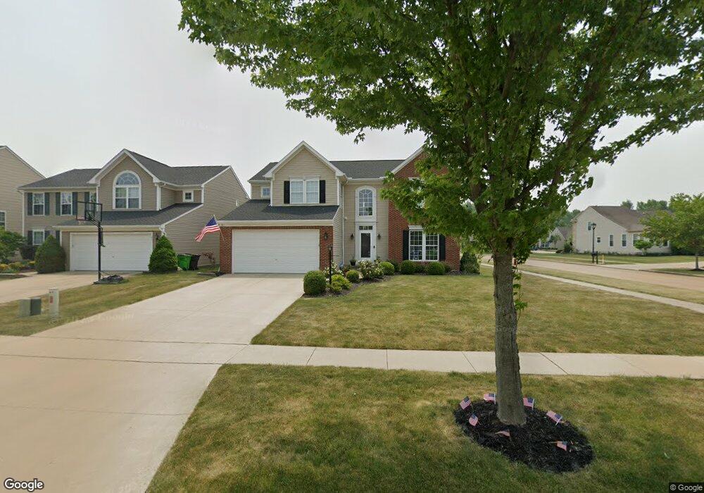
This home is located at 191 Stonepointe Dr, Berea, OH 44017 and is currently estimated at $423,100, approximately $154 per square foot. 191 Stonepointe Dr is a home located in Cuyahoga County with nearby schools including Falls-Lenox Primary Elementary School, Olmsted Falls Intermediate Building, and Olmsted Falls Middle School.
Ownership History
Date
Name
Owned For
Owner Type
Purchase Details
Closed on
Jul 24, 2006
Sold by
Nvr Inc
Bought by
Baron Geoffrey W and Baron Julie L
Current Estimated Value
Home Financials for this Owner
Home Financials are based on the most recent Mortgage that was taken out on this home.
Original Mortgage
$247,600
Outstanding Balance
$142,832
Interest Rate
6.62%
Mortgage Type
Purchase Money Mortgage
Estimated Equity
$280,268
Purchase Details
Closed on
Apr 28, 2006
Sold by
Lopat Development Co Llc
Bought by
Nvr Inc and Ryan Homes
Create a Home Valuation Report for This Property
The Home Valuation Report is an in-depth analysis detailing your home's value as well as a comparison with similar homes in the area
Home Values in the Area
Average Home Value in this Area
Purchase History
| Date | Buyer | Sale Price | Title Company |
|---|---|---|---|
| Baron Geoffrey W | $260,715 | Nvr Title Agency | |
| Nvr Inc | $40,355 | Nvr Title Agency |
Source: Public Records
Mortgage History
| Date | Status | Borrower | Loan Amount |
|---|---|---|---|
| Open | Baron Geoffrey W | $247,600 |
Source: Public Records
Tax History
| Year | Tax Paid | Tax Assessment Tax Assessment Total Assessment is a certain percentage of the fair market value that is determined by local assessors to be the total taxable value of land and additions on the property. | Land | Improvement |
|---|---|---|---|---|
| 2024 | $7,169 | $123,620 | $24,605 | $99,015 |
| 2023 | $7,196 | $104,200 | $22,230 | $81,970 |
| 2022 | $7,151 | $104,200 | $22,230 | $81,970 |
| 2021 | $7,132 | $104,200 | $22,230 | $81,970 |
| 2020 | $7,297 | $94,710 | $20,200 | $74,520 |
| 2019 | $7,104 | $270,600 | $57,700 | $212,900 |
| 2018 | $6,988 | $94,710 | $20,200 | $74,520 |
| 2017 | $7,411 | $92,230 | $17,570 | $74,660 |
| 2016 | $7,356 | $92,230 | $17,570 | $74,660 |
| 2015 | $6,777 | $92,230 | $17,570 | $74,660 |
| 2014 | $6,777 | $89,880 | $17,220 | $72,660 |
Source: Public Records
Map
Nearby Homes
- 160 Stonepointe Dr
- 446 Redwood Dr
- 100 River Rock Way
- 147 Stone Ridge Way
- 379 Laurel Dr
- 132 Stonefield Dr
- 0 River Rd Unit 5169658
- 428 Park Place
- 7461 River Rd
- 281-12-007 River Rd
- 281-12-024 River Rd
- V/L Columbia Rd
- 487 Karen Dr
- 25725 Cook Rd
- 0
- 24690 Thicket Ln Unit M32
- 5 Hawthorn Dr
- 659 Wesley Dr
- 19 Sycamore Dr
- 10 Corktree Dr
- 185 Stonepointe Dr
- 179 Stonepointe Dr
- 186 Sandstone Ridge Way
- 100 Weatherstone Dr
- 173 Stonepointe Dr
- 201 Sandstone Ridge Way
- 212 Sandstone Ridge Way
- 207 Sandstone Ridge Way
- 213 Sandstone Ridge Way
- 180 Sandstone Ridge Way
- 167 Stonepointe Dr
- 219 Sandstone Ridge Way
- 106 Weatherstone Dr
- 218 Sandstone Ridge Way
- 196 Stonepointe Dr
- 161 Stonepointe Dr
- 225 Sandstone Ridge Way
- 174 Sandstone Ridge Way
- 224 Sandstone Ridge Way
- 112 Weatherstone Dr
Your Personal Tour Guide
Ask me questions while you tour the home.