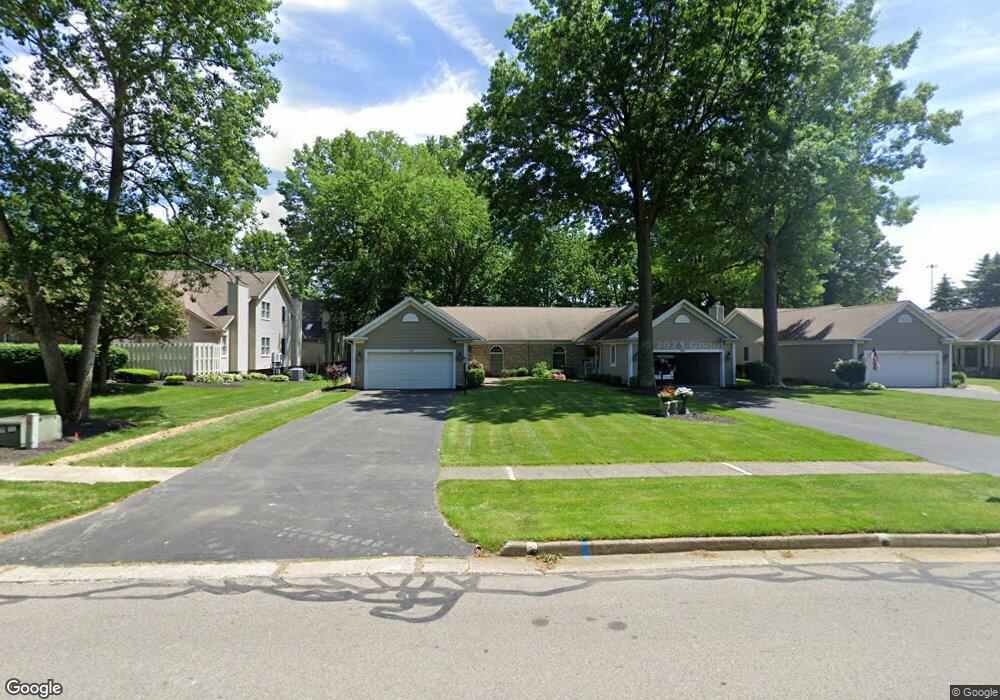
191 Talsman Dr Unit 6A Canfield, OH 44406
Estimated Value: $266,000 - $278,000
2
Beds
2
Baths
1,541
Sq Ft
$175/Sq Ft
Est. Value
About This Home
This home is located at 191 Talsman Dr Unit 6A, Canfield, OH 44406 and is currently estimated at $270,032, approximately $175 per square foot. 191 Talsman Dr Unit 6A is a home located in Mahoning County with nearby schools including Canfield Village Middle School, Canfield High School, and St Charles Elementary School.
Ownership History
Date
Name
Owned For
Owner Type
Purchase Details
Closed on
Apr 15, 2025
Sold by
Frank Barbara and Frank Dale
Bought by
Dale And Barbara Frank Revocable Living Trust and Frank
Current Estimated Value
Purchase Details
Closed on
Jul 26, 2023
Sold by
Frank Dale K and Frank Barbara
Bought by
Klughart Bridget L and Klughart Frank Patrick
Purchase Details
Closed on
Jun 5, 2013
Sold by
Fannie Mae
Bought by
Cene Taylor L
Purchase Details
Closed on
May 22, 2013
Sold by
Elaine F Cestone Trust
Bought by
Federal National Mortgage Association
Purchase Details
Closed on
Sep 10, 1992
Bought by
Herring Jack and Herring Dorothy
Create a Home Valuation Report for This Property
The Home Valuation Report is an in-depth analysis detailing your home's value as well as a comparison with similar homes in the area
Home Values in the Area
Average Home Value in this Area
Purchase History
| Date | Buyer | Sale Price | Title Company |
|---|---|---|---|
| Dale And Barbara Frank Revocable Living Trust | -- | None Listed On Document | |
| Dale And Barbara Frank Revocable Living Trust | -- | None Listed On Document | |
| Klughart Bridget L | -- | -- | |
| Cene Taylor L | $120,000 | Attorney | |
| Federal National Mortgage Association | $116,000 | None Available | |
| Herring Jack | $126,300 | -- |
Source: Public Records
Tax History Compared to Growth
Tax History
| Year | Tax Paid | Tax Assessment Tax Assessment Total Assessment is a certain percentage of the fair market value that is determined by local assessors to be the total taxable value of land and additions on the property. | Land | Improvement |
|---|---|---|---|---|
| 2024 | $3,218 | $74,660 | $6,200 | $68,460 |
| 2023 | $3,167 | $74,660 | $6,200 | $68,460 |
| 2022 | $2,714 | $50,900 | $6,200 | $44,700 |
| 2021 | $2,634 | $50,900 | $6,200 | $44,700 |
| 2020 | $2,645 | $50,900 | $6,200 | $44,700 |
| 2019 | $2,470 | $43,130 | $5,250 | $37,880 |
| 2018 | $2,440 | $43,130 | $5,250 | $37,880 |
| 2017 | $2,336 | $43,130 | $5,250 | $37,880 |
| 2016 | $2,234 | $40,280 | $5,250 | $35,030 |
| 2015 | $2,295 | $40,280 | $5,250 | $35,030 |
| 2014 | $2,194 | $40,280 | $5,250 | $35,030 |
| 2013 | $2,144 | $40,280 | $5,250 | $35,030 |
Source: Public Records
Map
Nearby Homes
- 201 Talsman Dr Unit 1
- 211 Talsman Dr Unit 1
- 120 Talsman Dr Unit 4
- 321 Hilltop Blvd
- 100 Talsman Dr
- 473 Carriage Hill Dr
- 419 Carriage Hill Dr
- 6670 Summit Dr
- 58 Skyline Dr
- 6850 Abbey Rd N
- 6645 Summit Dr
- 4032 Saint Andrews Ct Unit 1
- 125 Callahan Rd
- 6859 Fairground Blvd
- 5034 Macy Ln
- 78 Neff Dr
- 5025 Macy Ln
- 38 Skyline Dr
- 6845 Abbey Rd
- 6843 Abbey Rd
- 191 Talsman Dr Unit 6B
- 191 Talsman Dr
- 191 Talsman Dr Unit A
- 201 Talsman Dr Unit 4
- 201 Talsman Dr Unit 3
- 201 Talsman Dr Unit 2
- 181 Talsman Dr Unit 5B
- 181 Talsman Dr Unit 5A
- 181 Talsman Dr Unit B
- 181 Talsman Dr Unit A
- 211 Talsman Dr Unit 4
- 211 Talsman Dr Unit 3
- 211 Talsman Dr Unit 2
- 211 Talsman Dr
- 161 Talsman Dr Unit 2
- 161 Talsman Dr Unit 1
- 176 Talsman Dr Unit 2D
- 176 Talsman Dr Unit 2C
- 176 Talsman Dr Unit 2B
- 176 Talsman Dr Unit 2A