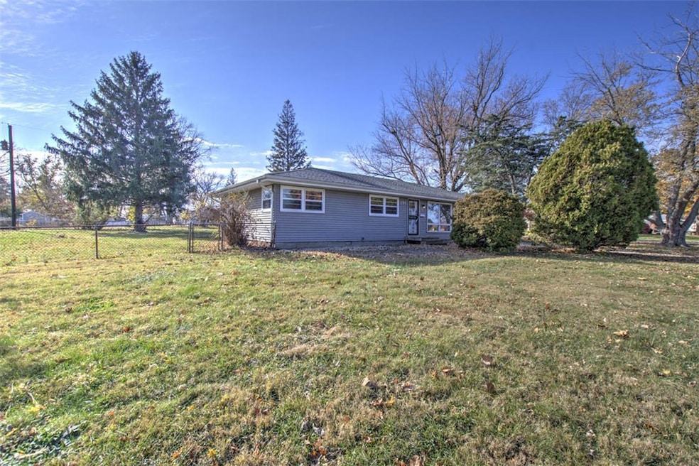
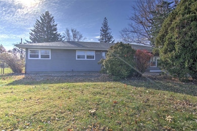
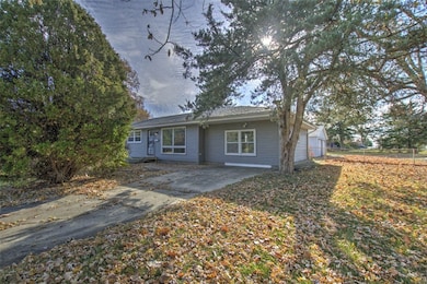
191 W Grove Rd Decatur, IL 62521
Devonshire NeighborhoodEstimated payment $1,074/month
Highlights
- 2 Car Detached Garage
- Central Air
- 1-Story Property
- En-Suite Primary Bedroom
- Heating System Uses Gas
About This Home
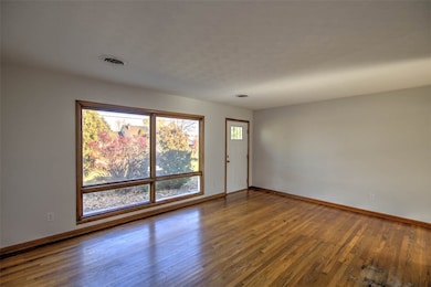
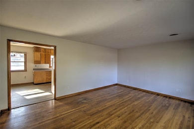
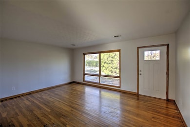
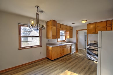
Welcome to this charming 4-bedroom, 2-bath home nestled in the desirable South Shores neighborhood. Situated on a generous .47-acre corner lot, this property offers both space and comfort with numerous updates completed within the last five years. Enjoy peace of mind with major improvements including a new roof, new furnace, new water heater, updated PEX plumbing supply lines, and PVC waste line extended to the city street. Both bathrooms have been beautifully renovated, and the crawl space features a sump pump with discharge routed all the way to the street for added protection. Inside, you’ll find a warm and inviting atmosphere with LVP or hardwood flooring throughout, complemented by fresh paint and thoughtful updates. The property also includes a detached 2-car garage, perfect for parking, storage, or hobby space. With modern improvements, classic charm, and a spacious corner lot, this South Shores gem is move-in ready and waiting for you to call it home.
Home Details
Home Type
- Single Family
Est. Annual Taxes
- $3,725
Year Built
- Built in 1960
Lot Details
- 0.47 Acre Lot
- Property is zoned MUN
Parking
- 2 Car Detached Garage
Home Design
- Asphalt Roof
- Vinyl Siding
Interior Spaces
- 1,554 Sq Ft Home
- 1-Story Property
- Crawl Space
- No Kitchen Appliances
- Laundry on main level
Bedrooms and Bathrooms
- 4 Bedrooms
- En-Suite Primary Bedroom
- 2 Full Bathrooms
Utilities
- Central Air
- Heating System Uses Gas
- Gas Water Heater
Community Details
- Crestwood Add Subdivision
Listing and Financial Details
- Assessor Parcel Number 17-12-34-227-001
Map
Home Values in the Area
Average Home Value in this Area
Tax History
| Year | Tax Paid | Tax Assessment Tax Assessment Total Assessment is a certain percentage of the fair market value that is determined by local assessors to be the total taxable value of land and additions on the property. | Land | Improvement |
|---|---|---|---|---|
| 2024 | $3,725 | $42,483 | $5,570 | $36,913 |
| 2023 | $3,359 | $38,236 | $5,570 | $32,666 |
| 2022 | $3,256 | $36,478 | $5,314 | $31,164 |
| 2021 | $3,666 | $34,703 | $5,056 | $29,647 |
| 2020 | $2,382 | $32,893 | $4,792 | $28,101 |
| 2019 | $2,382 | $32,893 | $4,792 | $28,101 |
| 2018 | $2,215 | $31,640 | $4,609 | $27,031 |
| 2017 | $2,161 | $31,345 | $4,566 | $26,779 |
| 2016 | $2,169 | $31,279 | $4,556 | $26,723 |
| 2015 | $2,001 | $30,368 | $4,423 | $25,945 |
| 2014 | $1,830 | $30,067 | $4,379 | $25,688 |
| 2013 | $1,819 | $30,067 | $4,379 | $25,688 |
Property History
| Date | Event | Price | List to Sale | Price per Sq Ft |
|---|---|---|---|---|
| 11/19/2025 11/19/25 | For Sale | $145,000 | -- | $93 / Sq Ft |
Purchase History
| Date | Type | Sale Price | Title Company |
|---|---|---|---|
| Warranty Deed | $62,000 | None Available |
Mortgage History
| Date | Status | Loan Amount | Loan Type |
|---|---|---|---|
| Open | $64,700 | New Conventional |
Source: Central Illinois Board of REALTORS®
MLS Number: 6256165
APN: 17-12-34-227-001
- 0 Wildwood Ct
- 2704 Brookville Place
- 3020 S Laura St
- 102 Phillips Dr
- 545 E Grove Rd
- 184 Dover Dr
- 98 Ridgeway Dr
- 43 Ridgedale Dr
- 23 La Salle Dr
- 112 Ridgeway Dr
- 20 Ridge Dr
- 19 Peggy Ann Dr
- 14 E Carroll Dr
- 2628 S Forrest Green Dr
- 51 E Carroll Dr
- 30 Sandcreek Dr
- 344 W Imboden Dr
- 2170 S Franklin Street Rd
- 51 Medial Dr
- 405 Hackberry Dr
- 185 W Imboden Dr Unit Studio
- 185 W Imboden Dr Unit 1-BR
- 1035 S Main St
- 1246 E Riverside Ave
- 1286 E Vanderhoof St
- 552 S Church St
- 1524 E Whitmer St
- 1061 W Decatur St
- 1971 E Cantrell St
- 1344 Sedgwick St
- 1613 E Johns Ave
- 1707 S Country Club Rd
- 1453 E Clay St
- 1076 W Main St
- 467 W William St Unit 467 W.William
- 105 N Illinois St
- 1405 W Wood St
- 1042 W Prairie Ave
- 816 W William St
- 312 S 19th St
