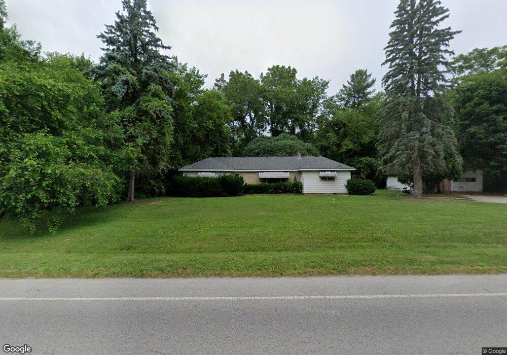
191 W Mcclung Rd La Porte, IN 46350
Estimated Value: $183,000 - $282,000
2
Beds
2
Baths
1,236
Sq Ft
$194/Sq Ft
Est. Value
About This Home
This home is located at 191 W Mcclung Rd, La Porte, IN 46350 and is currently estimated at $240,083, approximately $194 per square foot. 191 W Mcclung Rd is a home located in LaPorte County with nearby schools including Riley Elementary School, La Porte High School, and Dunkerton High School.
Ownership History
Date
Name
Owned For
Owner Type
Purchase Details
Closed on
Dec 3, 2012
Sold by
Muniz Dennis M
Bought by
City Of Laporte
Current Estimated Value
Purchase Details
Closed on
Sep 5, 2008
Sold by
Gaylord Mark A
Bought by
Muniz Dennis M
Home Financials for this Owner
Home Financials are based on the most recent Mortgage that was taken out on this home.
Original Mortgage
$67,760
Interest Rate
6.54%
Mortgage Type
Unknown
Create a Home Valuation Report for This Property
The Home Valuation Report is an in-depth analysis detailing your home's value as well as a comparison with similar homes in the area
Home Values in the Area
Average Home Value in this Area
Purchase History
| Date | Buyer | Sale Price | Title Company |
|---|---|---|---|
| City Of Laporte | $25,600 | None Available | |
| Muniz Dennis M | -- | Meridian Title Corp |
Source: Public Records
Mortgage History
| Date | Status | Borrower | Loan Amount |
|---|---|---|---|
| Previous Owner | Muniz Dennis M | $67,760 |
Source: Public Records
Tax History Compared to Growth
Tax History
| Year | Tax Paid | Tax Assessment Tax Assessment Total Assessment is a certain percentage of the fair market value that is determined by local assessors to be the total taxable value of land and additions on the property. | Land | Improvement |
|---|---|---|---|---|
| 2024 | $2,349 | $126,400 | $35,700 | $90,700 |
| 2022 | $2,181 | $106,200 | $30,700 | $75,500 |
| 2021 | $2,113 | $102,800 | $30,700 | $72,100 |
| 2020 | $2,151 | $102,800 | $30,700 | $72,100 |
| 2019 | $2,175 | $103,500 | $31,400 | $72,100 |
| 2018 | $1,909 | $90,700 | $25,400 | $65,300 |
| 2017 | $1,903 | $90,400 | $25,400 | $65,000 |
| 2016 | $1,686 | $79,700 | $22,100 | $57,600 |
| 2014 | $1,556 | $75,600 | $22,100 | $53,500 |
Source: Public Records
Map
Nearby Homes
- 195 W Mcclung Rd
- 169 W Mcclung Rd Unit 201
- 169 W Mcclung Rd Unit 203
- 206 Outlook Cove Dr
- 306 Outlook Cove Dr
- 17 Elm Dr
- 610 Home St
- 0 W Lot 81 Concord Dr Unit NRA809376
- 0 W 450 St N Unit NRA827579
- 842-Lot 59 W Broken Arrow Dr
- 0 N Us Hwy 35 Unit NRA809471
- 0 Pawnee Trail Unit NRA824498
- 6877 N Nature Ln
- 0 W Lot 38 Malaga Dr Unit NRA809384
- 0 N 400 W Unit NRA544762
- 3069 N Morning Glory Ave
- 3067 N Morning Glory Ave
- 0 N Kuchar Dr Unit NRA812041
- 410 Closser Ave
- 125 W Mcclung Rd
- 191 W Mcclung Rd
- 193 W Mcclung Rd
- 197 W Mcclung Rd
- 197 W Mcclung Rd
- 195 Mcclung Rd
- 192 Mcclung Rd
- 199 W Mcclung Rd Unit 5
- 198 Mcclung Rd
- 1239 N State Road 39
- 1237 Indiana 39
- 1233 Indiana 39
- 177 W Mcclung Rd
- 1239 N Hyw 39
- 1239 Indiana 39
- 1227 Indiana 39
- 1231 Indiana 39
- 173 W Mcclung Rd
- 0 State Road 39 Unit 2804828
- 1201 Pine Lake Rd
- 0 N Saint Road 39