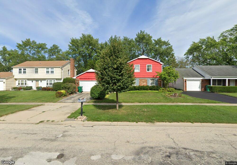
191 Weidner Rd Buffalo Grove, IL 60089
South Buffalo Grove NeighborhoodEstimated Value: $505,690 - $566,000
4
Beds
3
Baths
2,449
Sq Ft
$216/Sq Ft
Est. Value
About This Home
This home is located at 191 Weidner Rd, Buffalo Grove, IL 60089 and is currently estimated at $529,673, approximately $216 per square foot. 191 Weidner Rd is a home located in Cook County with nearby schools including Henry W Longfellow Elementary School, Cooper Middle School, and Buffalo Grove High School.
Ownership History
Date
Name
Owned For
Owner Type
Purchase Details
Closed on
Dec 2, 2016
Sold by
Gerboles Carlos A Trujillo and Trujillo Carlos
Bought by
Gerboles Carlos A Trujillo
Current Estimated Value
Home Financials for this Owner
Home Financials are based on the most recent Mortgage that was taken out on this home.
Original Mortgage
$284,500
Outstanding Balance
$233,881
Interest Rate
4.12%
Mortgage Type
New Conventional
Estimated Equity
$295,792
Purchase Details
Closed on
Aug 14, 2006
Sold by
Rischall Leon J and Rischall Judy
Bought by
Trujillo Carlos
Home Financials for this Owner
Home Financials are based on the most recent Mortgage that was taken out on this home.
Original Mortgage
$40,000
Interest Rate
6.77%
Mortgage Type
Stand Alone Second
Create a Home Valuation Report for This Property
The Home Valuation Report is an in-depth analysis detailing your home's value as well as a comparison with similar homes in the area
Home Values in the Area
Average Home Value in this Area
Purchase History
| Date | Buyer | Sale Price | Title Company |
|---|---|---|---|
| Gerboles Carlos A Trujillo | -- | Servicelink | |
| Trujillo Carlos | $400,000 | Pntn |
Source: Public Records
Mortgage History
| Date | Status | Borrower | Loan Amount |
|---|---|---|---|
| Open | Gerboles Carlos A Trujillo | $284,500 | |
| Closed | Trujillo Carlos | $40,000 | |
| Closed | Trujillo Carlos | $320,080 |
Source: Public Records
Tax History Compared to Growth
Tax History
| Year | Tax Paid | Tax Assessment Tax Assessment Total Assessment is a certain percentage of the fair market value that is determined by local assessors to be the total taxable value of land and additions on the property. | Land | Improvement |
|---|---|---|---|---|
| 2024 | $11,421 | $39,000 | $7,056 | $31,944 |
| 2023 | $10,956 | $39,000 | $7,056 | $31,944 |
| 2022 | $10,956 | $39,000 | $7,056 | $31,944 |
| 2021 | $9,610 | $30,532 | $4,508 | $26,024 |
| 2020 | $9,431 | $30,532 | $4,508 | $26,024 |
| 2019 | $9,419 | $33,850 | $4,508 | $29,342 |
| 2018 | $10,242 | $33,176 | $3,920 | $29,256 |
| 2017 | $10,074 | $33,176 | $3,920 | $29,256 |
| 2016 | $9,635 | $33,176 | $3,920 | $29,256 |
| 2015 | $9,449 | $30,438 | $3,332 | $27,106 |
| 2014 | $9,311 | $30,438 | $3,332 | $27,106 |
| 2013 | $8,589 | $30,438 | $3,332 | $27,106 |
Source: Public Records
Map
Nearby Homes
- 98 Stonegate Rd
- 329 Timber Hill Rd
- 921 Bernard Dr
- 410 Chatham Cir
- 408 Indian Hill Dr
- 535 Estate Dr
- 310 Rosewood Ave
- 1130 Bernard Dr
- 455 Mayfair Ln
- 859 Beechwood Rd
- 746 Old Checker Rd Unit E5
- 813 Stradford Cir Unit 21B2
- 1112 Auburn Ln
- 720 Weidner Rd Unit 302
- 872 Old Checker Rd Unit E3
- 780 Weidner Rd Unit 300
- 820 Weidner Rd Unit 409
- 476 Raupp Blvd
- 671 Hapsfield Ln Unit 105
- 222 St Marys Pkwy