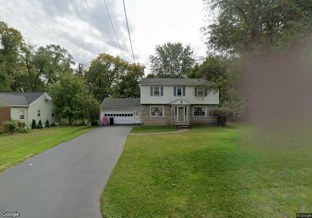
191 Westside Dr Rochester, NY 14624
Estimated Value: $224,000 - $266,000
4
Beds
2
Baths
1,698
Sq Ft
$142/Sq Ft
Est. Value
About This Home
This home is located at 191 Westside Dr, Rochester, NY 14624 and is currently estimated at $241,099, approximately $141 per square foot. 191 Westside Dr is a home located in Monroe County with nearby schools including Gates-Chili Middle School, Gates-Chili High School, and St Pius Tenth School.
Ownership History
Date
Name
Owned For
Owner Type
Purchase Details
Closed on
Sep 27, 2013
Sold by
Mael Michael and Turner Kaitlyn
Bought by
Mael Michael G
Current Estimated Value
Home Financials for this Owner
Home Financials are based on the most recent Mortgage that was taken out on this home.
Original Mortgage
$115,430
Outstanding Balance
$87,006
Interest Rate
4.58%
Mortgage Type
New Conventional
Estimated Equity
$154,093
Purchase Details
Closed on
May 26, 2010
Sold by
Hogan Steven M and Hogan Joy
Bought by
Mael Michael and Turner Kaitlyn
Home Financials for this Owner
Home Financials are based on the most recent Mortgage that was taken out on this home.
Original Mortgage
$118,306
Interest Rate
4.87%
Mortgage Type
FHA
Purchase Details
Closed on
Mar 10, 2002
Sold by
Wainwright Mark S
Bought by
Hogan Steven M
Purchase Details
Closed on
Jun 25, 1996
Sold by
Rowan Paul
Bought by
Wainwright Mark and Wainwright Lisa
Create a Home Valuation Report for This Property
The Home Valuation Report is an in-depth analysis detailing your home's value as well as a comparison with similar homes in the area
Home Values in the Area
Average Home Value in this Area
Purchase History
| Date | Buyer | Sale Price | Title Company |
|---|---|---|---|
| Mael Michael G | -- | None Available | |
| Mael Michael | $119,900 | None Available | |
| Hogan Steven M | $102,000 | Mindy Foxton | |
| Wainwright Mark | $93,000 | -- |
Source: Public Records
Mortgage History
| Date | Status | Borrower | Loan Amount |
|---|---|---|---|
| Open | Mael Michael G | $115,430 | |
| Closed | Mael Michael | $118,306 |
Source: Public Records
Tax History
| Year | Tax Paid | Tax Assessment Tax Assessment Total Assessment is a certain percentage of the fair market value that is determined by local assessors to be the total taxable value of land and additions on the property. | Land | Improvement |
|---|---|---|---|---|
| 2024 | $6,710 | $207,800 | $35,400 | $172,400 |
| 2023 | $6,264 | $145,000 | $28,300 | $116,700 |
| 2022 | $6,111 | $145,000 | $28,300 | $116,700 |
| 2021 | $5,756 | $145,000 | $28,300 | $116,700 |
| 2020 | $5,385 | $120,800 | $28,300 | $92,500 |
| 2019 | $5,021 | $120,800 | $28,300 | $92,500 |
| 2018 | $5,334 | $120,800 | $28,300 | $92,500 |
| 2017 | $3,054 | $115,000 | $28,300 | $86,700 |
| 2016 | $5,021 | $115,000 | $28,300 | $86,700 |
| 2015 | -- | $115,000 | $28,300 | $86,700 |
| 2014 | -- | $115,000 | $28,300 | $86,700 |
Source: Public Records
Map
Nearby Homes
- 12 Virginia Ln
- 532 Valley Creek Rd
- 237 Harpington Dr
- 11 Ventura Rd
- 11 Wilelen Rd
- 455 Upper Valley Rd
- 460 Upper Valley Rd
- 10 Fisher Rd
- 18 Mareeta Rd
- 58 Alger Dr
- 20 Ashwood Knoll
- 114 Brooklea Dr
- 33 Wedgewood Dr
- 15 Jacklyn Dr
- 4629 Royal Oaks Cir SW
- 4980 Royal Oaks Cir SW
- 134 Arrowhead Dr
- 4 Ruth Ellen Way
- 107 Burben Way
- 29 Marlands Rd
- 209 Westside Dr
- 177 Westside Dr
- 165 Westside Dr
- 17 Virginia Ln
- 15 Virginia Ln
- 213 Westside Dr
- 21 Virginia Ln
- 196 Westside Dr
- 184 Westside Dr
- 11 Virginia Ln
- 206 Westside Dr
- 174 Westside Dr
- 215 Westside Dr
- 210 Westside Dr
- 9 Virginia Ln
- 164 Westside Dr
- 222 Westside Dr
- 217 Westside Dr
- 7 Virginia Ln
- 16 Virginia Ln
Your Personal Tour Guide
Ask me questions while you tour the home.