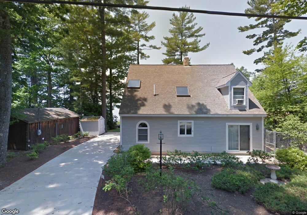
191 Whites Point Rd Standish, ME 04084
North Gorham NeighborhoodEstimated Value: $1,309,000 - $1,579,000
3
Beds
3
Baths
2,128
Sq Ft
$684/Sq Ft
Est. Value
About This Home
This home is located at 191 Whites Point Rd, Standish, ME 04084 and is currently estimated at $1,455,523, approximately $683 per square foot. 191 Whites Point Rd is a home located in Cumberland County with nearby schools including Bonny Eagle High School and Windham Christian Academy.
Ownership History
Date
Name
Owned For
Owner Type
Purchase Details
Closed on
Jan 31, 2024
Sold by
Standish Lake Prop Llc
Bought by
Harris James C and Harris Pamela D
Current Estimated Value
Home Financials for this Owner
Home Financials are based on the most recent Mortgage that was taken out on this home.
Original Mortgage
$661,000
Interest Rate
6.74%
Mortgage Type
Purchase Money Mortgage
Create a Home Valuation Report for This Property
The Home Valuation Report is an in-depth analysis detailing your home's value as well as a comparison with similar homes in the area
Home Values in the Area
Average Home Value in this Area
Purchase History
| Date | Buyer | Sale Price | Title Company |
|---|---|---|---|
| Harris James C | -- | None Available | |
| Harris James C | -- | None Available |
Source: Public Records
Mortgage History
| Date | Status | Borrower | Loan Amount |
|---|---|---|---|
| Previous Owner | Harris James C | $661,000 |
Source: Public Records
Tax History
| Year | Tax Paid | Tax Assessment Tax Assessment Total Assessment is a certain percentage of the fair market value that is determined by local assessors to be the total taxable value of land and additions on the property. | Land | Improvement |
|---|---|---|---|---|
| 2024 | $13,539 | $1,074,500 | $671,800 | $402,700 |
| 2023 | $11,710 | $845,500 | $509,900 | $335,600 |
| 2022 | $10,651 | $737,100 | $442,800 | $294,300 |
| 2021 | $10,241 | $682,700 | $402,400 | $280,300 |
| 2019 | $9,445 | $660,500 | $396,400 | $264,100 |
| 2018 | $9,016 | $648,600 | $384,500 | $264,100 |
| 2017 | $8,594 | $648,600 | $384,500 | $264,100 |
| 2016 | $8,315 | $648,600 | $384,500 | $264,100 |
| 2015 | $8,296 | $648,600 | $384,500 | $264,100 |
| 2014 | $7,880 | $648,600 | $384,500 | $264,100 |
| 2013 | $6,549 | $542,100 | $384,500 | $157,600 |
Source: Public Records
Map
Nearby Homes
- 72 Sand Beach Rd
- 194 Hearthside Rd
- 103 Basin Rd
- 96 Mineral Spring Rd
- 34 Trails End Rd
- 1042 Roosevelt Trail
- 99 Enterprise Dr
- 1083 Roosevelt Trail
- lot #8 Bedrock Terrace
- 10 Abby Rd
- 34 Robin Ln
- 6 Gilman Rd
- 32 Patriot Place
- 75 Tandberg Trail
- 1112 Roosevelt Trail Unit 8
- 1 Matinicus Way Unit 1
- 5 Sandbar Rd
- 55 Page Rd
- 0 Turning Leaf Dr Unit 1640377
- 361 Cape Rd
- 197 Whites Point Rd
- 187 Whites Point
- 187 Whites Point Rd
- 185 Whites Point Rd
- 85 Sand Beach Rd
- 181 Whites Point Rd
- 186 Whites Point Rd
- 179 Whites Point Rd
- 184 Whites Point Rd
- 77 Sand Beach Rd
- 173 Whites Point Rd
- 15 Hideaway Ln
- 73 Sand Beach Rd
- 171 Whites Point Rd
- 11 Hideaway Ln
- 169 Whites Point Rd
- 69 Sand Beach Rd
- 68 Sand Beach Rd
- 103 Shaw Acres Rd
- 42 Shaw Acres Extension
Your Personal Tour Guide
Ask me questions while you tour the home.