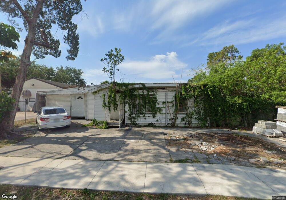
1910 18th St Sarasota, FL 34234
Downtown Sarasota Neighborhood
1
Bed
1
Bath
1,680
Sq Ft
6,534
Sq Ft Lot
About This Home
This home is located at 1910 18th St, Sarasota, FL 34234. 1910 18th St is a home located in Sarasota County with nearby schools including Gocio Elementary School, Riverview High School, and McIntosh Middle School.
Ownership History
Date
Name
Owned For
Owner Type
Purchase Details
Closed on
Nov 6, 2013
Sold by
Frank Linda M
Bought by
Lolo Investments Llc
Purchase Details
Closed on
May 12, 2008
Sold by
Melendez Julio M
Bought by
Frank Linda M
Purchase Details
Closed on
Jun 14, 2007
Sold by
Brown Larry Raymond
Bought by
Frank Linda M and Melendez Julio M
Home Financials for this Owner
Home Financials are based on the most recent Mortgage that was taken out on this home.
Original Mortgage
$213,600
Interest Rate
6.12%
Mortgage Type
Commercial
Create a Home Valuation Report for This Property
The Home Valuation Report is an in-depth analysis detailing your home's value as well as a comparison with similar homes in the area
Home Values in the Area
Average Home Value in this Area
Purchase History
| Date | Buyer | Sale Price | Title Company |
|---|---|---|---|
| Lolo Investments Llc | $50,700 | Attorney | |
| Frank Linda M | $15,000 | None Available | |
| Frank Linda M | $267,000 | Concord Title Agency Llc |
Source: Public Records
Mortgage History
| Date | Status | Borrower | Loan Amount |
|---|---|---|---|
| Previous Owner | Frank Linda M | $213,600 |
Source: Public Records
Tax History Compared to Growth
Tax History
| Year | Tax Paid | Tax Assessment Tax Assessment Total Assessment is a certain percentage of the fair market value that is determined by local assessors to be the total taxable value of land and additions on the property. | Land | Improvement |
|---|---|---|---|---|
| 2023 | $1,821 | $124,500 | $96,800 | $27,700 |
| 2022 | $1,336 | $58,700 | $36,300 | $22,400 |
| 2021 | $1,167 | $46,400 | $26,300 | $20,100 |
| 2020 | $1,178 | $46,400 | $26,200 | $20,200 |
| 2019 | $1,233 | $59,500 | $16,700 | $42,800 |
| 2018 | $1,144 | $53,300 | $16,700 | $36,600 |
| 2017 | $1,106 | $47,553 | $0 | $0 |
| 2016 | $1,034 | $46,200 | $16,700 | $29,500 |
| 2015 | $962 | $39,300 | $13,900 | $25,400 |
| 2014 | $915 | $36,200 | $0 | $0 |
Source: Public Records
Map
Nearby Homes
- 2005 Gillespie Ave
- 1460 17th St
- 1903 24th St
- 2251 19th St
- 1610 22nd St
- 2942 Pershing Ave
- 2012 Leon Ave
- 2395 19th St
- 417 N Osprey Ave
- 2105 Leon Ave
- 2050 10th St
- 941 N Osprey Ave
- 2825 N Links Ave
- 1744 10th St
- .31 ac - 21st St
- 1621 Dr Martin Luther King Way
- 1438 19th St
- 2822 Maple Ave
- 1427 18th St
- 2371 Leon Ave
- 1741 Gillespie Ave
- 1872 18th St
- 1935 18th St
- 1824 Gillespie Ave
- 1945 17th St
- 1848 Gillespie Ave
- 1845 Gillespie Ave
- 1967 17th St
- 1860 18th St
- 1890 19th St
- 1973 17th St
- 1850 18th St
- 1899 19th St
- 1801 N Washington Blvd
- 1845 18th St
- 1921 Gillespie Ave
- 1887 19th St
- 1885 19th St
- 1864 17th St
- 1931 Gillespie Ave