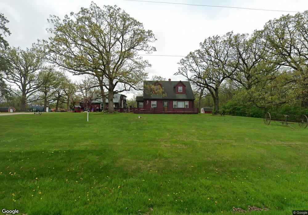
1910 Bell Rd Minooka, IL 60447
North Minooka NeighborhoodEstimated Value: $416,403 - $520,000
Studio
1
Bath
1,452
Sq Ft
$310/Sq Ft
Est. Value
About This Home
This home is located at 1910 Bell Rd, Minooka, IL 60447 and is currently estimated at $450,601, approximately $310 per square foot. 1910 Bell Rd is a home located in Kendall County with nearby schools including Jones Elementary School, Minooka Junior High School, and Minooka Intermediate School.
Ownership History
Date
Name
Owned For
Owner Type
Purchase Details
Closed on
Jan 13, 2012
Sold by
Davies Llewellyn Thomas and Spencer Johanna E
Bought by
Morgan Richard and Morgan Kristin
Current Estimated Value
Purchase Details
Closed on
Mar 11, 2009
Sold by
Boothe Johanna E and Boothe Spencer Johanna E
Bought by
Morgan Richard H and Morgan Kristin L
Home Financials for this Owner
Home Financials are based on the most recent Mortgage that was taken out on this home.
Original Mortgage
$176,000
Interest Rate
5.11%
Mortgage Type
Purchase Money Mortgage
Create a Home Valuation Report for This Property
The Home Valuation Report is an in-depth analysis detailing your home's value as well as a comparison with similar homes in the area
Home Values in the Area
Average Home Value in this Area
Purchase History
| Date | Buyer | Sale Price | Title Company |
|---|---|---|---|
| Morgan Richard | $58,000 | Fidelity National Title | |
| Morgan Richard H | $220,000 | Ticor Title |
Source: Public Records
Mortgage History
| Date | Status | Borrower | Loan Amount |
|---|---|---|---|
| Previous Owner | Morgan Richard H | $176,000 |
Source: Public Records
Tax History
| Year | Tax Paid | Tax Assessment Tax Assessment Total Assessment is a certain percentage of the fair market value that is determined by local assessors to be the total taxable value of land and additions on the property. | Land | Improvement |
|---|---|---|---|---|
| 2024 | $8,300 | $112,415 | $13,951 | $98,464 |
| 2023 | $7,629 | $106,782 | $12,654 | $94,128 |
| 2022 | $7,629 | $106,782 | $10,537 | $96,245 |
| 2021 | $7,391 | $96,206 | $10,697 | $85,509 |
| 2020 | $7,112 | $90,496 | $10,062 | $80,434 |
| 2019 | $6,971 | $86,583 | $9,627 | $76,956 |
| 2018 | $6,431 | $80,909 | $9,627 | $71,282 |
| 2017 | $6,324 | $76,558 | $9,627 | $66,931 |
| 2016 | $5,849 | $70,796 | $9,508 | $61,288 |
| 2015 | $5,890 | $70,796 | $9,508 | $61,288 |
| 2014 | -- | $64,643 | $9,508 | $55,135 |
| 2013 | -- | $64,643 | $9,508 | $55,135 |
Source: Public Records
Map
Nearby Homes
- Lot 1 Minooka Ridge & Jones Rd
- 2041 Isabella Ln
- 1529 Balboa Dr Unit 2A
- 1510 Balboa Dr
- 622 Gallant Dr
- 8010 Wood River St
- 0 County Line Rd
- 8021 Harrier Ave
- 0 W Seil Rd
- 901 Sable Ridge Dr
- 8500 Sawyer Ct
- 8412 Sawyer Ct
- 8513 Sawyer Ct
- 8038 Bluestem Ave
- 21127 Coventry Cir
- 8301 Trumbull Ave
- 8406 Coop Ave
- 1008 Heron Cir Unit 1
- 21042 Coventry Cir
- 1107 Van Dyke Rd
- 1870 Bell Rd
- 2024 Bell Rd
- 1820 Bell Rd
- 2068 Bell Rd
- 2100 Bell Rd
- 1775 Bell Rd
- 2154 Bell Rd
- 2211 Bell Rd
- 2233 Bell Rd
- 2275 Bell Rd
- 2259 Bell Rd Unit G
- 2259 Bell Rd Unit G
- 2259 Bell Rd Unit A
- 2259 Bell Rd Unit 2
- 2259 Bell Rd Unit C
- 2259 Bell Rd Unit D
- 2259 Bell Rd
- 2325 Bell Rd
- 2412 Bell Rd
- 15855 Hare Rd
Your Personal Tour Guide
Ask me questions while you tour the home.