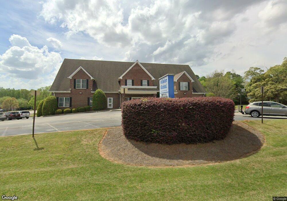
1910 Brannan Rd McDonough, GA 30253
Estimated Value: $2,879,145
--
Bed
4
Baths
80,704
Sq Ft
$36/Sq Ft
Est. Value
About This Home
This home is located at 1910 Brannan Rd, McDonough, GA 30253 and is currently estimated at $2,879,145, approximately $35 per square foot. 1910 Brannan Rd is a home located in Henry County with nearby schools including Flippen Elementary School, Eagle's Landing Middle School, and Eagle's Landing High School.
Ownership History
Date
Name
Owned For
Owner Type
Purchase Details
Closed on
Nov 21, 2007
Sold by
1910 Brannen Road Llc
Bought by
Piper Creek Llc
Current Estimated Value
Home Financials for this Owner
Home Financials are based on the most recent Mortgage that was taken out on this home.
Original Mortgage
$890,000
Interest Rate
6.36%
Mortgage Type
Commercial
Purchase Details
Closed on
Jan 19, 2006
Sold by
Vinson Prop Llc
Bought by
1910 Brannen Rd Llc
Home Financials for this Owner
Home Financials are based on the most recent Mortgage that was taken out on this home.
Original Mortgage
$889,816
Interest Rate
6.21%
Mortgage Type
Commercial
Purchase Details
Closed on
Jan 29, 2004
Sold by
Waldrop Smith Llc
Bought by
Vinsonb Prop Llc
Home Financials for this Owner
Home Financials are based on the most recent Mortgage that was taken out on this home.
Original Mortgage
$668,000
Interest Rate
5.62%
Mortgage Type
New Conventional
Create a Home Valuation Report for This Property
The Home Valuation Report is an in-depth analysis detailing your home's value as well as a comparison with similar homes in the area
Home Values in the Area
Average Home Value in this Area
Purchase History
| Date | Buyer | Sale Price | Title Company |
|---|---|---|---|
| Piper Creek Llc | $1,463,000 | -- | |
| 1910 Brannen Rd Llc | $888,800 | -- | |
| Vinsonb Prop Llc | $835,000 | -- |
Source: Public Records
Mortgage History
| Date | Status | Borrower | Loan Amount |
|---|---|---|---|
| Closed | Piper Creek Llc | $890,000 | |
| Previous Owner | 1910 Brannen Rd Llc | $889,816 | |
| Previous Owner | Vinsonb Prop Llc | $668,000 |
Source: Public Records
Tax History Compared to Growth
Tax History
| Year | Tax Paid | Tax Assessment Tax Assessment Total Assessment is a certain percentage of the fair market value that is determined by local assessors to be the total taxable value of land and additions on the property. | Land | Improvement |
|---|---|---|---|---|
| 2025 | $27,811 | $691,388 | $104,000 | $587,388 |
| 2024 | $27,811 | $623,720 | $104,040 | $519,680 |
| 2023 | $19,764 | $591,480 | $104,040 | $487,440 |
| 2022 | $16,338 | $413,440 | $104,040 | $309,400 |
| 2021 | $15,752 | $398,160 | $104,040 | $294,120 |
| 2020 | $15,827 | $401,160 | $104,040 | $297,120 |
| 2019 | $15,942 | $404,160 | $104,040 | $300,120 |
| 2018 | $0 | $388,240 | $104,040 | $284,200 |
| 2016 | $14,917 | $377,440 | $104,040 | $273,400 |
| 2015 | $14,221 | $348,480 | $104,040 | $244,440 |
| 2014 | $14,958 | $362,760 | $104,040 | $258,720 |
Source: Public Records
Map
Nearby Homes
- 228 Kensington Trace
- 169 Parkside Dr
- 214 Kensington Trace
- 941 Arbor Way
- 209 Kensington Trace
- 601 Sawgrass Walk
- 200 Kensington Trace
- 418 Abbey Springs Way
- 104 Riverside Close
- 153 Rockport Dr
- 805 Cog Hill
- 401 Crosshaven Way
- 241 Legends Trace
- 733 Stonehaven Chase
- 129 Breton Highlands
- 816 Cog Hill
- 441 Aviemore Loop
- 212 Himalaya Way
- 257 Kensington Trace
- 253 Kensington Trace Unit III
- 0 Highway 42 N Unit 2657279
- 0 Highway 42 N Unit 7005899
- 0 Highway 42 N Unit 7012481
- 0 Highway 42 N Unit 7312333
- 0 Highway 42 N Unit 7312308
- 0 Highway 42 N Unit 8 8048469
- 0 Highway 42 N Unit 7114784
- 0 Highway 42 N Unit 7114776
- 0 Highway 42 N Unit 8067455
- 0 Highway 42 N Unit 8293401
- 0 Highway 42 N Unit 8556910
- 0 Highway 42 N Unit 8710071
- 0 Highway 42 N Unit 8596303
- 0 Highway 42 N Unit 8511118
- 0 Highway 42 N Unit 8498848
- 10120 Brannan Rd
- 251 Kensington Trace Unit III
- 259 Kensington Trace Unit 3