Estimated Value: $326,000 - $376,000
3
Beds
3
Baths
2,396
Sq Ft
$148/Sq Ft
Est. Value
About This Home
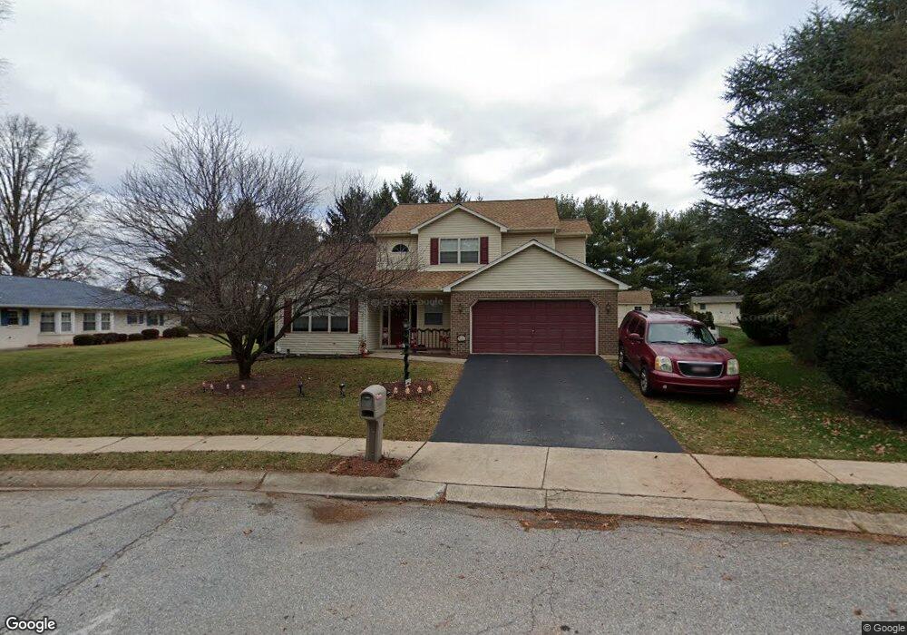
This home is located at 1910 Bretton Ln, York, PA 17408 and is currently estimated at $353,479, approximately $147 per square foot. 1910 Bretton Ln is a home located in York County with nearby schools including West York Area High School, York Adventist Christian School, and Christian School of York.
Ownership History
Date
Name
Owned For
Owner Type
Purchase Details
Closed on
May 20, 2011
Sold by
Groscost John E and Groscost Juliet M
Bought by
Street Chad and Street Lisa
Current Estimated Value
Home Financials for this Owner
Home Financials are based on the most recent Mortgage that was taken out on this home.
Original Mortgage
$91,000
Outstanding Balance
$5,629
Interest Rate
4.94%
Mortgage Type
New Conventional
Estimated Equity
$347,850
Purchase Details
Closed on
Jun 29, 1994
Bought by
Groscost John E and Groscost Juliet M
Create a Home Valuation Report for This Property
The Home Valuation Report is an in-depth analysis detailing your home's value as well as a comparison with similar homes in the area
Home Values in the Area
Average Home Value in this Area
Purchase History
| Date | Buyer | Sale Price | Title Company |
|---|---|---|---|
| Street Chad | $191,000 | None Available | |
| Groscost John E | $126,200 | -- |
Source: Public Records
Mortgage History
| Date | Status | Borrower | Loan Amount |
|---|---|---|---|
| Open | Street Chad | $91,000 |
Source: Public Records
Tax History Compared to Growth
Tax History
| Year | Tax Paid | Tax Assessment Tax Assessment Total Assessment is a certain percentage of the fair market value that is determined by local assessors to be the total taxable value of land and additions on the property. | Land | Improvement |
|---|---|---|---|---|
| 2025 | $5,829 | $172,870 | $42,270 | $130,600 |
| 2024 | $5,683 | $172,870 | $42,270 | $130,600 |
| 2023 | $5,683 | $172,870 | $42,270 | $130,600 |
| 2022 | $5,683 | $172,870 | $42,270 | $130,600 |
| 2021 | $5,510 | $172,870 | $42,270 | $130,600 |
| 2020 | $5,510 | $172,870 | $42,270 | $130,600 |
| 2019 | $5,406 | $172,870 | $42,270 | $130,600 |
| 2018 | $5,363 | $172,870 | $42,270 | $130,600 |
| 2017 | $5,199 | $172,870 | $42,270 | $130,600 |
| 2016 | $0 | $172,870 | $42,270 | $130,600 |
| 2015 | -- | $172,870 | $42,270 | $130,600 |
| 2014 | -- | $172,870 | $42,270 | $130,600 |
Source: Public Records
Map
Nearby Homes
- 1945 Normandie Dr
- 1965 Niagara Ln
- 2020 Parkton Ln
- 1879 Trolley Rd
- 2094 Winding Rd
- 0 Colony Rd
- 1837 Downing St
- 2200 Parkton Ln
- 1625 Haviland Rd
- 2248 Heather Rd
- 103 Winston Dr
- 2233 Loucks Rd
- 2300 Wyndhurst Ct
- 123 Winston Dr
- 1031 Willow Ridge Dr
- 2325 Middle St
- 2381 Sunset Ln
- 2481 Broad St
- 2290 School St
- 1701 Emerald Ave
- 1914 Bretton Ln
- 1890 Normandie Dr
- 1900 Normandie Dr
- 1919 Bretton Ln
- 1918 Bretton Ln
- 1895 Normandie Dr
- 1922 Bretton Ln
- 1910 Normandie Dr
- 1885 Normandie Dr
- 1927 Bretton Ln
- 1905 Normandie Dr
- 1919 Stonegate Rd
- 1915 Stonegate Rd
- 1855 Shiloh Dr
- 1926 Bretton Ln
- 1923 Stonegate Rd
- 1920 Normandie Dr
- 1850 Charleston Ln
- 1931 Bretton Ln
- 1927 Stonegate Rd