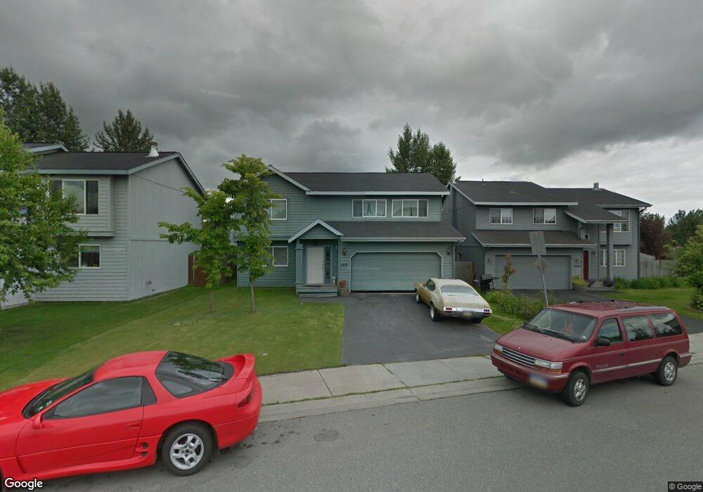
1910 Cannoneer Cir Anchorage, AK 99507
Abbott Loop NeighborhoodEstimated Value: $467,000 - $586,000
4
Beds
2
Baths
1,938
Sq Ft
$259/Sq Ft
Est. Value
About This Home
This home is located at 1910 Cannoneer Cir, Anchorage, AK 99507 and is currently estimated at $501,491, approximately $258 per square foot. 1910 Cannoneer Cir is a home located in Anchorage Municipality with nearby schools including Spring Hill Elementary School, Hanshew Middle School, and Service High School.
Ownership History
Date
Name
Owned For
Owner Type
Purchase Details
Closed on
Nov 10, 2011
Sold by
Reyes Curtley Emelanio and Reyes Emilia G
Bought by
Reyes Emelanio and Reyes Emilia G
Current Estimated Value
Home Financials for this Owner
Home Financials are based on the most recent Mortgage that was taken out on this home.
Original Mortgage
$228,000
Outstanding Balance
$22,847
Interest Rate
3.87%
Mortgage Type
New Conventional
Estimated Equity
$478,644
Purchase Details
Closed on
Jun 15, 2001
Sold by
Kennedy Theodore H and Kennedy Tammy L
Bought by
Reyes Emelanio and Reyes Emilia
Home Financials for this Owner
Home Financials are based on the most recent Mortgage that was taken out on this home.
Original Mortgage
$193,371
Interest Rate
7.14%
Mortgage Type
FHA
Purchase Details
Closed on
Jan 6, 1999
Sold by
Spinell Homes Inc
Bought by
Kennedy Theodore H and Kennedy Tammy L
Home Financials for this Owner
Home Financials are based on the most recent Mortgage that was taken out on this home.
Original Mortgage
$181,050
Interest Rate
6.73%
Mortgage Type
VA
Create a Home Valuation Report for This Property
The Home Valuation Report is an in-depth analysis detailing your home's value as well as a comparison with similar homes in the area
Home Values in the Area
Average Home Value in this Area
Purchase History
| Date | Buyer | Sale Price | Title Company |
|---|---|---|---|
| Reyes Emelanio | -- | Stewart Title Company | |
| Reyes Emelanio | -- | -- | |
| Reyes Emelanio | -- | -- | |
| Kennedy Theodore H | -- | -- | |
| Kennedy Theodore H | -- | -- |
Source: Public Records
Mortgage History
| Date | Status | Borrower | Loan Amount |
|---|---|---|---|
| Open | Reyes Emelanio | $228,000 | |
| Closed | Reyes Emelanio | $193,371 | |
| Previous Owner | Kennedy Theodore H | $181,050 |
Source: Public Records
Tax History Compared to Growth
Tax History
| Year | Tax Paid | Tax Assessment Tax Assessment Total Assessment is a certain percentage of the fair market value that is determined by local assessors to be the total taxable value of land and additions on the property. | Land | Improvement |
|---|---|---|---|---|
| 2025 | $6,692 | $423,200 | $89,200 | $334,000 |
| 2024 | $6,692 | $414,500 | $89,200 | $325,300 |
| 2023 | $6,475 | $380,200 | $89,200 | $291,000 |
| 2022 | $6,559 | $389,500 | $89,200 | $300,300 |
| 2021 | $6,264 | $347,600 | $89,200 | $258,400 |
| 2020 | $5,743 | $337,800 | $89,200 | $248,600 |
| 2019 | $5,504 | $336,400 | $89,200 | $247,200 |
| 2018 | $5,328 | $324,900 | $79,900 | $245,000 |
| 2017 | $5,199 | $332,000 | $79,900 | $252,100 |
| 2016 | $4,750 | $336,300 | $75,500 | $260,800 |
| 2015 | $4,750 | $328,100 | $75,500 | $252,600 |
| 2014 | $4,750 | $322,700 | $75,500 | $247,200 |
Source: Public Records
Map
Nearby Homes
- 9710 Vanguard Dr Unit 80
- 9700 Vanguard Dr Unit 70
- 9730 Vanguard Dr Unit 12
- 1917 Colony Place Unit 33
- 9830 Reliance Dr
- 1914 Sturbridge Ct Unit 3
- 267 Loop Unit 267
- 2060 Sturbridge Cir
- 9599 Brayton Dr Unit 422
- 9499 Brayton Dr Unit 39
- 9499 Brayton Dr Unit 152
- 9499 Brayton Dr Unit 245
- 10260 Jamestown Dr Unit A8
- 9130 Golovin St
- 1611 Betula Cir
- 10261 Arborvitae Dr
- 1900-1941 Marthas Vineyard Cir
- 10285 Arborvitae Dr
- 8000 Independence Park Dr
- 10009 Thimble Berry Dr
- 1920 Cannoneer Cir
- 1900 Cannoneer Cir
- 1930 Cannoneer Cir
- 9550 Flintlock St
- 1940 Cannoneer Cir
- 9540 Flintlock St
- 1950 Cannoneer Cir
- 1931 Cannoneer Cir
- 1941 Cannoneer Cir
- 9530 Flintlock St
- 2000 Cannoneer Cir
- L48B17 Cannoneer Cir
- L49-75 Cannoneer Cir
- 27 Lots Cannoneer Cir
- L61 B17 Cannoneer Cir
- 1951 Cannoneer Cir
- 9600 Vanguard Dr
- 9520 Flintlock St
- 2006 Cannoneer Cir
- 9470 Flintlock St