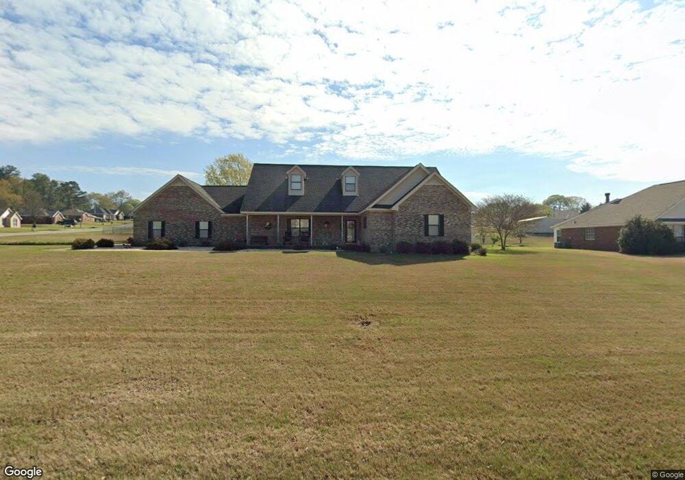
1910 Cedar Ridge Loop Prattville, AL 36067
Estimated Value: $322,000 - $394,000
--
Bed
--
Bath
2,883
Sq Ft
$126/Sq Ft
Est. Value
About This Home
This home is located at 1910 Cedar Ridge Loop, Prattville, AL 36067 and is currently estimated at $362,707, approximately $125 per square foot. 1910 Cedar Ridge Loop is a home located in Autauga County with nearby schools including Pine Level Elementary School, Marbury Middle School, and Marbury High School.
Ownership History
Date
Name
Owned For
Owner Type
Purchase Details
Closed on
May 4, 2011
Sold by
Thrailkill-Persons Patsy C and Thrailkill Patsy
Bought by
Thrailkill-Persons Patsy C and Persons John R
Current Estimated Value
Home Financials for this Owner
Home Financials are based on the most recent Mortgage that was taken out on this home.
Original Mortgage
$156,000
Interest Rate
4.81%
Purchase Details
Closed on
Feb 28, 2007
Sold by
Debbie Don M and Moser Debbie
Bought by
Patsy Thrailkill
Purchase Details
Closed on
May 2, 2000
Bought by
Champion Danny C and Champion Tanya R
Create a Home Valuation Report for This Property
The Home Valuation Report is an in-depth analysis detailing your home's value as well as a comparison with similar homes in the area
Home Values in the Area
Average Home Value in this Area
Purchase History
| Date | Buyer | Sale Price | Title Company |
|---|---|---|---|
| Thrailkill-Persons Patsy C | -- | -- | |
| Patsy Thrailkill | $243,000 | -- | |
| Champion Danny C | $17,800 | -- |
Source: Public Records
Mortgage History
| Date | Status | Borrower | Loan Amount |
|---|---|---|---|
| Open | Thrailkill-Persons Patsy C | $218,345 | |
| Closed | Thrailkill-Persons Patsy C | $156,000 |
Source: Public Records
Tax History Compared to Growth
Tax History
| Year | Tax Paid | Tax Assessment Tax Assessment Total Assessment is a certain percentage of the fair market value that is determined by local assessors to be the total taxable value of land and additions on the property. | Land | Improvement |
|---|---|---|---|---|
| 2024 | $980 | $36,280 | $0 | $0 |
| 2023 | $917 | $33,960 | $0 | $0 |
| 2022 | $763 | $28,260 | $0 | $0 |
| 2021 | $737 | $27,280 | $0 | $0 |
| 2020 | $746 | $27,620 | $0 | $0 |
| 2019 | $727 | $26,940 | $0 | $0 |
| 2018 | $734 | $27,180 | $0 | $0 |
| 2015 | $713 | $0 | $0 | $0 |
| 2014 | -- | $26,500 | $3,000 | $23,500 |
| 2013 | -- | $26,460 | $3,000 | $23,460 |
Source: Public Records
Map
Nearby Homes
- 1920 Cedar Ridge Loop
- 1929 Cedar Ridge Loop
- 1939 Cedar Ridge Loop
- 147 County Rd 40 Rd W
- 204 Pine Level Ridge
- 13 Commercial Pkwy
- 10 Commercial Pkwy
- 12 Commercial Pkwy
- 7 Commercial Pkwy
- 8 Commercial Pkwy
- 11 Commercial Pkwy
- 4 Commercial Pkwy
- 5 Commercial Pkwy
- 6 Commercial Pkwy
- 3 Commercial Pkwy
- 15 Commercial Pkwy
- 2 Commercial Pkwy
- 14 Commercial Pkwy
- 0 County Road 61
- 2118 Waterstone Dr
- 2050 Cedar Ridge Loop
- 1804 Aspen Way
- 1802 Aspen Way
- 1907 Cedar Ridge Loop
- 1806 Aspen Way
- 2048 Cedar Ridge Loop
- 1905 Cedar Ridge Loop
- 1909 Cedar Ridge Loop
- 2053 Cedar Ridge Loop
- 2051 Cedar Ridge Loop
- 1808 Aspen Way
- 2049 Cedar Ridge Loop
- 1906 Cedar Ridge Loop
- 2046 Cedar Ridge Loop
- 1911 Cedar Ridge Loop
- 171 County Road 40
- 1903 Cedar Ridge Loop
- 1810 Aspen Way
- 2047 Cedar Ridge Loop
- 1913 Cedar Ridge Loop
