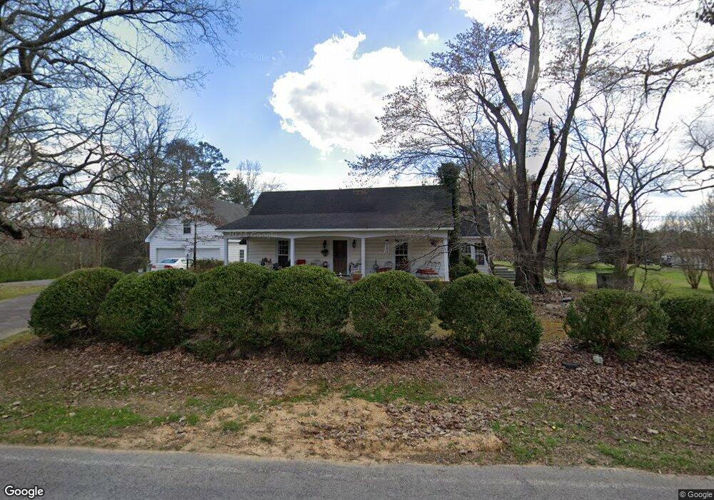
1910 Center Grove Rd Rock Spring, GA 30739
Rock Spring NeighborhoodEstimated Value: $323,000 - $458,000
4
Beds
3
Baths
3,600
Sq Ft
$114/Sq Ft
Est. Value
About This Home
This home is located at 1910 Center Grove Rd, Rock Spring, GA 30739 and is currently estimated at $410,845, approximately $114 per square foot. 1910 Center Grove Rd is a home located in Walker County with nearby schools including Rock Spring Elementary School, Lafayette High School, and Alice M Daley Adventist School.
Ownership History
Date
Name
Owned For
Owner Type
Purchase Details
Closed on
Mar 3, 2021
Sold by
Beekman Sandra
Bought by
Stephenson Timothy Lee
Current Estimated Value
Purchase Details
Closed on
Dec 23, 1989
Sold by
Neal Shirley S and Neal
Bought by
Neal Shirley S and Neal Barbara B
Purchase Details
Closed on
Mar 4, 1986
Sold by
Shanon Stephenson
Bought by
Neal Shirley S and Neal
Purchase Details
Closed on
Jan 1, 1972
Sold by
Stephenson Shanon
Bought by
Shanon Stephenson
Purchase Details
Closed on
Aug 9, 1941
Bought by
Stephenson Shanon
Create a Home Valuation Report for This Property
The Home Valuation Report is an in-depth analysis detailing your home's value as well as a comparison with similar homes in the area
Home Values in the Area
Average Home Value in this Area
Purchase History
| Date | Buyer | Sale Price | Title Company |
|---|---|---|---|
| Stephenson Timothy Lee | -- | -- | |
| Beekman Sandra | $65,000 | -- | |
| Neal Shirley S | -- | -- | |
| Neal Shirley S | -- | -- | |
| Shanon Stephenson | -- | -- | |
| Stephenson Shanon | -- | -- |
Source: Public Records
Tax History Compared to Growth
Tax History
| Year | Tax Paid | Tax Assessment Tax Assessment Total Assessment is a certain percentage of the fair market value that is determined by local assessors to be the total taxable value of land and additions on the property. | Land | Improvement |
|---|---|---|---|---|
| 2024 | $1,326 | $40,492 | $40,492 | $0 |
| 2023 | $666 | $32,137 | $32,137 | $0 |
| 2022 | $841 | $36,202 | $36,202 | $0 |
| 2021 | $1,559 | $56,266 | $39,392 | $16,874 |
| 2020 | $1,527 | $53,002 | $39,392 | $13,610 |
| 2019 | $1,555 | $53,002 | $39,392 | $13,610 |
| 2018 | $1,234 | $46,653 | $39,392 | $7,261 |
| 2017 | $1,508 | $46,653 | $39,392 | $7,261 |
| 2016 | $1,272 | $46,653 | $39,392 | $7,261 |
| 2015 | $1,353 | $46,973 | $45,005 | $1,968 |
| 2014 | $1,250 | $46,973 | $45,005 | $1,968 |
| 2013 | -- | $46,972 | $45,004 | $1,968 |
Source: Public Records
Map
Nearby Homes
- 0 Tarvin Rd Unit 1523862
- 0 Clyde Byrd Rd
- 0 Colbert Hollow Rd Unit 1513202
- 0 Veeler Rd Unit 1522679
- 0 Veeler Rd Unit 10628696
- 0 Cheshire Crossing Dr Unit 1387793
- 5602 Georgia 95
- 00 Georgia 95
- 10180 Us Highway 27
- 1585 E Reed Rd
- 287 E Teems Rd
- 265 Rodeo Dr
- 15 Willow Cir
- 0 E Teems Rd Unit 7573954
- 23 Willow Cir
- 16 Willow Cir
- 11 Willow Cir
- 1910 Center Grove Rd
- 1871 Center Grove Rd
- 1993 Center Grove Rd
- 1978 Center Grove Rd
- 1839 Center Grove Rd
- 2016 Center Grove Rd
- 2057 Center Grove Rd
- 254 Ringgold Rd
- 2056 Center Grove Rd
- 224 Ringgold Rd
- 248 Ringgold Rd
- 32 Ringgold Rd
- 1786 Center Grove Rd
- 360 Ringgold Rd
- 1677 Center Grove Rd
- 1703 Center Grove Rd
- 70 Ringgold Rd
- 851 Hankins Rd
- 1720 Center Grove Rd
- 819 Hankins Rd