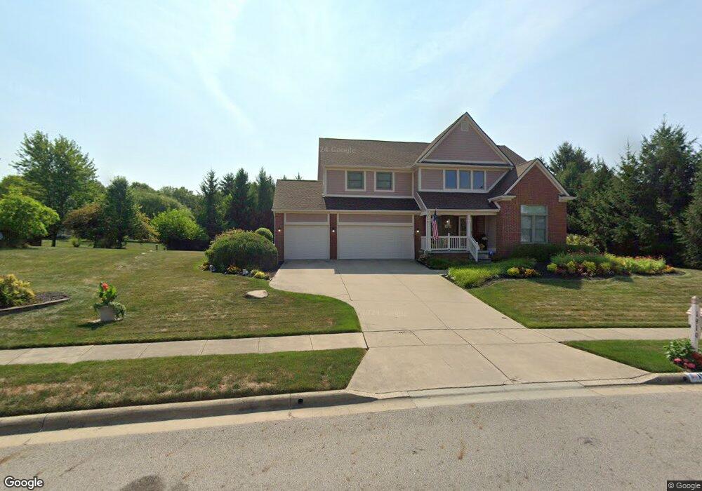
1910 Crosswick Dr Reynoldsburg, OH 43068
Estimated Value: $490,000 - $536,000
4
Beds
3
Baths
2,865
Sq Ft
$178/Sq Ft
Est. Value
About This Home
This home is located at 1910 Crosswick Dr, Reynoldsburg, OH 43068 and is currently estimated at $509,688, approximately $177 per square foot. 1910 Crosswick Dr is a home located in Franklin County with nearby schools including Slate Ridge Elementary School, Hannah J Ashton Middle School, and Baldwin Road Junior High School.
Ownership History
Date
Name
Owned For
Owner Type
Purchase Details
Closed on
Mar 11, 2005
Sold by
Fleming Bernard W and Fleming Barbara A
Bought by
Wallace Kelly V and Wallace Tammy L
Current Estimated Value
Home Financials for this Owner
Home Financials are based on the most recent Mortgage that was taken out on this home.
Original Mortgage
$216,000
Outstanding Balance
$109,941
Interest Rate
5.67%
Mortgage Type
Purchase Money Mortgage
Estimated Equity
$399,747
Purchase Details
Closed on
Jun 15, 2001
Sold by
Donley Inc
Bought by
Fleming Bernard W and Fleming Barbara A
Home Financials for this Owner
Home Financials are based on the most recent Mortgage that was taken out on this home.
Original Mortgage
$220,000
Interest Rate
6.87%
Mortgage Type
Purchase Money Mortgage
Create a Home Valuation Report for This Property
The Home Valuation Report is an in-depth analysis detailing your home's value as well as a comparison with similar homes in the area
Home Values in the Area
Average Home Value in this Area
Purchase History
| Date | Buyer | Sale Price | Title Company |
|---|---|---|---|
| Wallace Kelly V | $292,000 | Amerititle | |
| Fleming Bernard W | $282,700 | -- |
Source: Public Records
Mortgage History
| Date | Status | Borrower | Loan Amount |
|---|---|---|---|
| Open | Wallace Kelly V | $216,000 | |
| Closed | Fleming Bernard W | $220,000 |
Source: Public Records
Tax History Compared to Growth
Tax History
| Year | Tax Paid | Tax Assessment Tax Assessment Total Assessment is a certain percentage of the fair market value that is determined by local assessors to be the total taxable value of land and additions on the property. | Land | Improvement |
|---|---|---|---|---|
| 2024 | $7,888 | $154,070 | $31,500 | $122,570 |
| 2023 | $7,528 | $154,070 | $31,500 | $122,570 |
| 2022 | $7,684 | $118,970 | $18,060 | $100,910 |
| 2021 | $7,714 | $118,970 | $18,060 | $100,910 |
| 2020 | $7,871 | $118,970 | $18,060 | $100,910 |
| 2019 | $7,259 | $99,470 | $15,050 | $84,420 |
| 2018 | $7,203 | $99,470 | $15,050 | $84,420 |
| 2017 | $7,317 | $99,470 | $15,050 | $84,420 |
| 2016 | $7,376 | $90,380 | $14,740 | $75,640 |
| 2015 | $7,147 | $90,380 | $14,740 | $75,640 |
| 2014 | $7,180 | $90,380 | $14,740 | $75,640 |
| 2013 | $3,447 | $89,180 | $14,735 | $74,445 |
Source: Public Records
Map
Nearby Homes
- 1890 Lockmere Ct
- 1849 Drugan Ct SW
- 7832 Country Brook Ln
- 1788 Leighton Dr
- 7933 Meadowlark Ln S Unit 7933
- 7645 Redman Ln
- 7607 Palmer Rd SW
- 7961 Oak Valley Rd
- 0 Oak Valley Rd Unit 5148458
- 0 Oak Valley Rd Unit Lot 4, 1.088 ac.
- 10039 Taylor Rd SW
- 1744 Graham Rd
- 1545 Alar Ave
- 214 Estates Ln
- 8210 Green Tree Ct
- 210 Estates Ln
- 258 Baron Ct
- 7682 E Main St
- 8055 Eliot Dr
- 1370 Crestview St
- 1910 Crosswick Ct
- 1898 Crosswick Ct
- 1949 Sherring Ct
- 1898 Crosswick Dr
- 7954 Slate Ridge Blvd
- 7964 Slate Ridge Blvd
- 1844 Crosswick Ct
- 1941 Sherring Ct
- 1909 Crosswick Dr
- 1832 Crosswick Ct
- 1955 Sherring Ct
- 1893 Crosswick Ct
- 1893 Crosswick Dr
- 1942 Sherring Ct
- 1822 Crosswick Ct
- 7928 Slate Ridge Blvd
- 1965 Farmsbury Dr
- 7935 Slate Ridge Blvd
- 1952 Sherring Ct
- 1952 Sherring Ct Unit 133