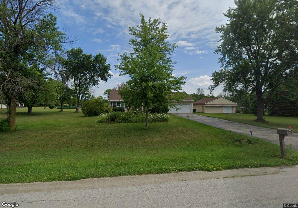
1910 Cypress Rd de Pere, WI 54115
Estimated Value: $381,000 - $405,000
3
Beds
2
Baths
1,300
Sq Ft
$304/Sq Ft
Est. Value
About This Home
This home is located at 1910 Cypress Rd, de Pere, WI 54115 and is currently estimated at $395,398, approximately $304 per square foot. 1910 Cypress Rd is a home located in Brown County with nearby schools including Hemlock Creek Elementary School, West De Pere Middle School, and West De Pere High School.
Ownership History
Date
Name
Owned For
Owner Type
Purchase Details
Closed on
Feb 28, 2003
Sold by
Hughes Michael A and Hughes Janet A
Bought by
Tillman Steven E and Tillman Lisa L
Current Estimated Value
Home Financials for this Owner
Home Financials are based on the most recent Mortgage that was taken out on this home.
Original Mortgage
$163,200
Outstanding Balance
$70,774
Interest Rate
6%
Mortgage Type
VA
Estimated Equity
$324,624
Create a Home Valuation Report for This Property
The Home Valuation Report is an in-depth analysis detailing your home's value as well as a comparison with similar homes in the area
Home Values in the Area
Average Home Value in this Area
Purchase History
| Date | Buyer | Sale Price | Title Company |
|---|---|---|---|
| Tillman Steven E | $160,000 | Bay Title & Abstract Inc |
Source: Public Records
Mortgage History
| Date | Status | Borrower | Loan Amount |
|---|---|---|---|
| Open | Tillman Steven E | $163,200 |
Source: Public Records
Tax History Compared to Growth
Tax History
| Year | Tax Paid | Tax Assessment Tax Assessment Total Assessment is a certain percentage of the fair market value that is determined by local assessors to be the total taxable value of land and additions on the property. | Land | Improvement |
|---|---|---|---|---|
| 2024 | $3,503 | $239,800 | $59,600 | $180,200 |
| 2023 | $3,216 | $239,800 | $59,600 | $180,200 |
| 2022 | $3,220 | $239,800 | $59,600 | $180,200 |
| 2021 | $3,223 | $239,800 | $59,600 | $180,200 |
| 2020 | $3,547 | $187,600 | $38,900 | $148,700 |
| 2019 | $3,493 | $187,600 | $38,900 | $148,700 |
| 2018 | $3,341 | $187,600 | $38,900 | $148,700 |
| 2017 | $3,405 | $187,600 | $38,900 | $148,700 |
| 2016 | $3,439 | $187,600 | $38,900 | $148,700 |
| 2015 | $3,511 | $187,600 | $38,900 | $148,700 |
| 2014 | $3,602 | $185,500 | $38,900 | $146,600 |
| 2013 | $3,602 | $185,500 | $38,900 | $146,600 |
Source: Public Records
Map
Nearby Homes
- 0 Fernando Dr
- 1280 W Main Ave
- 3566 W Hank Ave
- 3629 W Hank Ave
- 3581 W Hank Ave
- 3578 W Hank Ave
- 3571 Sand Acres Dr
- 0 Contract Dr
- 1338 Highland Ridge Dr
- 1359 Shelby Ln
- 3644 E Hank Ave
- 1477 Wexford Ln
- 2689 Clive St
- 3683 Ponds Edge Ct
- 3161 Trinity Ct
- 3106 Trinity Ct
- 3166 Trinity Ct
- 1108 Hoks Ridge Ln
- 2549 Babcock Rd Unit 2551
- 1308 Carole Ln
- 1894 Cypress Rd
- 1920 Cypress Rd
- 1888 Cypress Rd
- 1874 Cypress Rd
- 3400 Riverstone Ct
- 3408 Riverstone Ct
- 1864 Cypress Rd
- 3412 Riverstone Ct
- 3401 Riverstone Ct Unit 24
- 3405 Riverstone Ct
- 1674 Ledgestone Ct
- 1686 W Main Cr Unit 5
- 1686 W Main Cr Unit 1
- 1686 W Main Cr Unit 6
- 1686 W Main Cr Unit 2
- 1686 W Main Cr Unit 3
- 1686 W Main Cr Unit 4
- 1686 W Main Cr
- 1694-4 W Main Cir
- 1681 W Main Cir Unit 5