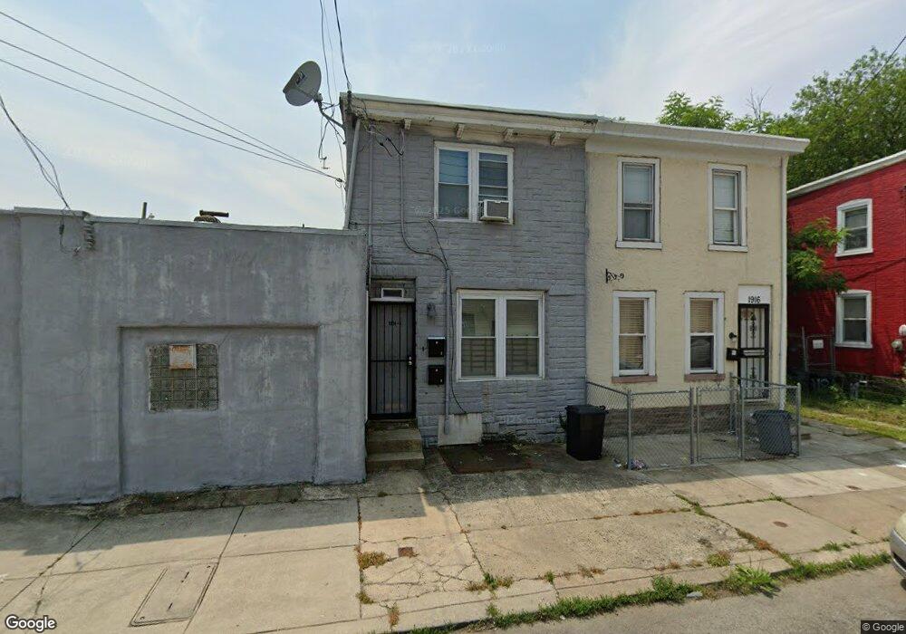
1910 E Haines St Philadelphia, PA 19138
West Oak Lane NeighborhoodEstimated Value: $119,910
1
Bed
1
Bath
2,360
Sq Ft
$51/Sq Ft
Est. Value
About This Home
This home is located at 1910 E Haines St, Philadelphia, PA 19138 and is currently estimated at $119,910, approximately $50 per square foot. 1910 E Haines St is a home located in Philadelphia County with nearby schools including William Rowen School, Gen. Louis Wagner Middle School, and Martin Luther King High School.
Ownership History
Date
Name
Owned For
Owner Type
Purchase Details
Closed on
Mar 27, 2021
Sold by
Wattley Charles and Wattley Candice
Bought by
Wattley Candice and Wattley Charles
Current Estimated Value
Purchase Details
Closed on
Jul 17, 2015
Sold by
Jackson Eddie
Bought by
Wattley Candice and Wattley Charles
Purchase Details
Closed on
May 25, 1988
Bought by
Jackson Eddie
Create a Home Valuation Report for This Property
The Home Valuation Report is an in-depth analysis detailing your home's value as well as a comparison with similar homes in the area
Home Values in the Area
Average Home Value in this Area
Purchase History
| Date | Buyer | Sale Price | Title Company |
|---|---|---|---|
| Wattley Candice | -- | None Available | |
| Wattley Candice | $60,000 | None Available | |
| Jackson Eddie | -- | -- |
Source: Public Records
Tax History Compared to Growth
Tax History
| Year | Tax Paid | Tax Assessment Tax Assessment Total Assessment is a certain percentage of the fair market value that is determined by local assessors to be the total taxable value of land and additions on the property. | Land | Improvement |
|---|---|---|---|---|
| 2026 | $2,103 | $148,200 | $29,640 | $118,560 |
| 2025 | $2,103 | $148,200 | $29,640 | $118,560 |
| 2024 | $2,103 | $148,200 | $29,640 | $118,560 |
| 2023 | $2,103 | $150,200 | $30,040 | $120,160 |
| 2022 | $2,731 | $150,200 | $30,040 | $120,160 |
| 2021 | $2,731 | $0 | $0 | $0 |
| 2020 | $2,731 | $0 | $0 | $0 |
| 2019 | $2,704 | $0 | $0 | $0 |
| 2018 | $2,626 | $0 | $0 | $0 |
| 2017 | $1,982 | $0 | $0 | $0 |
| 2016 | $1,982 | $0 | $0 | $0 |
| 2015 | $1,897 | $0 | $0 | $0 |
| 2014 | -- | $141,600 | $25,300 | $116,300 |
| 2012 | -- | $11,520 | $3,600 | $7,920 |
Source: Public Records
Map
Nearby Homes
- 6732 Ogontz Ave
- 6869 Forrest Ave
- 6838 Ogontz Ave
- 6905 Forrest Ave
- 6908 Ogontz Ave
- 2056 Eastburn Ave
- 6642 N 20th St
- 6731 N Woodstock St
- 6733 N Woodstock St
- 1934 69th Ave
- 6944 Cedar Park Ave
- 1816 67th Ave
- 1729 68th Ave
- 6625 Ogontz Ave
- 1733 67th Ave
- 1731 67th Ave
- 1720 68th Ave
- 6629 N Gratz St
- 2070 E Haines St
- 6603 Ogontz Ave
- 1916 E Haines St
- 1918 E Haines St
- 1920 E Haines St
- 6830 Wyncote Ave
- 6830 Ogontz Ave
- 6828 Wyncote Ave
- 6826 Wyncote Ave
- 6824 Wyncote Ave
- 6832 Ogontz Ave
- 6822 Wyncote Ave
- 6820 Wyncote Ave
- 6859 Forrest Ave
- 6834 Ogontz Ave
- 6861 Forrest Ave
- 6863 Forrest Ave
- 6816 Wyncote Ave
- 6813 Ogontz Ave
- 6865 Forrest Ave
- 6814 Wyncote Ave
- 6825 Ogontz Ave