Estimated Value: $279,000 - $342,000
4
Beds
4
Baths
2,120
Sq Ft
$145/Sq Ft
Est. Value
About This Home
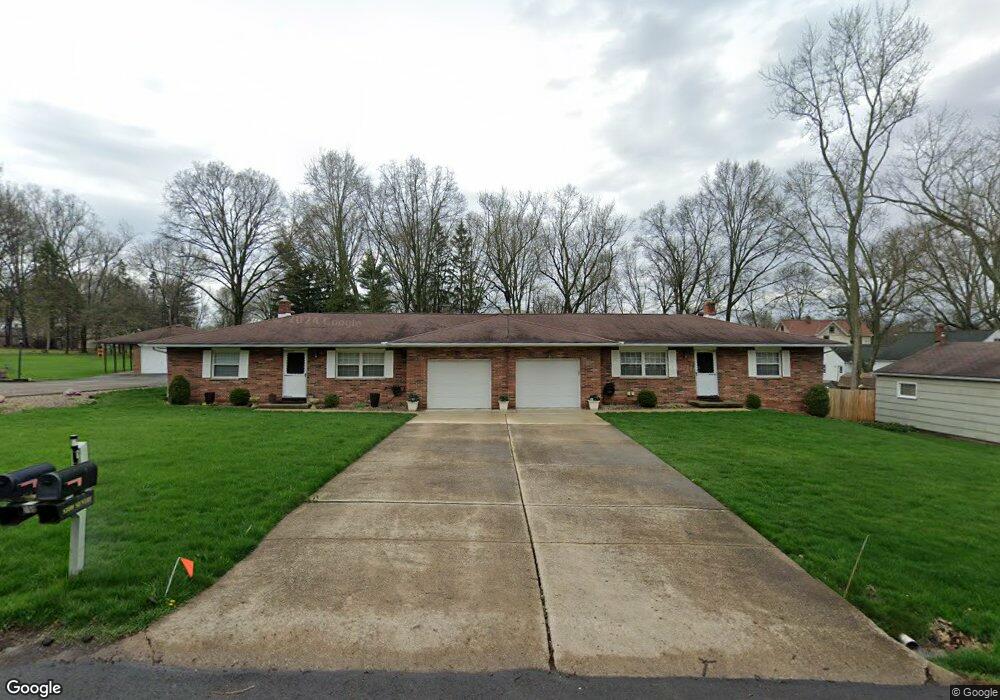
This home is located at 1910 Echo Rd Unit 1914, Stow, OH 44224 and is currently estimated at $308,259, approximately $145 per square foot. 1910 Echo Rd Unit 1914 is a home located in Summit County with nearby schools including Stow-Munroe Falls High School, Holy Family Elementary School, and Walsh Jesuit High School.
Ownership History
Date
Name
Owned For
Owner Type
Purchase Details
Closed on
May 6, 2024
Sold by
Robert James Post Jr Living Trust and Post Robert James
Bought by
Savage Clifton Leon
Current Estimated Value
Home Financials for this Owner
Home Financials are based on the most recent Mortgage that was taken out on this home.
Original Mortgage
$269,027
Outstanding Balance
$264,750
Interest Rate
6.87%
Mortgage Type
Credit Line Revolving
Estimated Equity
$43,509
Purchase Details
Closed on
Apr 14, 2004
Sold by
Post Robert James
Bought by
Post Robert James and The Robert James Post Jr Living Trust
Purchase Details
Closed on
Jun 25, 2003
Sold by
Grosso George and Walchalk Loretta
Bought by
Post Robert James and The Robert James Post Sr Living Trust
Create a Home Valuation Report for This Property
The Home Valuation Report is an in-depth analysis detailing your home's value as well as a comparison with similar homes in the area
Home Values in the Area
Average Home Value in this Area
Purchase History
| Date | Buyer | Sale Price | Title Company |
|---|---|---|---|
| Savage Clifton Leon | $274,000 | Accurate Abstracting | |
| Post Robert James | -- | -- | |
| Post Robert James | $181,300 | Land America/Lawyers Title |
Source: Public Records
Mortgage History
| Date | Status | Borrower | Loan Amount |
|---|---|---|---|
| Open | Savage Clifton Leon | $269,027 |
Source: Public Records
Tax History Compared to Growth
Tax History
| Year | Tax Paid | Tax Assessment Tax Assessment Total Assessment is a certain percentage of the fair market value that is determined by local assessors to be the total taxable value of land and additions on the property. | Land | Improvement |
|---|---|---|---|---|
| 2025 | $5,649 | $96,037 | $11,466 | $84,571 |
| 2024 | $5,649 | $96,037 | $11,466 | $84,571 |
| 2023 | $5,649 | $96,037 | $11,466 | $84,571 |
| 2022 | $4,504 | $67,159 | $8,019 | $59,140 |
| 2021 | $4,055 | $67,159 | $8,019 | $59,140 |
| 2020 | $3,932 | $67,160 | $8,020 | $59,140 |
| 2019 | $3,692 | $58,790 | $7,180 | $51,610 |
| 2018 | $3,635 | $58,790 | $7,180 | $51,610 |
| 2017 | $3,735 | $58,790 | $7,180 | $51,610 |
| 2016 | $3,840 | $58,790 | $7,180 | $51,610 |
| 2015 | $3,735 | $58,790 | $7,180 | $51,610 |
| 2014 | $3,739 | $58,790 | $7,180 | $51,610 |
| 2013 | $3,821 | $58,790 | $7,180 | $51,610 |
Source: Public Records
Map
Nearby Homes
- 1974 Hawthorne Ave
- 1857 Gorge Park Blvd
- 93 Silver Valley Blvd
- 75 River Ridge Ln
- 197 Lindsey Rd
- 3068 Kent Rd Unit 105
- 3068 Kent Rd Unit 506
- 104 Falls River Dr
- 354 Hiwood Ave
- 2194 Santom Rd E
- 3005 Kent Rd
- 3058 N Oak Hill Rd
- 3679 Sanford Ave
- 3407 Stillwood Blvd
- 3682 Vira Rd
- 2872 Silver Lake Blvd
- 3711 Vira Rd
- 1231 Graham Rd
- 70 Richard Dr
- 3114 W Edgerton Rd