
Seller's Agent in 2025
Edward Watts
Jameson Sotheby's International Realty
(847) 910-9595
4 in this area
84 Total Sales
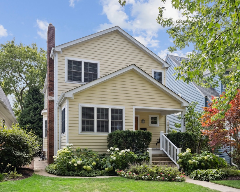
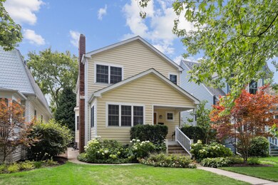
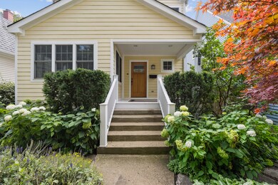
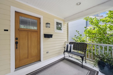
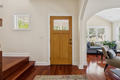
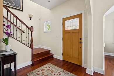

Stunning home in pristine move-in condition! Beautifully updated throughout, gorgeous hardwood flooring, excellent floor plan, nicely finished dry basement with plenty of room to add a 4th bedroom and/or 4th bathroom. Great deck off kitchen/family room, lovely patio and back yard. Two heating and cooling systems for maximum comfort and efficiency. Perfect location near Central Street's shops and trains! Click on 'additional information' for floor plan.
Last Agent to Sell the Property
Jameson Sotheby's International Realty Brokerage Phone: (847) 869-9494 License #475127442 Listed on: 09/14/2025
| Date | Type | Sale Price | Title Company |
|---|---|---|---|
| Warranty Deed | $949,000 | None Listed On Document | |
| Warranty Deed | $775,000 | Multiple | |
| Warranty Deed | $300,000 | Multiple |
| Date | Status | Loan Amount | Loan Type |
|---|---|---|---|
| Open | $550,420 | New Conventional | |
| Previous Owner | $380,000 | Unknown | |
| Previous Owner | $225,000 | Unknown |
| Date | Event | Price | List to Sale | Price per Sq Ft |
|---|---|---|---|---|
| 11/19/2025 11/19/25 | Sold | $949,000 | +5.6% | $364 / Sq Ft |
| 09/19/2025 09/19/25 | Pending | -- | -- | -- |
| 09/14/2025 09/14/25 | For Sale | $899,000 | -- | $344 / Sq Ft |
| Year | Tax Paid | Tax Assessment Tax Assessment Total Assessment is a certain percentage of the fair market value that is determined by local assessors to be the total taxable value of land and additions on the property. | Land | Improvement |
|---|---|---|---|---|
| 2025 | $12,204 | $76,000 | $11,880 | $64,120 |
| 2024 | $12,204 | $51,494 | $11,138 | $40,356 |
| 2023 | $11,686 | $53,729 | $11,138 | $42,591 |
| 2022 | $11,686 | $53,729 | $11,138 | $42,591 |
| 2021 | $11,870 | $48,060 | $7,425 | $40,635 |
| 2020 | $11,772 | $48,060 | $7,425 | $40,635 |
| 2019 | $11,557 | $52,756 | $7,425 | $45,331 |
| 2018 | $13,089 | $51,209 | $6,187 | $45,022 |
| 2017 | $12,763 | $51,209 | $6,187 | $45,022 |
| 2016 | $12,328 | $51,209 | $6,187 | $45,022 |
| 2015 | $10,696 | $42,513 | $5,197 | $37,316 |
| 2014 | $10,609 | $42,513 | $5,197 | $37,316 |
| 2013 | $10,349 | $42,513 | $5,197 | $37,316 |
Seller's Agent in 2025
Edward Watts
Jameson Sotheby's International Realty
(847) 910-9595
4 in this area
84 Total Sales
Buyer's Agent in 2025
Sam Shaffer
Chicago Properties Firm
(773) 297-9792
2 in this area
507 Total Sales
Source: Midwest Real Estate Data (MRED)
MLS Number: 12471546
APN: 10-12-314-007-0000
Disclaimer: Certain information contained herein is derived from information provided by parties other than Homes.com. All information provided is deemed reliable, but is not guaranteed to be accurate and should be independently verified.
![]() Based on information submitted to the MLS GRID. All data is obtained from various sources and may not have been verified by broker or MLS GRID. Supplied Open House Information is subject to change without notice. All information should be independently reviewed and verified for accuracy. Properties may or may not be listed by the office/agent presenting the information. Some IDX listings have been excluded from this website.
Based on information submitted to the MLS GRID. All data is obtained from various sources and may not have been verified by broker or MLS GRID. Supplied Open House Information is subject to change without notice. All information should be independently reviewed and verified for accuracy. Properties may or may not be listed by the office/agent presenting the information. Some IDX listings have been excluded from this website.
Based on information submitted to the MLS GRID
Ask me questions while you tour the home.