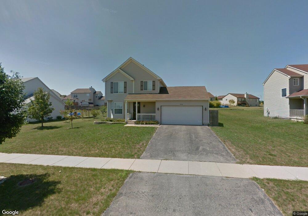
1910 Midday Dr Zion, IL 60099
West Zion NeighborhoodEstimated Value: $331,000 - $372,000
3
Beds
3
Baths
1,656
Sq Ft
$210/Sq Ft
Est. Value
About This Home
This home is located at 1910 Midday Dr, Zion, IL 60099 and is currently estimated at $347,976, approximately $210 per square foot. 1910 Midday Dr is a home located in Lake County with nearby schools including Kenneth Murphy School, Beach Park Middle School, and Zion-Benton Township High School.
Ownership History
Date
Name
Owned For
Owner Type
Purchase Details
Closed on
Mar 24, 2003
Sold by
Bank Of Waukegan
Bought by
Thiele Daniel C and Thiele Carla D
Current Estimated Value
Home Financials for this Owner
Home Financials are based on the most recent Mortgage that was taken out on this home.
Original Mortgage
$173,350
Outstanding Balance
$75,284
Interest Rate
6.02%
Estimated Equity
$272,692
Create a Home Valuation Report for This Property
The Home Valuation Report is an in-depth analysis detailing your home's value as well as a comparison with similar homes in the area
Home Values in the Area
Average Home Value in this Area
Purchase History
| Date | Buyer | Sale Price | Title Company |
|---|---|---|---|
| Thiele Daniel C | $179,000 | Matc |
Source: Public Records
Mortgage History
| Date | Status | Borrower | Loan Amount |
|---|---|---|---|
| Open | Thiele Daniel C | $173,350 |
Source: Public Records
Tax History
| Year | Tax Paid | Tax Assessment Tax Assessment Total Assessment is a certain percentage of the fair market value that is determined by local assessors to be the total taxable value of land and additions on the property. | Land | Improvement |
|---|---|---|---|---|
| 2024 | $8,516 | $92,227 | $15,296 | $76,931 |
| 2023 | $8,859 | $76,849 | $12,746 | $64,103 |
| 2022 | $8,859 | $73,896 | $10,472 | $63,424 |
| 2021 | $8,730 | $69,321 | $9,824 | $59,497 |
| 2020 | $8,417 | $65,200 | $9,240 | $55,960 |
| 2019 | $8,185 | $60,736 | $8,607 | $52,129 |
| 2018 | $7,488 | $55,096 | $7,793 | $47,303 |
| 2017 | $7,341 | $51,109 | $7,229 | $43,880 |
| 2016 | $6,798 | $46,395 | $6,562 | $39,833 |
| 2015 | $6,516 | $42,097 | $5,954 | $36,143 |
| 2014 | $5,757 | $38,700 | $5,541 | $33,159 |
| 2012 | $6,272 | $41,214 | $5,901 | $35,313 |
Source: Public Records
Map
Nearby Homes
- 2020 Dawn Ln
- 4539 Illinois 173
- 4109 Sarah Dr
- 2414 Phillip Dr
- 2410 Miriam Ave
- 4014 Ridge Rd
- 3816 Tickseed Dr
- 1305 Reed Rd
- 1210 Lorelei Dr
- 3805 Parkway Ln
- 3905 Harmony Dr
- 1509 Schooner Ct
- 908 Countrywood Dr
- 40827 N Delany Rd
- 2204 Joanna Ave
- 13051 Bucksburn Ct
- 4108 Douglas Dr
- 2313 Joppa Ave
- 13980 W Stonegate Rd
- 1405 Lewis Ave
- 1908 Midday Dr
- 2000 Midday Dr
- 2003 Sunset Ct
- 2001 Sunset Ct
- 1906 Midday Dr
- 2005 Sunset Ct
- 2002 Midday Dr
- 1909 Midday Dr
- 2001 Midday Dr
- 1911 Sunshine Ln
- 1907 Midday Dr
- 2003 Midday Dr
- 1909 Sunshine Ln
- 1904 Midday Dr
- 2007 Sunset Ct
- 2004 Midday Dr
- 1905 Midday Dr
- 2005 Midday Dr
- 1907 Sunshine Ln
- 2000 Sunset Ct
Your Personal Tour Guide
Ask me questions while you tour the home.