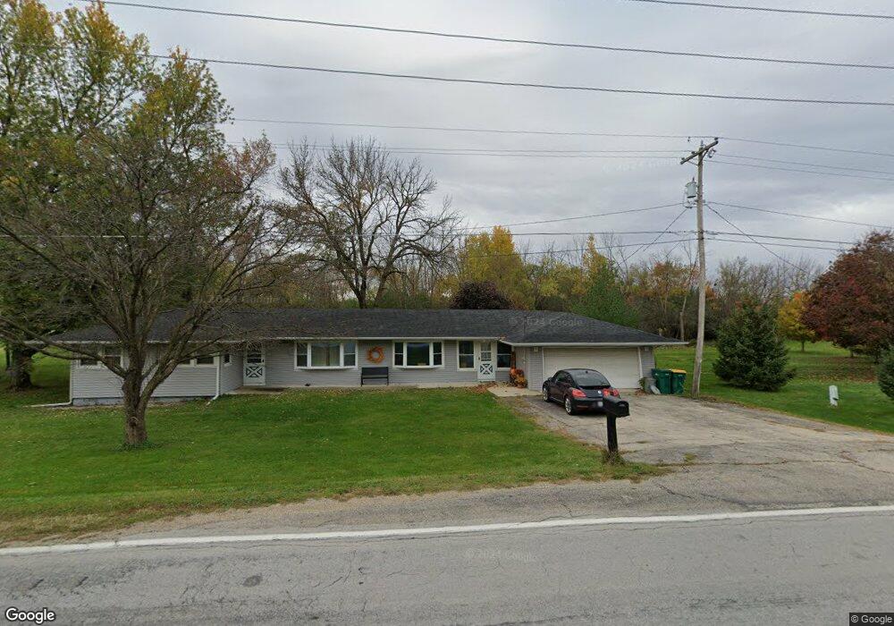
1910 N 2753rd Rd Ottawa, IL 61350
Estimated Value: $200,087 - $315,000
3
Beds
2
Baths
1,467
Sq Ft
$172/Sq Ft
Est. Value
About This Home
This home is located at 1910 N 2753rd Rd, Ottawa, IL 61350 and is currently estimated at $253,029, approximately $172 per square foot. 1910 N 2753rd Rd is a home located in LaSalle County with nearby schools including Rutland Elementary School, Ottawa Township High School, and Marquette Academy.
Ownership History
Date
Name
Owned For
Owner Type
Purchase Details
Closed on
Jun 8, 2011
Sold by
Yepsen Christopher and Yepsen Shawn
Bought by
Wick Brody L and Wick Alexander M
Current Estimated Value
Purchase Details
Closed on
May 5, 2007
Sold by
Yepsen Steven
Bought by
Yepsen Christopher and Vredeveld Shawn
Home Financials for this Owner
Home Financials are based on the most recent Mortgage that was taken out on this home.
Original Mortgage
$83,750
Interest Rate
5.92%
Mortgage Type
New Conventional
Create a Home Valuation Report for This Property
The Home Valuation Report is an in-depth analysis detailing your home's value as well as a comparison with similar homes in the area
Home Values in the Area
Average Home Value in this Area
Purchase History
| Date | Buyer | Sale Price | Title Company |
|---|---|---|---|
| Wick Brody L | $106,000 | None Available | |
| Yepsen Christopher | $125,000 | None Available |
Source: Public Records
Mortgage History
| Date | Status | Borrower | Loan Amount |
|---|---|---|---|
| Previous Owner | Yepsen Christopher | $83,750 |
Source: Public Records
Tax History Compared to Growth
Tax History
| Year | Tax Paid | Tax Assessment Tax Assessment Total Assessment is a certain percentage of the fair market value that is determined by local assessors to be the total taxable value of land and additions on the property. | Land | Improvement |
|---|---|---|---|---|
| 2024 | $4,275 | $51,452 | $7,735 | $43,717 |
| 2023 | $3,873 | $46,311 | $6,962 | $39,349 |
| 2022 | $3,671 | $43,657 | $6,563 | $37,094 |
| 2021 | $3,465 | $41,116 | $6,181 | $34,935 |
| 2020 | $3,288 | $39,599 | $5,953 | $33,646 |
| 2019 | $3,244 | $38,841 | $5,839 | $33,002 |
| 2018 | $3,114 | $37,919 | $5,700 | $32,219 |
| 2017 | $3,036 | $37,020 | $5,565 | $31,455 |
| 2016 | $2,946 | $36,419 | $5,475 | $30,944 |
| 2015 | $2,868 | $36,040 | $5,418 | $30,622 |
| 2012 | -- | $33,274 | $5,002 | $28,272 |
Source: Public Records
Map
Nearby Homes
- 5 Willow Way
- The Sycamore Plan at Heritage Harbor
- 7 Willow Way
- The Washington Plan at Heritage Harbor
- The Mendota Plan at Heritage Harbor
- The Norway Plan at Heritage Harbor
- 7 Beech Tree Place
- 9 Beech Tree Place
- 6 Waterside Way
- 4 Port Place
- 3 Port Place
- 12 Great Loop W
- 8 Port Place
- 11 River Row
- 5 Windward Way
- 17 Windward Way
- 44 Great Loop Dr
- 12 Redbud Row
- 13 Starboard St
- 40 Waterside Way
- 1908 N 2753rd Rd
- 1904 N 2753rd Rd
- 1900 N 2753rd Rd
- 1922 N 2753rd Rd
- 1896 N 2753rd Rd
- 1928 N 2753rd Rd
- 1892 N 2753rd Rd
- 1930 N 2753rd Rd
- 1886 N 2753rd Rd
- 1884 N 2753rd Rd
- 4 Warehouse Dr
- 0 Warehouse Dr Unit 7508426
- 1 Warehouse Dr
- 1880 N 2753rd Rd
- 11-13 Great Loop Dr W
- 39 Great Loop Dr
- 1878 N 2753rd Rd
- 1775 Chessie Ln