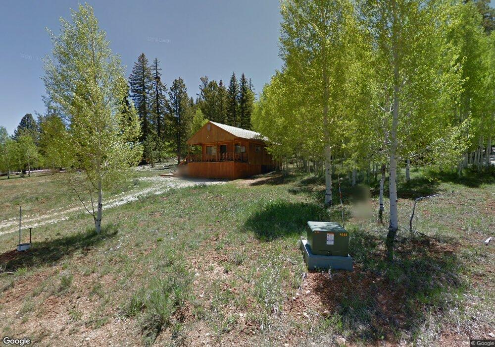
1910 N White Pine Rd Kanab, UT 84741
Duck Creek Village NeighborhoodEstimated Value: $442,419 - $883,000
Studio
--
Bath
576
Sq Ft
$1,029/Sq Ft
Est. Value
About This Home
This home is located at 1910 N White Pine Rd, Kanab, UT 84741 and is currently estimated at $592,473, approximately $1,028 per square foot. 1910 N White Pine Rd is a home with nearby schools including Valley Elementary School and Valley High School.
Ownership History
Date
Name
Owned For
Owner Type
Purchase Details
Closed on
Feb 10, 2025
Bought by
Tressler Joseph Paul and Tressler Kathryn Ann
Current Estimated Value
Purchase Details
Closed on
Jul 23, 2021
Sold by
Thomsen Nicholas E
Bought by
Tressler Joseph and Tressler Kathryn
Purchase Details
Closed on
Jun 9, 2020
Bought by
Tullius Jerome P
Purchase Details
Closed on
Jul 20, 2015
Sold by
Nicholas E Nicholas E and Thomsen Mary Caroline
Bought by
Frichtel Robert and Catmull-Frichtel Rosa
Create a Home Valuation Report for This Property
The Home Valuation Report is an in-depth analysis detailing your home's value as well as a comparison with similar homes in the area
Home Values in the Area
Average Home Value in this Area
Purchase History
| Date | Buyer | Sale Price | Title Company |
|---|---|---|---|
| Tressler Joseph Paul | -- | -- | |
| Tressler Joseph | -- | -- | |
| Tullius Jerome P | -- | -- | |
| Frichtel Robert | -- | -- |
Source: Public Records
Tax History
| Year | Tax Paid | Tax Assessment Tax Assessment Total Assessment is a certain percentage of the fair market value that is determined by local assessors to be the total taxable value of land and additions on the property. | Land | Improvement |
|---|---|---|---|---|
| 2025 | $2,877 | $418,296 | $108,412 | $309,884 |
| 2024 | $2,713 | $214,976 | $49,689 | $165,287 |
| 2023 | $2,456 | $206,694 | $41,407 | $165,287 |
| 2022 | $2,646 | $197,139 | $31,852 | $165,287 |
| 2021 | $2,246 | $251,226 | $43,367 | $207,859 |
| 2020 | $2,006 | $216,611 | $43,367 | $173,244 |
| 2019 | $1,909 | $200,395 | $43,367 | $157,028 |
| 2018 | $1,729 | $179,908 | $48,185 | $131,723 |
| 2017 | $1,806 | $179,908 | $48,185 | $131,723 |
| 2016 | $819 | $79,370 | $37,536 | $41,834 |
| 2015 | $770 | $79,370 | $37,536 | $41,834 |
| 2014 | $770 | $74,474 | $32,640 | $41,834 |
| 2013 | -- | $75,700 | $0 | $0 |
Source: Public Records
Map
Nearby Homes
- 1610 Gulf Stream Dr
- 1840 Gulf Stream Dr
- 1620 Centurion Cir
- 1766 Gulf Stream Dr
- 1675 Centurion Cir
- Lot 5 Valley View Dr
- 1830 Gulf Stream Dr
- 1335 E Boeing Dr
- 2075 Ridge View Rd
- 1815 E Beech Craft Dr
- 1965 E Runway Dr
- 2150 Ridge View Rd
- 2255 E Knoll Rd
- 1675 Strawberry Creek Dr
- 1675 E Strawberry Creek Cir
- 1820 N Strawberry Ridge Rd
- 1820 Strawberry Ridge Rd
- 1630 Willis Creek
- 1730&1740 Willis Creek
- 1730-1740 E Willis Creek Cir
- 1680 E Strawberry Point Rd
- 1685 Ponderosa View Loop Unit Ponderosa Villa G-37
- 1950&1960 Ponderosa View Loop Unit Ponderosa Villa G-23
- 36 Ponderosa View Loop Unit AKA 1860 N WHITE PIN
- 1740 Ponderosa View Loop
- 1685 Ponderosa View Loop Unit G
- 36 Ponderosa View Loop
- 1950&1960 Ponderosa View Loop Unit G
- 1710 Ponderosa View Loop
- 1890 N White Pine Rd
- 1690 E Strawberry Point Rd
- 1905 N White Pine Rd
- 1715 E Ponderosa View Loop
- 1880 N White Pine Rd
- 1730 E Strawberry Point Rd
- 1915 N Ponderosa View Loop
- 1860 N White Pine Rd
- 1915 N Ponderosa View Loop
- 1895 N Ponderosa View Loop
- 1945 N Ponderosa View Loop