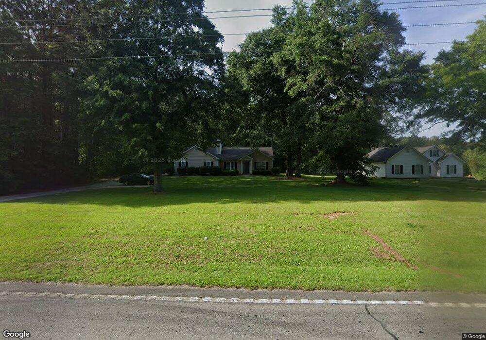
1910 Poplar Rd Newnan, GA 30265
Estimated Value: $219,000 - $316,000
3
Beds
2
Baths
1,319
Sq Ft
$205/Sq Ft
Est. Value
About This Home
This home is located at 1910 Poplar Rd, Newnan, GA 30265 and is currently estimated at $270,981, approximately $205 per square foot. 1910 Poplar Rd is a home located in Coweta County with nearby schools including Welch Elementary School, East Coweta Middle School, and East Coweta High School.
Ownership History
Date
Name
Owned For
Owner Type
Purchase Details
Closed on
Sep 24, 2013
Sold by
Cranford William R
Bought by
Poplar Road Rentals Llc
Current Estimated Value
Purchase Details
Closed on
Jul 20, 2010
Sold by
Cranford Dana M
Bought by
Cranford William R
Purchase Details
Closed on
Sep 20, 2002
Sold by
Cranford William R
Bought by
Cranford Dana M
Purchase Details
Closed on
Feb 10, 1999
Sold by
Cranford Homes Inc
Bought by
Cranford William R
Home Financials for this Owner
Home Financials are based on the most recent Mortgage that was taken out on this home.
Original Mortgage
$63,000
Interest Rate
6.44%
Mortgage Type
New Conventional
Purchase Details
Closed on
Feb 27, 1995
Sold by
Cason Elaine Wynette
Bought by
Cranford Homes Inc
Purchase Details
Closed on
Sep 9, 1994
Sold by
Cason Harold C
Bought by
Cason Elaine Wynette
Purchase Details
Closed on
Nov 30, 1971
Bought by
Cason Harold C
Create a Home Valuation Report for This Property
The Home Valuation Report is an in-depth analysis detailing your home's value as well as a comparison with similar homes in the area
Home Values in the Area
Average Home Value in this Area
Purchase History
| Date | Buyer | Sale Price | Title Company |
|---|---|---|---|
| Poplar Road Rentals Llc | -- | -- | |
| Cranford William R | -- | -- | |
| Cranford Dana M | -- | -- | |
| Cranford William R | $52,900 | -- | |
| Cranford Homes Inc | $20,000 | -- | |
| Cason Elaine Wynette | -- | -- | |
| Cason Harold C | -- | -- |
Source: Public Records
Mortgage History
| Date | Status | Borrower | Loan Amount |
|---|---|---|---|
| Previous Owner | Cranford William R | $63,000 |
Source: Public Records
Tax History Compared to Growth
Tax History
| Year | Tax Paid | Tax Assessment Tax Assessment Total Assessment is a certain percentage of the fair market value that is determined by local assessors to be the total taxable value of land and additions on the property. | Land | Improvement |
|---|---|---|---|---|
| 2025 | $1,881 | $79,606 | $6,401 | $73,204 |
| 2024 | $1,826 | $78,656 | $6,401 | $72,254 |
| 2023 | $1,826 | $78,164 | $8,809 | $69,354 |
| 2022 | $1,487 | $60,351 | $5,873 | $54,478 |
| 2021 | $1,370 | $52,041 | $5,593 | $46,448 |
| 2020 | $1,379 | $52,041 | $5,593 | $46,448 |
| 2019 | $1,253 | $42,793 | $8,000 | $34,793 |
| 2018 | $1,255 | $42,793 | $8,000 | $34,793 |
| 2017 | $1,254 | $42,793 | $8,000 | $34,793 |
| 2016 | $1,239 | $42,793 | $8,000 | $34,793 |
| 2015 | $1,218 | $42,793 | $8,000 | $34,793 |
| 2014 | $1,208 | $42,793 | $8,000 | $34,793 |
Source: Public Records
Map
Nearby Homes
- 26 Berkeley Park
- 18 Berkeley Park
- 460 Vanderbilt Pkwy
- 21 Delaware Way
- 49 Leverett Dr
- 10 Fenway Ct
- 18 Boyd Point
- 34 Fenway Ct
- 3 Avondale Cir
- 0 Mary Freeman Rd Unit 20069973
- 14 Avondale Cir
- 37 Fox Ridge Dr
- 28 Fox Ridge Dr
- 161 Lake Shore Dr
- 19 S York Dr
- 185 Lake Shore Dr
- 161 Briandwood Dr
- 306 Freeman Forest Dr
- 21 Terrace Park
- 59 Gables Way
- 12 White Oak Rd
- 44 White Oak Rd
- 1906 Poplar Rd Unit BIG
- 52 White Oak Rd
- 47 White Oak Rd
- 1980 Poplar Rd
- 68 White Oak Rd
- 1909 Poplar Rd
- 67 White Oak Rd
- 17 Goodwyn Rd
- 0 White Oak Rd Unit 3193223
- 1998 Poplar Rd
- 82 White Oak Rd
- 1858 Poplar Rd
- 81 White Oak Rd
- 22 Berkeley Park
- 45 Goodwyn Rd
- 98 White Oak Rd
- 2016 Poplar Rd
- 26 Berkeley Park