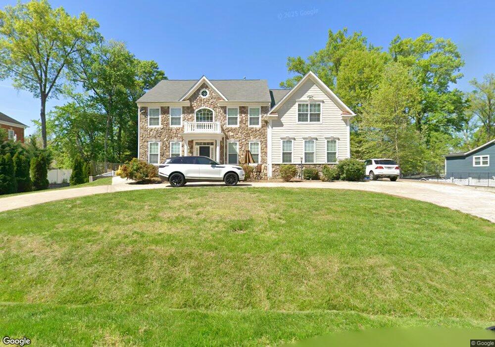
1910 Prices Ln Alexandria, VA 22308
Fort Hunt NeighborhoodEstimated Value: $1,576,200 - $1,823,000
5
Beds
5
Baths
4,139
Sq Ft
$403/Sq Ft
Est. Value
About This Home
This home is located at 1910 Prices Ln, Alexandria, VA 22308 and is currently estimated at $1,669,050, approximately $403 per square foot. 1910 Prices Ln is a home located in Fairfax County with nearby schools including Fort Hunt Elementary School, Sandburg Middle, and West Potomac High School.
Ownership History
Date
Name
Owned For
Owner Type
Purchase Details
Closed on
Jan 6, 2010
Sold by
Cutchall Trustee Carol M and Cutchall Trustee Leila H
Bought by
El Bourini Tarek and El Deeb Rasha
Current Estimated Value
Home Financials for this Owner
Home Financials are based on the most recent Mortgage that was taken out on this home.
Original Mortgage
$758,400
Outstanding Balance
$493,620
Interest Rate
4.78%
Mortgage Type
Construction
Estimated Equity
$1,175,430
Create a Home Valuation Report for This Property
The Home Valuation Report is an in-depth analysis detailing your home's value as well as a comparison with similar homes in the area
Home Values in the Area
Average Home Value in this Area
Purchase History
| Date | Buyer | Sale Price | Title Company |
|---|---|---|---|
| El Bourini Tarek | $450,000 | -- |
Source: Public Records
Mortgage History
| Date | Status | Borrower | Loan Amount |
|---|---|---|---|
| Open | El Bourini Tarek | $758,400 |
Source: Public Records
Tax History Compared to Growth
Tax History
| Year | Tax Paid | Tax Assessment Tax Assessment Total Assessment is a certain percentage of the fair market value that is determined by local assessors to be the total taxable value of land and additions on the property. | Land | Improvement |
|---|---|---|---|---|
| 2025 | $16,967 | $1,480,170 | $349,000 | $1,131,170 |
| 2024 | $16,967 | $1,416,660 | $329,000 | $1,087,660 |
| 2023 | $16,857 | $1,450,300 | $329,000 | $1,121,300 |
| 2022 | $15,300 | $1,296,480 | $329,000 | $967,480 |
| 2021 | $15,250 | $1,265,480 | $298,000 | $967,480 |
| 2020 | $14,611 | $1,203,270 | $273,000 | $930,270 |
| 2019 | $14,568 | $1,198,390 | $265,000 | $933,390 |
| 2018 | $13,354 | $1,161,200 | $255,000 | $906,200 |
| 2017 | $13,827 | $1,161,200 | $255,000 | $906,200 |
| 2016 | $13,453 | $1,161,200 | $255,000 | $906,200 |
| 2015 | $12,536 | $1,123,290 | $255,000 | $868,290 |
Source: Public Records
Map
Nearby Homes
- 8917 Linton Ln
- 2308 Creek Dr
- 8628 Plymouth Rd
- 8601 Buckboard Dr
- 2410 Ryegate Ln
- 8518 Riverside Rd
- 8705 Stockton Pkwy
- 8602 Cushman Place
- 8408 Conover Place
- 8305 Fort Hunt Rd
- Hampton II Plan at Collingwood Chase
- 8260 Colling Manor Ct
- 2408 William And Mary Dr
- 3301 Battersea Ln
- 8281 Colling Manor Ct
- 3108 Battersea Ln
- 8280 Colling Manor Ct
- 8276 Colling Manor Ct
- 8264 Colling Manor Ct
- 8352 Orange Ct
- 1912 Prices Ln
- 1906 Prices Ln
- 1913 Westfield St
- 1915 Westfield St
- 1911 Westfield St
- 1914 Prices Ln
- 1909 Westfield St
- 9013 Linton Ln
- 1904 Prices Ln
- 1917 Westfield St
- 1905 Westfield St
- 0 Prices Ln
- 1900 Prices Ln
- 9014 Vernon View Dr
- 1914 Westfield St
- 9012 Vernon View Dr
- 1908 Westfield St
- 2000 Prices Ln
- 1901 Westfield St
- 9007 Linton Ln