Estimated Value: $244,567 - $278,000
3
Beds
2
Baths
1,440
Sq Ft
$181/Sq Ft
Est. Value
About This Home
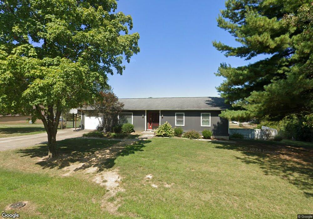
This home is located at 1910 Ransom Dr, Union, KY 41091 and is currently estimated at $260,392, approximately $180 per square foot. 1910 Ransom Dr is a home located in Boone County with nearby schools including New Haven Elementary School, Gray Middle School, and Larry A. Ryle High School.
Ownership History
Date
Name
Owned For
Owner Type
Purchase Details
Closed on
Mar 17, 2005
Sold by
Mcfadden Mary E
Bought by
Mcfadden Mary E and Umberg Karla K
Current Estimated Value
Purchase Details
Closed on
Jun 25, 2001
Sold by
Gilliam Mauri N
Bought by
Umberg Karla K
Home Financials for this Owner
Home Financials are based on the most recent Mortgage that was taken out on this home.
Original Mortgage
$108,328
Outstanding Balance
$41,504
Interest Rate
7.06%
Mortgage Type
New Conventional
Estimated Equity
$218,888
Purchase Details
Closed on
Oct 6, 1994
Sold by
Swinford Stephen P
Bought by
Mauri N Gilliam
Home Financials for this Owner
Home Financials are based on the most recent Mortgage that was taken out on this home.
Original Mortgage
$65,000
Interest Rate
8.53%
Mortgage Type
New Conventional
Create a Home Valuation Report for This Property
The Home Valuation Report is an in-depth analysis detailing your home's value as well as a comparison with similar homes in the area
Home Values in the Area
Average Home Value in this Area
Purchase History
| Date | Buyer | Sale Price | Title Company |
|---|---|---|---|
| Mcfadden Mary E | -- | None Available | |
| Umberg Karla K | $117,900 | -- | |
| Mauri N Gilliam | $84,300 | -- |
Source: Public Records
Mortgage History
| Date | Status | Borrower | Loan Amount |
|---|---|---|---|
| Open | Umberg Karla K | $108,328 | |
| Previous Owner | Mauri N Gilliam | $65,000 |
Source: Public Records
Tax History Compared to Growth
Tax History
| Year | Tax Paid | Tax Assessment Tax Assessment Total Assessment is a certain percentage of the fair market value that is determined by local assessors to be the total taxable value of land and additions on the property. | Land | Improvement |
|---|---|---|---|---|
| 2024 | $1,857 | $162,200 | $15,000 | $147,200 |
| 2023 | $1,846 | $162,200 | $15,000 | $147,200 |
| 2022 | $1,821 | $162,200 | $15,000 | $147,200 |
| 2021 | $1,900 | $162,200 | $15,000 | $147,200 |
| 2020 | $1,488 | $130,000 | $130,000 | $0 |
| 2019 | $1,506 | $130,000 | $130,000 | $0 |
| 2018 | $1,558 | $130,000 | $130,000 | $0 |
| 2017 | $1,483 | $130,000 | $130,000 | $0 |
| 2015 | $1,465 | $130,000 | $130,000 | $0 |
| 2013 | -- | $130,000 | $130,000 | $0 |
Source: Public Records
Map
Nearby Homes
- 11126 Lakeview Dr
- 2619 Twin Hills Ct
- 10659 Mountain Laurel Way
- 1855 Woodward Ct
- 1284 Brookstone Dr
- 14086 Bridlegate Dr
- 11179 War Admiral Dr
- Lot 5 Hicks Pike
- 1200 Brookstone Dr
- 11012 War Admiral Dr
- 10007 Glensprings Place
- 1052 Aristides Dr
- 1049 Swale Ct
- 1042 Spectacular Bid Dr
- 5100 Limerick Ct
- 6800 Green Isle Ln
- 815 Devin Ct
- 1205 Citation Dr
- 15005 Prat Ct
- 928 Dustwhirl Dr
- 172 Lakeview
- 173 Lakeview
- 0 Lake View Dr Unit 434355
- 1920 Ransom Dr
- 1920 Ransom Dr
- 1892 Ransom Dr
- 1935 Benson Place
- 1917 Ransom Dr
- 1926 Ransom Dr
- Lot 68 & 6 Benson Place
- 1921 Ransom Dr
- 1943 Benson Place
- 1882 Ransom Dr
- 1895 Benson Place
- 1895 Benson Place
- 1895 Benson Place
- 1895 Benson Place
- 13317 Lakeview Dr
- 1920 Benson Place
- 1920 Benson Place