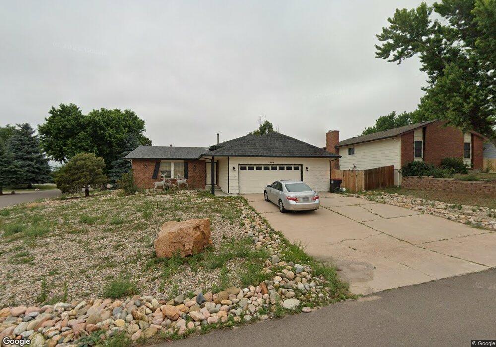
1910 Rusty Hinge Dr Colorado Springs, CO 80920
Briargate NeighborhoodEstimated Value: $436,156 - $478,000
4
Beds
3
Baths
1,236
Sq Ft
$372/Sq Ft
Est. Value
About This Home
This home is located at 1910 Rusty Hinge Dr, Colorado Springs, CO 80920 and is currently estimated at $460,039, approximately $372 per square foot. 1910 Rusty Hinge Dr is a home located in El Paso County with nearby schools including High Plains Elementary School, Mountain Ridge Middle School, and Rampart High School.
Ownership History
Date
Name
Owned For
Owner Type
Purchase Details
Closed on
Dec 4, 2019
Sold by
Monical Kathleen
Bought by
Lrlc Llc
Current Estimated Value
Purchase Details
Closed on
Nov 5, 2015
Sold by
Monical Robert and Monical Kathleen
Bought by
Monical Robert
Purchase Details
Closed on
Dec 22, 1998
Sold by
St Andrews Homes Ltd
Bought by
Monical Robert and Monical Kathleen
Home Financials for this Owner
Home Financials are based on the most recent Mortgage that was taken out on this home.
Original Mortgage
$122,400
Interest Rate
6.85%
Purchase Details
Closed on
Feb 16, 1996
Sold by
Landhuis Leroy
Bought by
Muriithi Deborah K
Home Financials for this Owner
Home Financials are based on the most recent Mortgage that was taken out on this home.
Original Mortgage
$91,700
Interest Rate
7.09%
Purchase Details
Closed on
Nov 1, 1981
Bought by
Monical Kathleen
Create a Home Valuation Report for This Property
The Home Valuation Report is an in-depth analysis detailing your home's value as well as a comparison with similar homes in the area
Home Values in the Area
Average Home Value in this Area
Purchase History
| Date | Buyer | Sale Price | Title Company |
|---|---|---|---|
| Lrlc Llc | $140,000 | Unified Title Company | |
| Monical Robert | -- | None Available | |
| Monical Robert | $136,000 | Stewart Title | |
| Muriithi Deborah K | $131,000 | -- | |
| Monical Kathleen | -- | -- |
Source: Public Records
Mortgage History
| Date | Status | Borrower | Loan Amount |
|---|---|---|---|
| Previous Owner | Monical Robert | $122,400 | |
| Previous Owner | Muriithi Deborah K | $91,700 |
Source: Public Records
Tax History Compared to Growth
Tax History
| Year | Tax Paid | Tax Assessment Tax Assessment Total Assessment is a certain percentage of the fair market value that is determined by local assessors to be the total taxable value of land and additions on the property. | Land | Improvement |
|---|---|---|---|---|
| 2025 | $1,944 | $32,750 | -- | -- |
| 2024 | $1,902 | $34,080 | $5,360 | $28,720 |
| 2022 | $1,687 | $23,910 | $4,340 | $19,570 |
| 2021 | $1,866 | $24,590 | $4,460 | $20,130 |
| 2020 | $1,752 | $21,530 | $3,720 | $17,810 |
| 2019 | $1,735 | $21,530 | $3,720 | $17,810 |
| 2018 | $1,366 | $16,670 | $2,880 | $13,790 |
| 2017 | $1,361 | $16,670 | $2,880 | $13,790 |
| 2016 | $1,286 | $15,740 | $2,930 | $12,810 |
| 2015 | $1,284 | $15,740 | $2,930 | $12,810 |
| 2014 | $1,201 | $14,710 | $2,930 | $11,780 |
Source: Public Records
Map
Nearby Homes
- 1932 Silkwood Dr
- 2110 Whitehorn Dr N
- 1880 Independence Dr
- 2068 Silkwood Dr
- 1907 Independence Dr
- 2006 Summerset Dr
- 1884 Fuller Rd
- 2114 Summerset Dr
- 8161 Regiment Ct
- 2512 Elite Terrace
- 2650 Bannister Ct
- 8335 Sutterfield Dr
- 7191 Ross Dr
- 1931 London Carriage Grove
- 2270 Cloverdale Dr
- 8146 Horizon Dr
- 2615 Thrush Grove
- 7849 Flicker Grove
- 2326 Parliament Dr
- 2340 Winstead View
- 1920 Rusty Hinge Dr
- 1938 Flintlock Terrace W
- 1930 Rusty Hinge Dr
- 1949 Flintlock Terrace W
- 1915 Rusty Hinge Dr
- 1930 Flintlock Terrace W
- 1925 Rusty Hinge Dr
- 1945 Flintlock Terrace W
- 2003 Flintlock Terrace E
- 1940 Rusty Hinge Dr
- 1935 Rusty Hinge Dr
- 1926 Flintlock Terrace W
- 2012 Flintlock Terrace E
- 1937 Flintlock Terrace W
- 1933 Flintlock Terrace W
- 1945 Rusty Hinge Dr
- 2005 Flintlock Terrace E
- 2014 Flintlock Terrace E
- 1929 Flintlock Terrace W
- 1941 Flintlock Terrace W