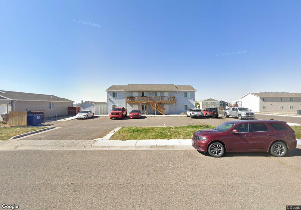
1910 S 11th St Laramie, WY 82070
Estimated Value: $773,000
12
Beds
8
Baths
4,224
Sq Ft
$183/Sq Ft
Est. Value
About This Home
This home is located at 1910 S 11th St, Laramie, WY 82070 and is currently estimated at $773,000, approximately $183 per square foot. 1910 S 11th St is a home located in Albany County with nearby schools including Spring Creek Elementary School, Laramie Middle School, and Laramie High School.
Ownership History
Date
Name
Owned For
Owner Type
Purchase Details
Closed on
Sep 29, 2006
Sold by
Gateway Construction Llc
Bought by
Zook Lester E and Zook Lester E
Current Estimated Value
Home Financials for this Owner
Home Financials are based on the most recent Mortgage that was taken out on this home.
Original Mortgage
$386,386
Outstanding Balance
$230,692
Interest Rate
6.47%
Mortgage Type
FHA
Estimated Equity
$542,308
Create a Home Valuation Report for This Property
The Home Valuation Report is an in-depth analysis detailing your home's value as well as a comparison with similar homes in the area
Home Values in the Area
Average Home Value in this Area
Purchase History
| Date | Buyer | Sale Price | Title Company |
|---|---|---|---|
| Zook Lester E | -- | -- |
Source: Public Records
Mortgage History
| Date | Status | Borrower | Loan Amount |
|---|---|---|---|
| Open | Zook Lester E | $386,386 |
Source: Public Records
Tax History Compared to Growth
Tax History
| Year | Tax Paid | Tax Assessment Tax Assessment Total Assessment is a certain percentage of the fair market value that is determined by local assessors to be the total taxable value of land and additions on the property. | Land | Improvement |
|---|---|---|---|---|
| 2025 | $4,646 | $72,000 | $5,843 | $66,157 |
| 2024 | $4,646 | $63,649 | $5,843 | $57,806 |
| 2023 | $3,938 | $53,942 | $5,434 | $48,508 |
| 2022 | $3,935 | $53,908 | $5,434 | $48,474 |
| 2021 | $2,813 | $46,886 | $5,434 | $41,452 |
| 2020 | $3,037 | $41,602 | $5,434 | $36,168 |
| 2019 | $2,917 | $39,953 | $5,434 | $34,519 |
| 2018 | $2,813 | $38,537 | $5,434 | $33,103 |
| 2017 | $2,815 | $38,555 | $5,434 | $33,121 |
| 2016 | $2,498 | $34,219 | $5,434 | $28,785 |
| 2015 | $2,675 | $35,561 | $5,434 | $30,127 |
| 2014 | $2,675 | $36,638 | $0 | $0 |
Source: Public Records
Map
Nearby Homes
- Lot37Blk2 Boswell Dr
- Lot38Blk2 Boswell Dr
- Lot19Blk 4 Boswell Dr
- Blk7 Lot2 Boswell Dr
- 1027 Boswell Dr
- 29 Star Struck Ln
- 1303 Person St
- 903 Sanders Dr
- 1206 S 11th St
- 912 Fetterman Dr
- 1121 S 7th St
- 1534 Palmer Dr Unit 4
- 1425 Fetterman Dr
- 1613 Barratt St
- 523 Fetterman St
- 1401 S 3rd St
- 1412 S 17th St Unit A
- 1714 Symons St
- 906 S 15th St
- 1203 E Park Ave
- 1922 S 11th St
- 1825 10th St
- 1825 S 10th St
- 1927 S 11th St Unit A
- 1824 S 11th St Unit a
- 1824 S 11th St Unit d
- 1817 10th St
- 1837 S 11th St Unit A
- 1837 S 11th St Unit D
- 1837 S 11th St
- 1837 S 11th St Unit C
- 1817 S 10th St
- 1908 Autumn Cir
- 1914 Autumn Cir
- 1115 Symons St
- 1818 S 11th St Unit a
- 1827 S 11th St Unit C
- 1811 S 10th St
- 1811 S 10th St Unit C
- 1121 Symons St