Estimated Value: $297,000 - $312,000
4
Beds
2
Baths
2,072
Sq Ft
$147/Sq Ft
Est. Value
About This Home
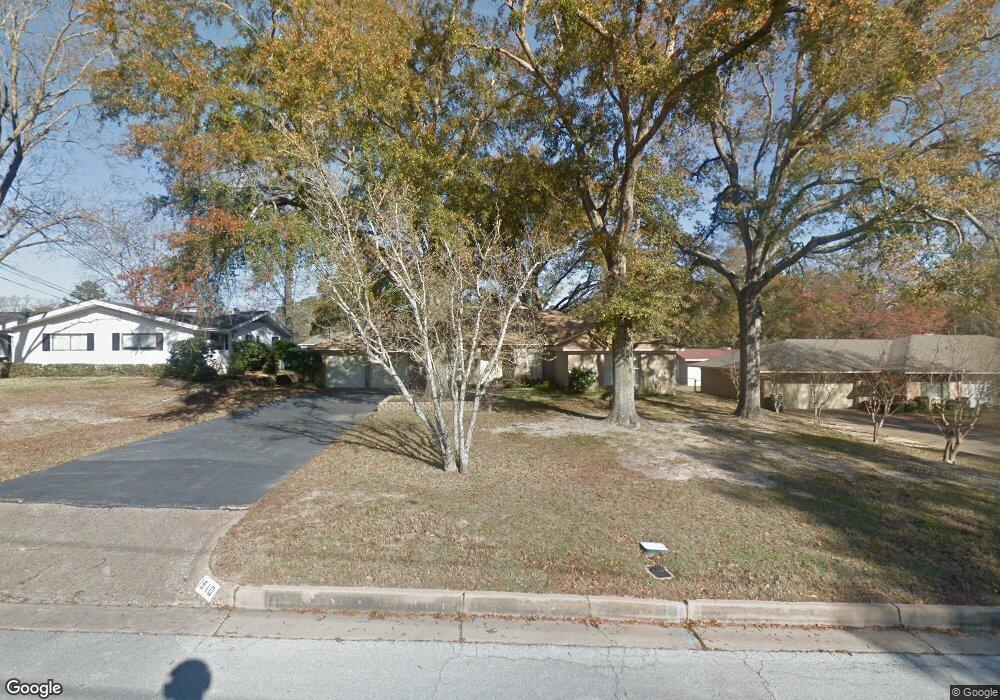
This home is located at 1910 Sterling Dr, Tyler, TX 75701 and is currently estimated at $303,932, approximately $146 per square foot. 1910 Sterling Dr is a home located in Smith County with nearby schools including Clarkston Elementary School, Hubbard Middle School, and Tyler Legacy High School.
Ownership History
Date
Name
Owned For
Owner Type
Purchase Details
Closed on
Oct 22, 2019
Sold by
Hamilton Voss Vickie Lynn and Hamilton Doann Marie
Bought by
Wilson James Ruyle
Current Estimated Value
Home Financials for this Owner
Home Financials are based on the most recent Mortgage that was taken out on this home.
Original Mortgage
$145,500
Outstanding Balance
$127,184
Interest Rate
3.5%
Mortgage Type
New Conventional
Estimated Equity
$176,748
Create a Home Valuation Report for This Property
The Home Valuation Report is an in-depth analysis detailing your home's value as well as a comparison with similar homes in the area
Home Values in the Area
Average Home Value in this Area
Purchase History
| Date | Buyer | Sale Price | Title Company |
|---|---|---|---|
| Wilson James Ruyle | -- | None Available |
Source: Public Records
Mortgage History
| Date | Status | Borrower | Loan Amount |
|---|---|---|---|
| Open | Wilson James Ruyle | $145,500 |
Source: Public Records
Tax History Compared to Growth
Tax History
| Year | Tax Paid | Tax Assessment Tax Assessment Total Assessment is a certain percentage of the fair market value that is determined by local assessors to be the total taxable value of land and additions on the property. | Land | Improvement |
|---|---|---|---|---|
| 2025 | $5,013 | $295,399 | $50,901 | $244,498 |
| 2024 | $5,013 | $294,668 | $30,375 | $264,293 |
| 2023 | $5,151 | $295,506 | $30,375 | $265,131 |
| 2022 | $4,705 | $240,132 | $30,375 | $209,757 |
| 2021 | $4,408 | $210,086 | $26,325 | $183,761 |
| 2020 | $4,259 | $199,034 | $26,325 | $172,709 |
| 2019 | $3,833 | $175,278 | $22,275 | $153,003 |
| 2018 | $3,607 | $165,854 | $20,250 | $145,604 |
| 2017 | $3,541 | $165,854 | $20,250 | $145,604 |
| 2016 | $3,520 | $164,871 | $20,250 | $144,621 |
| 2015 | $1,374 | $155,428 | $20,250 | $135,178 |
| 2014 | $1,374 | $150,948 | $20,250 | $130,698 |
Source: Public Records
Map
Nearby Homes
- 1931 Sterling Dr
- 2006 McDonald Rd
- 2010 McDonald Rd
- 1929 Oakhurst Cir
- 2026 Neeley St
- 2126 McDonald Rd
- 2002 E Faulkner St
- 2515 Preston Ave
- 2014 Miller Dr
- The Dawson Plan at New Home Living at Medina
- 2949 Medina Dr
- The Hubbard Plan at New Home Living at Medina
- 2716 Royal Village Way
- 3024 Royal Garden Rd
- 2820 Oak Knob St
- 2929 Dinah Ln
- 2938 Dinah Ln
- 1520 Clubview Dr
- 2226 Mimosa Dr
- 2918 Oak Knob St
- 1910 1910 Sterling Dr
- 1916 Sterling Dr
- 1904 Sterling Dr
- 1909 McDonald Rd
- 1922 Sterling Dr
- 1911 Sterling Dr
- 1922 1922 Sterling Dr
- 1901 McDonald Rd
- 1901 Sterling Dr
- 1901 1901 Sterling
- 1919 McDonald Rd
- 1915 Sterling Dr
- 1919 1919 McDonald Rd
- 1928 Sterling Dr
- 1810 1810 Sterling
- 1906 1906 Montrose
- 1908 Montrose Dr
- 1900 Montrose Dr
- 1810 Sterling Dr
- 1811 Sterling Dr