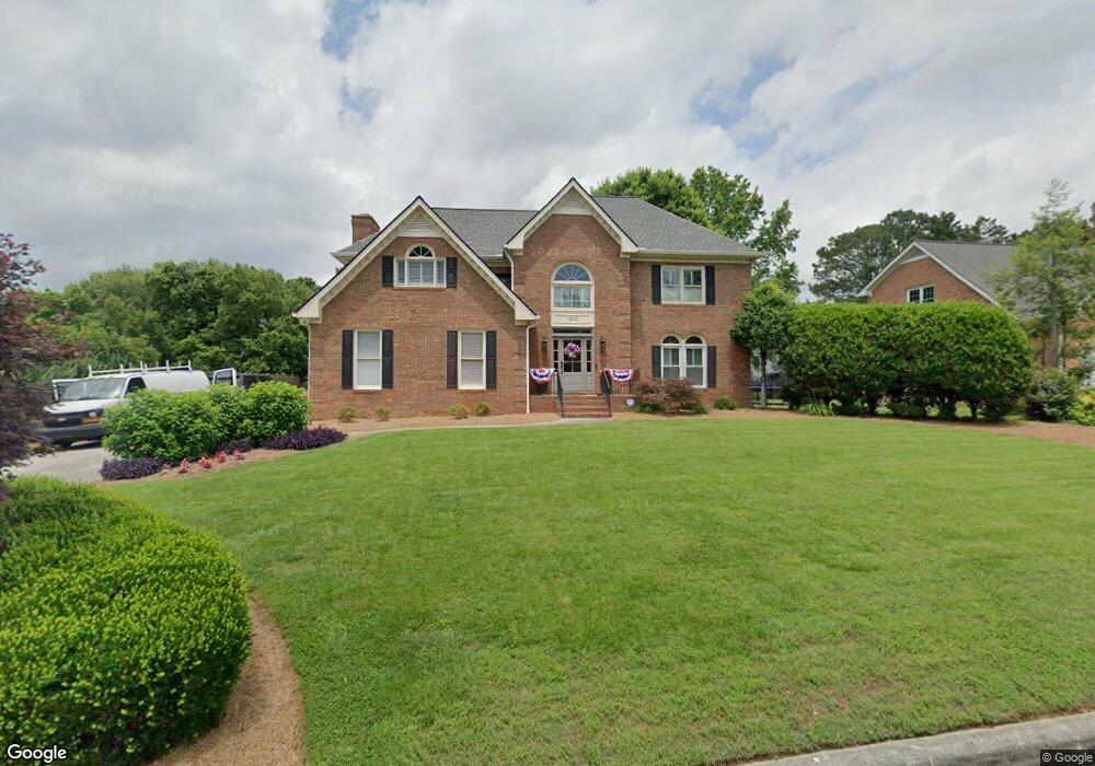
1910 Tara Place Dalton, GA 30720
Estimated Value: $475,339 - $637,000
4
Beds
4
Baths
2,933
Sq Ft
$194/Sq Ft
Est. Value
About This Home
This home is located at 1910 Tara Place, Dalton, GA 30720 and is currently estimated at $569,835, approximately $194 per square foot. 1910 Tara Place is a home located in Whitfield County with nearby schools including Brookwood Elementary School, Dalton Middle School, and Dalton High School.
Ownership History
Date
Name
Owned For
Owner Type
Purchase Details
Closed on
Jun 5, 2007
Sold by
Sain Michael A
Bought by
Coon Jeffrey T
Current Estimated Value
Home Financials for this Owner
Home Financials are based on the most recent Mortgage that was taken out on this home.
Original Mortgage
$185,000
Outstanding Balance
$115,209
Interest Rate
6.52%
Mortgage Type
New Conventional
Estimated Equity
$454,626
Purchase Details
Closed on
Dec 14, 2004
Sold by
Junkins Michael and Junkins Gail
Bought by
Sain Michael A and Sain Angela T
Create a Home Valuation Report for This Property
The Home Valuation Report is an in-depth analysis detailing your home's value as well as a comparison with similar homes in the area
Home Values in the Area
Average Home Value in this Area
Purchase History
| Date | Buyer | Sale Price | Title Company |
|---|---|---|---|
| Coon Jeffrey T | $295,000 | -- | |
| Sain Michael A | $330,000 | -- |
Source: Public Records
Mortgage History
| Date | Status | Borrower | Loan Amount |
|---|---|---|---|
| Open | Coon Jeffrey T | $185,000 |
Source: Public Records
Tax History Compared to Growth
Tax History
| Year | Tax Paid | Tax Assessment Tax Assessment Total Assessment is a certain percentage of the fair market value that is determined by local assessors to be the total taxable value of land and additions on the property. | Land | Improvement |
|---|---|---|---|---|
| 2024 | $4,987 | $206,242 | $23,600 | $182,642 |
| 2023 | $4,987 | $140,734 | $21,600 | $119,134 |
| 2022 | $3,661 | $113,679 | $16,000 | $97,679 |
| 2021 | $3,539 | $109,980 | $16,000 | $93,980 |
| 2020 | $3,664 | $109,980 | $16,000 | $93,980 |
| 2019 | $3,774 | $109,980 | $16,000 | $93,980 |
| 2018 | $3,825 | $109,980 | $16,000 | $93,980 |
| 2017 | $3,676 | $109,980 | $16,000 | $93,980 |
| 2016 | $3,570 | $106,476 | $21,000 | $85,476 |
| 2014 | $3,285 | $106,476 | $21,000 | $85,476 |
| 2013 | -- | $106,476 | $21,000 | $85,476 |
Source: Public Records
Map
Nearby Homes
- 1913 Tara Place
- 1709 Dug Gap Rd
- 1603 Habersham Way
- 1901 Keystone Way
- 1506 Summer Gate Way
- 1506 Summer Gate Way Unit 8
- 1922 Fairfield Dr
- 0 Horizon Ct Unit 130497
- 0 Horizon Ct Unit 130499
- 0 Horizon Ct Unit 130479
- 0 Horizon Ct Unit 130477
- 0 Horizon Ct Unit 130478
- 0 Horizon Ct Unit 130496
- 0 Horizon Ct Unit 130498
- 1704 Southmont Dr
- 1410 Rosewood Cir Unit 46
- 1410 Rosewood Cir Unit 45
- 1410 Rosewood Cir
- 1411 Rosewood Cir
- 1482 Mineral Springs Rd
- 1908 Tara Place
- 1912 Tara Place
- 2003 Kingsridge Dr
- 1905 Tara Place
- 1906 Tara Place
- 1905 Kingsridge Dr
- 0 Tara Place
- 1914 Tara Place
- 2001 Kingsridge Dr
- 1903 Tara Place
- 2005 Kingsridge Dr
- 1904 Tara Place
- 2007 Kingsridge Dr
- 1909 Tara Place
- 1903 Kingsridge Dr
- 2000 Kingsridge Dr
- 1916 Tara Place
- 1901 Tara Place
- 2002 Kingsridge Dr
- 2007 Kingsridge Dr