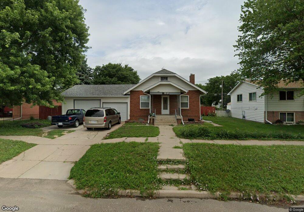
1910 W 8th St Hastings, NE 68901
Estimated Value: $172,000 - $229,000
2
Beds
2
Baths
1,298
Sq Ft
$158/Sq Ft
Est. Value
About This Home
This home is located at 1910 W 8th St, Hastings, NE 68901 and is currently estimated at $205,522, approximately $158 per square foot. 1910 W 8th St is a home located in Adams County with nearby schools including Hastings Senior High School, St. Michael's Preschool & Elementary School, and Zion Lutheran School.
Ownership History
Date
Name
Owned For
Owner Type
Purchase Details
Closed on
Jun 3, 2022
Sold by
Callahan Andrew D and Callahan Cecile J
Bought by
Tellez Osvaldo and Tellez Melissa
Current Estimated Value
Purchase Details
Closed on
Feb 28, 2012
Sold by
Brink Edward E
Bought by
Secretary Of Veterans Affairs
Purchase Details
Closed on
Sep 2, 2009
Sold by
Sipes Scot D
Bought by
Hoenig Michael Lee
Home Financials for this Owner
Home Financials are based on the most recent Mortgage that was taken out on this home.
Original Mortgage
$105,000
Interest Rate
4.37%
Mortgage Type
VA
Purchase Details
Closed on
Aug 25, 2009
Sold by
Sipes Peggy A
Bought by
Sipes Scot D
Home Financials for this Owner
Home Financials are based on the most recent Mortgage that was taken out on this home.
Original Mortgage
$105,000
Interest Rate
4.37%
Mortgage Type
VA
Create a Home Valuation Report for This Property
The Home Valuation Report is an in-depth analysis detailing your home's value as well as a comparison with similar homes in the area
Home Values in the Area
Average Home Value in this Area
Purchase History
| Date | Buyer | Sale Price | Title Company |
|---|---|---|---|
| Tellez Osvaldo | $50,000 | None Listed On Document | |
| Secretary Of Veterans Affairs | -- | None Available | |
| Hoenig Michael Lee | $105,000 | -- | |
| Sipes Scot D | -- | -- |
Source: Public Records
Mortgage History
| Date | Status | Borrower | Loan Amount |
|---|---|---|---|
| Previous Owner | Hoenig Michael Lee | $105,000 | |
| Previous Owner | Sipes Scot D | $18,411 | |
| Previous Owner | Sipes Scot D | $98,100 |
Source: Public Records
Tax History Compared to Growth
Tax History
| Year | Tax Paid | Tax Assessment Tax Assessment Total Assessment is a certain percentage of the fair market value that is determined by local assessors to be the total taxable value of land and additions on the property. | Land | Improvement |
|---|---|---|---|---|
| 2024 | $2,797 | $176,519 | $22,849 | $153,670 |
| 2023 | $3,608 | $174,832 | $22,849 | $151,983 |
| 2022 | $2,946 | $130,798 | $22,849 | $107,949 |
| 2021 | $2,594 | $118,292 | $18,339 | $99,953 |
| 2020 | $2,448 | $113,532 | $18,339 | $95,193 |
| 2019 | $2,325 | $108,999 | $18,339 | $90,660 |
| 2018 | $2,165 | $100,975 | $10,315 | $90,660 |
| 2017 | $2,164 | $100,975 | $0 | $0 |
| 2016 | $2,005 | $93,490 | $10,315 | $83,175 |
| 2011 | -- | $0 | $0 | $0 |
Source: Public Records
Map
Nearby Homes
- 1814 Boyce St
- 736 N Barnes Ave
- 711 Crane Ave
- 1801 W 7th St
- 1911 W 11th St
- 1619 Boyce St
- 2229 W 8th St
- 514 Oswego Ave
- 1911 W 5th St
- 1513 Crane Ave
- 1505 Crane Ave
- 2301 Bateman Ave
- 1615 W 7th St
- 1733 W 5th St
- 904 N Washington Ave
- 1918 W 3rd St
- 2416 W 9th St
- 1201 Pershing Rd
- 2330 W 11th St
- 714 N Baltimore Ave