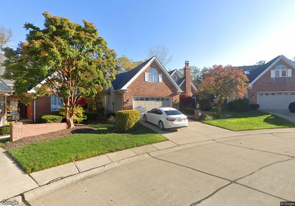
19101 Bridge Path Strongsville, OH 44136
Estimated Value: $367,097 - $400,000
3
Beds
3
Baths
2,598
Sq Ft
$148/Sq Ft
Est. Value
About This Home
This home is located at 19101 Bridge Path, Strongsville, OH 44136 and is currently estimated at $384,024, approximately $147 per square foot. 19101 Bridge Path is a home located in Cuyahoga County with nearby schools including Strongsville High School and Saint Ambrose Catholic School.
Ownership History
Date
Name
Owned For
Owner Type
Purchase Details
Closed on
Nov 7, 2002
Sold by
Hetzel Jeffrey R and Hetzel Eugenie
Bought by
Hetzel Eugenie
Current Estimated Value
Purchase Details
Closed on
Jan 10, 1994
Sold by
Perla Randall M
Bought by
Hetzel Jeffrey R
Purchase Details
Closed on
Apr 19, 1991
Sold by
Framingham Group Inc
Bought by
Hetzel Jeffrey R
Purchase Details
Closed on
Feb 11, 1991
Bought by
Framingham Group Inc
Purchase Details
Closed on
Jan 1, 1987
Bought by
Kingswood Group Inc
Create a Home Valuation Report for This Property
The Home Valuation Report is an in-depth analysis detailing your home's value as well as a comparison with similar homes in the area
Home Values in the Area
Average Home Value in this Area
Purchase History
| Date | Buyer | Sale Price | Title Company |
|---|---|---|---|
| Hetzel Eugenie | -- | -- | |
| Hetzel Jeffrey R | -- | -- | |
| Perla Randall M | -- | -- | |
| Hetzel Jeffrey R | $166,200 | -- | |
| Framingham Group Inc | $19,500 | -- | |
| Kingswood Group Inc | -- | -- |
Source: Public Records
Tax History Compared to Growth
Tax History
| Year | Tax Paid | Tax Assessment Tax Assessment Total Assessment is a certain percentage of the fair market value that is determined by local assessors to be the total taxable value of land and additions on the property. | Land | Improvement |
|---|---|---|---|---|
| 2024 | $4,437 | $104,300 | $21,910 | $82,390 |
| 2023 | $5,197 | $81,240 | $17,220 | $64,020 |
| 2022 | $4,506 | $81,240 | $17,220 | $64,020 |
| 2021 | $4,470 | $81,240 | $17,220 | $64,020 |
| 2020 | $4,539 | $73,850 | $15,650 | $58,210 |
| 2019 | $4,406 | $211,000 | $44,700 | $166,300 |
| 2018 | $3,998 | $73,850 | $15,650 | $58,210 |
| 2017 | $3,787 | $65,840 | $13,410 | $52,430 |
| 2016 | $3,756 | $65,840 | $13,410 | $52,430 |
| 2015 | $3,810 | $65,840 | $13,410 | $52,430 |
| 2014 | $3,810 | $65,840 | $13,410 | $52,430 |
Source: Public Records
Map
Nearby Homes
- 16711 Beech Cir
- 18411 Yorktown Oval
- 17934 Cambridge Oval
- 18848 Pearl Rd
- 17682 Drake Rd
- 16486 S Red Rock Dr
- 3550 Boston Rd
- 18294 Drake Rd
- 17159 Turkey Meadow Ln
- 17024 Bear Creek Ln
- 196 Pinnacle Dr
- 17130 Golden Star Dr
- 97 Weathervane Ln
- 18229 Howe Rd
- 15604-REAR Boston Rd
- 19694 Benbow Rd
- 19740 Benbow Rd
- 16650 Lanier Ave
- 328 Crestway Oval
- 338 Delaware Dr
- 19079 Bridge Path
- 19123 Bridge Path
- 19057 Bridge Path
- 19155 Bridge Path
- 19148 Bridge Path
- 19177 Bridge Path
- 17573 Hampton Place
- 17547 Hampton Place
- 19025 Bridge Path
- 19160 Bridge Path
- 18788 Saratoga Trail
- 18734 Saratoga Trail
- 17599 Hampton Place
- 17521 Hampton Place
- 19209 Bridge Path
- 19192 Bridge Path
- 18844 Saratoga Trail
- 19003 Bridge Path
- 19086 Bridge Path
- 17495 Hampton Place